
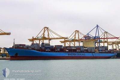
GUDRUN MAERSK
Container Ship
Current Trip
| Time Travelled | 4 days |
|---|---|
| Remaining Time | 2 days |
| Distance Travelled | 975.33 nm |
| Remaining Distance | 579.59 nm |
| AVG Speed | 13.6 Knots |
| MAX Speed | 18.3 Knots |
| AVG Wind | 11.6 knots |
| MAX Wind | 19.6 knots |
| MIN Temp | 25.3°C / 77.54°F |
| MAX Temp | 32.4°C / 90.32°F |
| Draught | 13.4 m |
| Position Received | 7 h, 58 m ago |
Current Position
| Longitude | 106.99544° |
|---|---|
| Latitude | 10.46809° |
| Status | Under way using engine |
| Speed | 9.1 Knots |
| Course | 182° |
| Area | South China Sea |
| Station | T-AIS |
| Position Received | 7 h, 58 m ago |
Info
Information
The current position of GUDRUN MAERSK is in South China Sea with coordinates 10.46809° / 106.99544° as reported on 2024-05-09 01:54 by AIS to our vessel tracker app. The vessel's current speed is 9.1 Knots and is heading at the port of SINGAPORE. The estimated time of arrival as calculated by MyShipTracking vessel tracking app is 2024-05-11 15:30 LT
The vessel GUDRUN MAERSK (IMO: 9302877, MMSI: 220379000) is a Container Ship that was built in 2005 ( 19 years old ). It's sailing under the flag of [DK] Denmark.
In this page you can find informations about the vessels current position, last detected port calls, and current voyage information. If the vessels is not in coverage by AIS you will find the latest position.
The current position of GUDRUN MAERSK is detected by our AIS receivers and we are not responsible for the reliability of the data. The last position was recorded while the vessel was in Coverage by the Ais receivers of our vessel tracking app.
The current draught of GUDRUN MAERSK as reported by AIS is 13.4 meters
Weather
| Temperature | 29.5°C / 85.1°F |
|---|---|
| Wind Speed | 16 knots |
| Direction | 91° E |
| Pressure | 1009.9 hPa |
| Humidity | 76.6 % |
| Cloud Coverage | 95 % |
Featured Company
Last Port Calls
| Port | Arrival | Departure | Time In Port |
|---|---|---|---|
| 2024-05-04 07:16 | 2024-05-05 09:36 | 1 d | |
| 2024-05-03 00:56 | 2024-05-03 22:16 | 21 h | |
| 2024-05-01 06:18 | 2024-05-02 11:13 | 1 d | |
| 2024-04-25 13:00 | 2024-04-27 04:04 | 1 d | |
| 2024-03-25 12:23 | 2024-03-27 03:35 | 1 d | |
| 2024-03-17 13:04 | 2024-03-19 04:21 | 1 d | |
| 2024-03-14 16:16 | 2024-03-16 03:23 | 1 d | |
| 2024-03-13 07:33 | 2024-03-14 06:14 | 22 h | |
| 2024-03-09 09:44 | 2024-03-10 14:40 | 1 d |
Most Visited Ports (Last year)
| Port | Arrivals | |
|---|---|---|
| 5 | ||
| 4 | ||
| 4 | ||
| 3 | ||
| 3 | ||
| 3 |
Last Trips
| Origin | Departure | Destination | Arrival | Distance | |
|---|---|---|---|---|---|
| 2024-05-04 06:16 | 2024-05-04 15:16 | 126.85 nm | |||
| 2024-05-02 19:13 | 2024-05-03 08:56 | 118.22 nm | |||
| 2024-04-27 12:04 | 2024-05-01 14:18 | 1499.32 nm | |||
| 2024-03-26 23:35 | 2024-04-25 21:00 | 12287.44 nm | |||
| 2024-03-19 00:21 | 2024-03-25 08:23 | 311.22 nm | |||
| 2024-03-15 23:23 | 2024-03-17 09:04 | 419.84 nm | |||
| 2024-03-14 02:14 | 2024-03-14 12:16 | 119.78 nm | |||
| 2024-03-10 10:40 | 2024-03-13 03:33 | 616.26 nm | |||
| 2024-02-10 18:49 | 2024-03-09 04:44 | 12469.96 nm |
Events
| Time | Event | Details | Position / Dest | Info |
|---|---|---|---|---|
| 2024-05-09 02:01 | Status Changed | Default Under way using engine |
10.45215 / 106.99696
VNVUT > SGSIN
|
Speed: 9.1 kn Course: 182° |
| 2024-05-09 01:54 | OUT of Coverage |
10.46809 / 106.99544
South China Sea
VNVUT > SGSIN
|
Speed: 9.1 kn Course: 182° |
|
| 2024-05-09 01:50 | Draught Changed | 13.4 14.7 |
10.48086 / 106.99583
VNVUT > SGSIN
|
Speed: 9.9 kn Course: 184.9° |
| 2024-05-09 01:50 | Destination Changed | VNVUT > SGSIN CNYTN > VNVUT |
10.48086 / 106.99583
VNVUT > SGSIN
|
Speed: 9.9 kn Course: 184.9° |
| 2024-05-09 01:50 | ETA Changed | 2024/05/16 18:30 2024/05/07 06:00 |
10.48086 / 106.99583
VNVUT > SGSIN
|
Speed: 9.9 kn Course: 184.9° |
| 2024-05-09 01:34 | START Moving | 2.01 nm, South West of CAI MEP |
10.51417 / 107.00683
CNYTN > VNVUT
|
Speed: 4.2 kn Course: 216° |
| 2024-05-09 01:29 | Status Changed | Under way using engine Default |
10.51605 / 107.01008
CNYTN > VNVUT
|
Speed: 0.3 kn Course: 321° |
| 2024-05-09 01:24 | IN Coverage |
10.51605 / 107.01008
South China Sea
|
Speed: 1.3 kn Course: 286.6° |
|
| 2024-05-07 20:37 | STOP Moving | 1.87 nm, South West of CAI MEP |
10.51364 / 107.01200
CNYTN > VNVUT
|
Speed: 0.2 kn Course: 28° |
| 2024-05-07 19:47 | OUT of Coverage |
10.45243 / 106.99822
South China Sea
|
Speed: 12 kn Course: 332.3° |