
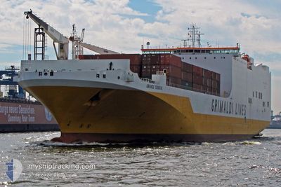
GRANDE SENEGAL
Ro-Ro Cargo
Current Trip
| Time Travelled | 3 days |
|---|---|
| Remaining Time | 22 h, 58 mins |
| Distance Travelled | 1247.01 nm |
| Remaining Distance | 819.38 nm |
| AVG Speed | 18.4 Knop |
| MAX Speed | 21.4 Knop |
| AVG Wind | 6.9 knots |
| MAX Wind | 12 knots |
| MIN Temp | 28.4°C / 83.12°F |
| MAX Temp | 30°C / 86°F |
| Djupgående | 8.6 m |
| Position mottagen | 17 h, 51 m sen |
Current Position
| Longitud | -79.52348° |
|---|---|
| Latitude | 26.56878° |
| Status | Under way using engine |
| Fart | 20.3 Knop |
| Kurs | --- |
| Område | North Atlantic Ocean |
| Station | T-AIS |
| Position mottagen | 17 h, 51 m sen |
Info
Information
The current position of GRANDE SENEGAL is in North Atlantic Ocean with coordinates 26.56878° / -79.52348° as reported on 2024-09-19 03:32 by AIS to our vessel tracker app. The vessel's current speed is 20.3 Knop and is heading at the port of BALTIMORE. The estimated time of arrival as calculated by MyShipTracking vessel tracking app is 2024-09-20 20:22 LT
The vessel GRANDE SENEGAL (IMO: 9377470, MMSI: 247285500) is a Ro-Ro Cargo that was built in 2010 ( 14 År gammal ). It's sailing under the flag of [IT] Italy.
In this page you can find informations about the vessels current position, last detected port calls, and current voyage information. If the vessels is not in coverage by AIS you will find the latest position.
The current position of GRANDE SENEGAL is detected by our AIS receivers and we are not responsible for the reliability of the data. The last position was recorded while the vessel was in Coverage by the Ais receivers of our vessel tracking app.
The current draught of GRANDE SENEGAL as reported by AIS is 8.6 meters
Weather
| Temperature | 28°C / 82.4°F |
|---|---|
| Wind Speed | 10 knots |
| Direction | 230° SW |
| Pressure | 1010.9 hPa |
| Humidity | 73.6 % |
| Cloud Coverage | 7 % |
Featured Company
Last Port Calls
| Port | Arrival | Departure | Time In Port |
|---|---|---|---|
| 2024-09-14 19:54 | 2024-09-16 14:58 | 1 d | |
| 2024-09-10 21:25 | 2024-09-14 05:31 | 3 d | |
| 2024-09-03 00:14 | 2024-09-03 23:43 | 23 h | |
| 2024-08-28 05:29 | 2024-08-29 01:06 | 19 h | |
| 2024-08-27 21:48 | 2024-08-28 05:08 | 7 h | |
| 2024-08-26 20:53 | 2024-08-27 21:42 | 1 d | |
| 2024-08-22 22:15 | 2024-08-23 18:39 | 20 h | |
| 2024-08-11 11:17 | 2024-08-12 18:46 | 1 d | |
| 2024-08-09 04:45 | 2024-08-11 05:23 | 2 d | |
| 2024-08-07 08:17 | 2024-08-08 01:47 | 17 h |
Last Trips
| Origin | Departure | Destination | Arrival | Distance | |
|---|---|---|---|---|---|
| 2024-09-14 00:31 | 2024-09-14 14:54 | 248.55 nm | |||
| 2024-09-03 18:43 | 2024-09-10 16:25 | 753.98 nm | |||
| 2024-08-28 21:06 | 2024-09-02 19:14 | 2018.89 nm | |||
| 2024-08-28 01:08 | 2024-08-28 01:29 | 0.76 nm | |||
| 2024-08-27 17:42 | 2024-08-27 17:48 | 0.64 nm | |||
| 2024-08-23 15:39 | 2024-08-26 16:53 | 1012.82 nm | |||
| 2024-08-12 20:46 | 2024-08-22 19:15 | 3712.93 nm | |||
| 2024-08-11 07:23 | 2024-08-11 13:17 | 94.61 nm | |||
| 2024-08-08 03:47 | 2024-08-09 06:45 | 434.21 nm | |||
| 2024-08-05 00:57 | 2024-08-07 10:17 | 924.49 nm |
Events
| Tid | Event | Detaljer | Position / Dest | Information |
|---|---|---|---|---|
| 2024-09-19 03:39 | Status ändrad | Default Under way using engine |
26.60568 / -79.52174
MXATM>USBAL
|
Fart: 20.3 kn Kurs: 0° |
| 2024-09-19 03:32 | Status ändrad | Under way using engine Default |
26.56878 / -79.52348
MXATM>USBAL
|
Fart: 20.4 kn Kurs: 2° |
| 2024-09-19 03:32 | UTANFÖR täckningsområde |
26.56878 / -79.52348
North Atlantic Ocean
MXATM>USBAL
|
Fart: 20.3 kn Kurs: 0° |
|
| 2024-09-19 03:19 | Status ändrad | Default Under way using engine |
26.49084 / -79.52651
MXATM>USBAL
|
Fart: 20.4 kn Kurs: 1.8° |
| 2024-09-19 03:08 | Status ändrad | Under way using engine Default |
26.42961 / -79.52886
MXATM>USBAL
|
Fart: 20.3 kn Kurs: 2° |
| 2024-09-19 02:52 | Status ändrad | Default Under way using engine |
26.34232 / -79.53242
MXATM>USBAL
|
Fart: 20.3 kn Kurs: 2.2° |
| 2024-09-19 02:49 | Byter havsområde | United States part of the North Atlantic Ocean Bahamas part of the North Atlantic Ocean |
26.32491 / -79.53320
North Atlantic Ocean
MXATM>USBAL
|
Fart: 20.3 kn Kurs: 1.3° |
| 2024-09-19 00:38 | Byter havsområde | Bahamas part of the North Atlantic Ocean United States part of the North Atlantic Ocean |
25.62490 / -79.69329
North Atlantic Ocean
MXATM>USBAL
|
Fart: 19.9 kn Kurs: 27.4° |
| 2024-09-18 23:01 | Status ändrad | Under way using engine Default |
25.14725 / -79.96918
MXATM>USBAL
|
Fart: 20.1 kn Kurs: 27° |
| 2024-09-18 22:56 | Status ändrad | Default Under way using engine |
25.12118 / -79.98386
MXATM>USBAL
|
Fart: 20.2 kn Kurs: 27.1° |