
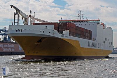
GRANDE SENEGAL
Ro-Ro Cargo
Current Trip
| Time Travelled | 10 days |
|---|---|
| Remaining Time | --- |
| Distance Travelled | 3166.15 nm |
| Remaining Distance | --- |
| AVG Speed | 13.3 Knots |
| MAX Speed | 17.1 Knots |
| AVG Wind | 17.6 knots |
| MAX Wind | 37 knots |
| MIN Temp | 12.4°C / 54.32°F |
| MAX Temp | 22.3°C / 72.14°F |
| Dybgang | 8.8 m |
| Position Modtaget | 9 d siden |
Current Position
| Longitude | --- |
|---|---|
| Latitude | --- |
| Status | Under way using engine |
| Fart | 15.1 Knots |
| Kurs | 266.1° |
| Område | North Atlantic Ocean |
| Station | T-AIS |
| Position Modtaget | 9 d siden |
Info
Information
The current position of GRANDE SENEGAL is in North Atlantic Ocean with coordinates 35.87018° / -6.01192° as reported on 2025-01-06 00:28 by AIS to our vessel tracker app. The vessel's current speed is 15.1 Knots and is heading at the port of BALTIMORE. The estimated time of arrival as calculated by MyShipTracking vessel tracking app is 2025-01-14 13:00 LT
The vessel GRANDE SENEGAL (IMO: 9377470, MMSI: 247285500) is a Ro-Ro Cargo that was built in 2010 ( 15 år gamle ). It's sailing under the flag of [IT] Italy.
In this page you can find informations about the vessels current position, last detected port calls, and current voyage information. If the vessels is not in coverage by AIS you will find the latest position.
The current position of GRANDE SENEGAL is detected by our AIS receivers and we are not responsible for the reliability of the data. The last position was recorded while the vessel was in Coverage by the Ais receivers of our vessel tracking app.
The current draught of GRANDE SENEGAL as reported by AIS is 8.8 meters
Weather
| Temperature | 19.3°C / 66.74°F |
|---|---|
| Wind Speed | 22 knots |
| Direction | 263° W |
| Pressure | 1012.3 hPa |
| Humidity | 78.5 % |
| Cloud Coverage | 17 % |
Featured Company
Last Port Calls
| Port | Arrival | Departure | Time In Port |
|---|---|---|---|
| 2025-01-04 02:51 | 2025-01-04 22:01 | 19 h | |
| 2024-12-31 20:15 | 2025-01-02 02:20 | 1 d | |
| 2024-12-30 07:52 | 2024-12-30 14:49 | 6 h | |
| 2024-12-30 07:13 | 2024-12-30 07:43 | 30 m | |
| 2024-12-29 08:13 | 2024-12-29 16:47 | 8 h | |
| 2024-12-27 00:05 | 2024-12-28 13:18 | 1 d | |
| 2024-12-21 13:53 | 2024-12-23 06:20 | 1 d | |
| 2024-12-15 06:07 | 2024-12-15 15:37 | 9 h | |
| 2024-12-11 08:33 | 2024-12-12 19:10 | 1 d | |
| 2024-12-09 08:29 | 2024-12-09 18:01 | 9 h |
Last Trips
| Origin | Departure | Destination | Arrival | Distance | |
|---|---|---|---|---|---|
| 2025-01-02 02:20 | 2025-01-04 02:51 | 771.56 nm | |||
| 2024-12-30 14:49 | 2024-12-31 20:15 | 498.34 nm | |||
| 2024-12-30 07:43 | 2024-12-30 07:52 | 0.30 nm | |||
| 2024-12-29 16:47 | 2024-12-30 07:13 | 137.30 nm | |||
| 2024-12-28 13:18 | 2024-12-29 08:13 | 146.54 nm | |||
| 2024-12-23 06:20 | 2024-12-27 00:05 | 1517.15 nm | |||
| 2024-12-12 19:10 | 2024-12-21 13:53 | 3223.71 nm | |||
| 2024-12-12 19:10 | 2024-12-15 06:07 | 635.93 nm | |||
| 2024-12-04 16:27 | 2024-12-11 08:33 | 2337.87 nm | |||
| 2024-12-04 16:27 | 2024-12-09 08:29 | 1618.09 nm |
Events
| Tid | Hændelsen | Detaljer | Position / Dest | Info |
|---|---|---|---|---|
| 2025-01-06 00:31 | Status er ændret | Default Under way using engine |
35.86950 / -6.02682
ESVLC>USBAL
|
Fart: 15.1 kn Kurs: 266.1° |
| 2025-01-06 00:28 | Udenfor Dækning |
35.87018 / -6.01192
North Atlantic Ocean
ESVLC>USBAL
|
Fart: 15.1 kn Kurs: 266.1° |
|
| 2025-01-06 00:21 | Ændre havområde | Moroccan part of the North Atlantic Ocean Moroccan part of the Strait of Gibraltar |
35.87149 / -5.97541
North Atlantic Ocean
ESVLC>USBAL
|
Fart: 15.1 kn Kurs: 265.4° |
| 2025-01-06 00:21 | Status er ændret | Under way using engine Default |
35.87149 / -5.97541
ESVLC>USBAL
|
Fart: 14.6 kn Kurs: 261° |
| 2025-01-06 00:10 | Status er ændret | Default Under way using engine |
35.87822 / -5.92364
ESVLC>USBAL
|
Fart: 14.5 kn Kurs: 258.4° |
| 2025-01-06 00:08 | Status er ændret | Under way using engine Default |
35.87986 / -5.91385
ESVLC>USBAL
|
Fart: 14.7 kn Kurs: 248° |
| 2025-01-06 00:01 | Status er ændret | Default Under way using engine |
35.88778 / -5.88039
ESVLC>USBAL
|
Fart: 15 kn Kurs: 245.4° |
| 2025-01-05 23:56 | Status er ændret | Under way using engine Default |
35.89660 / -5.85679
ESVLC>USBAL
|
Fart: 14.6 kn Kurs: 238° |
| 2025-01-05 23:38 | Status er ændret | Default Under way using engine |
35.93306 / -5.78048
ESVLC>USBAL
|
Fart: 14.5 kn Kurs: 270.7° |
| 2025-01-05 23:24 | Ændre havområde | Moroccan part of the Strait of Gibraltar Spanish part of the Strait of Gibraltar |
35.94004 / -5.71738
Strait of Gibraltar
ESVLC>USBAL
|
Fart: 13.5 kn Kurs: 257.8° |