
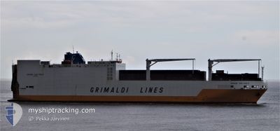
GRANDE SAN PAOLO
Ro-Ro Cargo
Current Trip
| Time Travelled | 2 days |
|---|---|
| Remaining Time | 3 days |
| Distance Travelled | 1089.22 nm |
| Remaining Distance | 1377.05 nm |
| AVG Speed | 15.7 Knop |
| MAX Speed | 16.6 Knop |
| AVG Wind | 7.5 knots |
| MAX Wind | 12 knots |
| MIN Temp | 27.4°C / 81.32°F |
| MAX Temp | 29.7°C / 85.46°F |
| Djupgående | 9.8 m |
| Position mottagen | 5 d sen |
Current Position
| Longitud | -16.89500° |
|---|---|
| Latitude | 10.08483° |
| Status | Under way using engine |
| Fart | 15.6 Knop |
| Kurs | 132° |
| Område | North Atlantic Ocean |
| Station | T-AIS |
| Position mottagen | 5 d sen |
Info
Information
The current position of GRANDE SAN PAOLO is in North Atlantic Ocean with coordinates 10.08483° / -16.89500° as reported on 2024-04-29 16:13 by AIS to our vessel tracker app. The vessel's current speed is 15.6 Knop and is heading at the port of DAKAR. The estimated time of arrival as calculated by MyShipTracking vessel tracking app is 2024-05-08 06:43 LT
The vessel GRANDE SAN PAOLO (IMO: 9253208, MMSI: 247091500) is a Ro-Ro Cargo that was built in 2003 ( 21 År gammal ). It's sailing under the flag of [IT] Italy.
In this page you can find informations about the vessels current position, last detected port calls, and current voyage information. If the vessels is not in coverage by AIS you will find the latest position.
The current position of GRANDE SAN PAOLO is detected by our AIS receivers and we are not responsible for the reliability of the data. The last position was recorded while the vessel was in Coverage by the Ais receivers of our vessel tracking app.
The current draught of GRANDE SAN PAOLO as reported by AIS is 9.8 meters
Weather
| Temperature | 29.5°C / 85.1°F |
|---|---|
| Wind Speed | 8 knots |
| Direction | 192° SSW |
| Pressure | 1009.5 hPa |
| Humidity | 76.1 % |
| Cloud Coverage | 7 % |
Featured Company
Last Port Calls
| Port | Arrival | Departure | Time In Port |
|---|---|---|---|
| 2024-04-30 08:34 | 2024-05-01 20:03 | 1 d | |
| 2024-04-26 08:06 | 2024-04-28 19:56 | 2 d | |
| 2024-04-17 21:17 | 2024-04-18 15:30 | 18 h | |
| 2024-04-14 08:01 | 2024-04-14 23:45 | 15 h | |
| 2024-04-09 22:38 | 2024-04-13 10:58 | 3 d | |
| 2024-04-08 16:37 | 2024-04-09 20:06 | 1 d | |
| 2024-03-20 03:18 | 2024-03-20 08:36 | 5 h | |
| 2024-03-20 03:15 | |||
| 2024-03-19 14:42 | |||
| 2024-03-19 14:36 |
Last Trips
| Origin | Departure | Destination | Arrival | Distance | |
|---|---|---|---|---|---|
| 2024-04-28 19:56 | 2024-04-30 08:34 | 528.90 nm | |||
| 2024-04-18 16:30 | 2024-04-26 08:06 | 1885.35 nm | |||
| 2024-04-15 01:45 | 2024-04-17 22:17 | 807.30 nm | |||
| 2024-04-13 12:58 | 2024-04-14 10:01 | 280.86 nm | |||
| 2024-04-09 22:06 | 2024-04-10 00:38 | 31.89 nm | |||
| 2024-03-20 11:36 | 2024-04-08 18:37 | 4103.77 nm | |||
| 2024-03-18 12:48 | 2024-03-20 06:18 | 79.17 nm | |||
| 2024-03-18 12:48 | 2024-03-20 06:15 | 79.17 nm | |||
| 2024-03-18 12:48 | 2024-03-19 17:42 | 79.18 nm | |||
| 2024-03-18 12:48 | 2024-03-19 17:36 | 79.18 nm |
Events
| Tid | Event | Detaljer | Position / Dest | Information |
|---|---|---|---|---|
| 2024-05-01 20:03 | AVGÅTT HAMN |
|
9.50283 / -13.72633
PTLIS>SNDKR
|
Fart: 5.2 kn Kurs: 196° |
| 2024-05-01 20:00 | STARTAR förflyttning |
9.50700 / -13.72583
[GN] CONAKRY
|
Fart: 5.2 kn Kurs: 196° |
|
| 2024-04-30 08:42 | STOPPAR förflyttning |
9.51167 / -13.72250
[GN] CONAKRY
|
Fart: 0.3 kn Kurs: 35° |
|
| 2024-04-30 08:34 | ANLÄNDER HAMN |
|
9.51250 / -13.72267
[GN] CONAKRY
|
Fart: 2.6 kn Kurs: 31° |
| 2024-04-29 16:15 | Status ändrad | Default Under way using engine |
10.07950 / -16.88917
PTLIS>SNDKR
|
Fart: 15.6 kn Kurs: 132° |
| 2024-04-29 16:13 | UTANFÖR täckningsområde |
10.08483 / -16.89500
North Atlantic Ocean
|
Fart: 15.6 kn Kurs: 132° |
|
| 2024-04-29 15:24 | Status ändrad | Under way using engine Default |
10.22717 / -17.05100
PTLIS>SNDKR
|
Fart: 15.1 kn Kurs: 131° |
| 2024-04-29 15:10 | I täckningsområde |
10.22717 / -17.05100
North Atlantic Ocean
|
Fart: 15.1 kn Kurs: 131° |
|
| 2024-04-29 14:19 | Status ändrad | Default Under way using engine |
10.42083 / -17.24200
PTLIS>SNDKR
|
Fart: 14.5 kn Kurs: 136° |
| 2024-04-29 14:14 | UTANFÖR täckningsområde |
10.43583 / -17.25633
North Atlantic Ocean
|
Fart: 14.5 kn Kurs: 136° |