
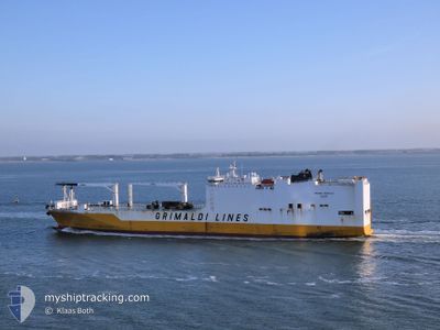
GRANDE MAROCCO
Ro-Ro Cargo
Current Trip
| Time Travelled | 1 day |
|---|---|
| Remaining Time | 6 h, 8 mins |
| Distance Travelled | 368.99 nm |
| Remaining Distance | 20.49 nm |
| AVG Speed | 7.9 Knop |
| MAX Speed | 18.1 Knop |
| AVG Wind | 21 knots |
| MAX Wind | 28 knots |
| MIN Temp | 19.7°C / 67.46°F |
| MAX Temp | 24.7°C / 76.46°F |
| Djupgående | 8 m |
| Position mottagen | 22 m sen |
Current Position
| Longitud | --- |
|---|---|
| Latitude | --- |
| Status | Under way using engine |
| Fart | 3.5 Knop |
| Kurs | --- |
| Område | Gulf of Mexico |
| Station | T-AIS |
| Position mottagen | 22 m sen |
Info
Information
The current position of GRANDE MAROCCO is in Gulf of Mexico with coordinates 22.67587° / -97.57603° as reported on 2025-02-17 12:19 by AIS to our vessel tracker app. The vessel's current speed is 3.5 Knop and is heading at the port of ALTAMIRA. The estimated time of arrival as calculated by MyShipTracking vessel tracking app is 2025-02-17 18:50 LT
The vessel GRANDE MAROCCO (IMO: 9437907, MMSI: 247281100) is a Ro-Ro Cargo that was built in 2010 ( 15 År gammal ). It's sailing under the flag of [IT] Italy.
In this page you can find informations about the vessels current position, last detected port calls, and current voyage information. If the vessels is not in coverage by AIS you will find the latest position.
The current position of GRANDE MAROCCO is detected by our AIS receivers and we are not responsible for the reliability of the data. The last position was recorded while the vessel was in Coverage by the Ais receivers of our vessel tracking app.
The current draught of GRANDE MAROCCO as reported by AIS is 8 meters
Weather
| Temperature | 19.2°C / 66.56°F |
|---|---|
| Wind Speed | 10 knots |
| Direction | 326° NW |
| Pressure | 1020.6 hPa |
| Humidity | 79.4 % |
| Cloud Coverage | 85 % |
Featured Company
Last Port Calls
| Port | Arrival | Departure | Time In Port |
|---|---|---|---|
| 2025-02-15 04:28 | 2025-02-15 21:49 | 17 h | |
| 2025-02-12 05:19 | 2025-02-13 08:12 | 1 d | |
| 2025-02-06 21:47 | 2025-02-07 06:46 | 8 h | |
| 2025-02-05 22:41 | 2025-02-06 21:27 | 22 h | |
| 2025-01-24 17:51 | 2025-01-25 13:52 | 20 h | |
| 2025-01-22 11:28 | 2025-01-23 07:30 | 20 h | |
| 2025-01-21 13:29 | 2025-01-21 20:35 | 7 h | |
| 2025-01-17 05:04 | 2025-01-19 20:09 | 2 d | |
| 2025-01-13 22:15 | 2025-01-14 19:41 | 21 h | |
| 2025-01-08 07:27 | 2025-01-11 12:31 | 3 d |
Last Trips
| Origin | Departure | Destination | Arrival | Distance | |
|---|---|---|---|---|---|
| 2025-02-13 02:12 | 2025-02-14 22:28 | 656.82 nm | |||
| 2025-02-07 01:46 | 2025-02-11 23:19 | 1886.81 nm | |||
| 2025-02-06 16:27 | 2025-02-06 16:47 | 1.02 nm | |||
| 2025-01-25 14:52 | 2025-02-05 17:41 | 4228.48 nm | |||
| 2025-01-23 08:30 | 2025-01-24 18:51 | 546.15 nm | |||
| 2025-01-21 21:35 | 2025-01-22 12:28 | 136.53 nm | |||
| 2025-01-19 21:09 | 2025-01-21 14:29 | 496.92 nm | |||
| 2025-01-11 15:31 | 2025-01-17 06:04 | 1909.26 nm | |||
| 2025-01-11 15:31 | 2025-01-14 00:15 | 855.75 nm | |||
| 2025-01-02 17:20 | 2025-01-08 10:27 | 1702.68 nm |
Events
| Tid | Event | Detaljer | Position / Dest | Information |
|---|---|---|---|---|
| 2025-02-17 12:29 | Status ändrad | Default Under way using engine |
22.68607 / -97.57598
MX VER > MX ATM
|
Fart: 3.5 kn Kurs: 0° |
| 2025-02-17 12:19 | Status ändrad | Under way using engine Default |
22.67587 / -97.57603
MX VER > MX ATM
|
Fart: 3.5 kn Kurs: 360° |
| 2025-02-17 12:10 | I täckningsområde |
22.67587 / -97.57603
Gulf of Mexico
|
Fart: 3.5 kn Kurs: 359.9° |
|
| 2025-02-17 11:06 | Status ändrad | Default Under way using engine |
22.60496 / -97.57594
MX VER > MX ATM
|
Fart: 3.5 kn Kurs: 0° |
| 2025-02-17 10:55 | UTANFÖR täckningsområde |
22.59377 / -97.57573
Gulf of Mexico
|
Fart: 3.5 kn Kurs: 359.6° |
|
| 2025-02-17 09:15 | Status ändrad | Under way using engine Default |
22.50025 / -97.54537
MX VER > MX ATM
|
Fart: 7.2 kn Kurs: 186° |
| 2025-02-17 09:10 | I täckningsområde |
22.49923 / -97.54602
Gulf of Mexico
|
Fart: 12.4 kn Kurs: 211.9° |
|
| 2025-02-17 07:49 | Status ändrad | Default Under way using engine |
22.67345 / -97.54026
MX VER > MX ATM
|
Fart: 5.8 kn Kurs: 190° |
| 2025-02-17 07:44 | UTANFÖR täckningsområde |
22.68251 / -97.53872
Gulf of Mexico
|
Fart: 5.8 kn Kurs: 190° |
|
| 2025-02-17 07:35 | Status ändrad | Under way using engine Default |
22.69638 / -97.53592
MX VER > MX ATM
|
Fart: 5.8 kn Kurs: 190° |