
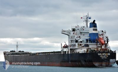
GALAPAGOS
Bulk Carrier
Current Trip
VN PHU
| Time Travelled | 5 days |
|---|---|
| Remaining Time | --- |
| Distance Travelled | 1499.10 nm |
| Remaining Distance | --- |
| AVG Speed | 10.8 Knop |
| MAX Speed | 13.7 Knop |
| AVG Wind | 13 knots |
| MAX Wind | 30.2 knots |
| MIN Temp | 18.2°C / 64.76°F |
| MAX Temp | 31.9°C / 89.42°F |
| Djupgående | 12.9 m |
| Position mottagen | 9 h, 10 m sen |
Current Position
| Longitud | 121.22536° |
|---|---|
| Latitude | 26.13561° |
| Status | Under way using engine |
| Fart | 11.8 Knop |
| Kurs | 39.4° |
| Område | Eastern China Sea |
| Station | T-AIS |
| Position mottagen | 9 h, 10 m sen |
Info
Information
The current position of GALAPAGOS is in Eastern China Sea with coordinates 26.13561° / 121.22536° as reported on 2024-05-12 03:27 by AIS to our vessel tracker app. The vessel's current speed is 11.8 Knop
The vessel GALAPAGOS (IMO: 9473169, MMSI: 248146000) is a Bulk Carrier that was built in 2010 ( 14 År gammal ). It's sailing under the flag of [MT] Malta.
In this page you can find informations about the vessels current position, last detected port calls, and current voyage information. If the vessels is not in coverage by AIS you will find the latest position.
The current position of GALAPAGOS is detected by our AIS receivers and we are not responsible for the reliability of the data. The last position was recorded while the vessel was in Coverage by the Ais receivers of our vessel tracking app.
The current draught of GALAPAGOS as reported by AIS is 12.9 meters
Weather
| Temperature | 18.2°C / 64.76°F |
|---|---|
| Wind Speed | 28 knots |
| Direction | 16° NNE |
| Pressure | 1013.5 hPa |
| Humidity | 87.8 % |
| Cloud Coverage | 100 % |
Featured Company
Last Port Calls
| Port | Arrival | Departure | Time In Port |
|---|---|---|---|
| 2024-05-02 06:36 | 2024-05-07 00:12 | 4 d | |
| 2024-03-14 08:35 | 2024-03-19 02:37 | 4 d | |
| 2024-03-04 19:13 | 2024-03-07 01:24 | 2 d | |
| 2024-03-02 19:49 | 2024-03-04 08:47 | 1 d |
Last Trips
| Origin | Departure | Destination | Arrival | Distance | |
|---|---|---|---|---|---|
| 2024-03-18 23:37 | 2024-05-02 13:36 | 6886.86 nm | |||
| 2024-03-06 22:24 | 2024-03-14 05:35 | 1044.14 nm | |||
| 2024-03-04 05:47 | 2024-03-04 16:13 | 11.20 nm | |||
| 2024-01-16 19:19 | 2024-03-02 16:49 | 5859.62 nm |
Events
| Tid | Event | Detaljer | Position / Dest | Information |
|---|---|---|---|---|
| 2024-05-12 03:32 | Status ändrad | Default Under way using engine |
26.14833 / 121.23666
VN PHU
|
Fart: 11.8 kn Kurs: 39.4° |
| 2024-05-12 03:27 | Byter havsområde | Chinese part of the Eastern China Sea Chinese part of the South China Sea |
26.13561 / 121.22536
Eastern China Sea
|
Fart: 11.8 kn Kurs: 39.4° |
| 2024-05-12 03:27 | Status ändrad | Under way using engine Default |
26.13561 / 121.22536
VN PHU
|
Fart: 11.8 kn Kurs: 39° |
| 2024-05-12 03:27 | UTANFÖR täckningsområde |
26.13561 / 121.22536
Eastern China Sea
|
Fart: 11.8 kn Kurs: 39.4° |
|
| 2024-05-12 03:07 | I täckningsområde |
26.13561 / 121.22536
Eastern China Sea
|
Fart: 11.8 kn Kurs: 39.4° |
|
| 2024-05-11 10:40 | Status ändrad | Default Under way using engine |
23.73285 / 118.51648
VN PHU
|
Fart: 12.2 kn Kurs: 51.5° |
| 2024-05-11 10:34 | UTANFÖR täckningsområde |
23.71937 / 118.49819
South China Sea
|
Fart: 12.2 kn Kurs: 51.5° |
|
| 2024-05-11 07:23 | Upptäckt i hav | Chinese part of the South China Sea |
23.33348 / 117.95431
South China Sea
|
Fart: 11.6 kn Kurs: 53.3° |
| 2024-05-11 07:23 | Status ändrad | Under way using engine Default |
23.33348 / 117.95431
VN PHU
|
Fart: 11.6 kn Kurs: 53° |
| 2024-05-11 07:13 | I täckningsområde |
23.33348 / 117.95431
South China Sea
|
Fart: 11.6 kn Kurs: 53.3° |