
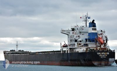
GALAPAGOS
Bulk Carrier
Current Trip
| Time Travelled | 6 days |
|---|---|
| Remaining Time | --- |
| Distance Travelled | 1052.75 nm |
| Remaining Distance | 4.08 nm |
| AVG Speed | 10.1 Noeuds |
| MAX Speed | 14.6 Noeuds |
| AVG Wind | 8.8 knots |
| MAX Wind | 22 knots |
| MIN Temp | 8.8°C / 47.84°F |
| MAX Temp | 30°C / 86°F |
| Tirant d eau | 7.4 m |
| Position reçue | 2 m depuis |
Current Position
| Longitude | 132.95105° |
|---|---|
| Latitude | 42.77270° |
| Etat | At anchor |
| Vitesse | 0.1 Noeuds |
| Parcours | 241° |
| Zone | Japan Sea |
| Station | T-AIS |
| Position reçue | 2 m depuis |
Info
Information
The current position of GALAPAGOS is in Japan Sea with coordinates 42.77270° / 132.95105° as reported on 2024-05-23 14:02 by AIS to our vessel tracker app. The vessel's current speed is 0.1 Noeuds and is heading at the port of VOSTOCHNYY. The estimated time of arrival as calculated by MyShipTracking vessel tracking app is 2024-05-21 16:00 LT
The vessel GALAPAGOS (IMO: 9473169, MMSI: 248146000) is a Bulk Carrier that was built in 2010 ( 14 Age ). It's sailing under the flag of [MT] Malta.
In this page you can find informations about the vessels current position, last detected port calls, and current voyage information. If the vessels is not in coverage by AIS you will find the latest position.
The current position of GALAPAGOS is detected by our AIS receivers and we are not responsible for the reliability of the data. The last position was recorded while the vessel was in Coverage by the Ais receivers of our vessel tracking app.
The current draught of GALAPAGOS as reported by AIS is 7.4 meters
Weather
| Temperature | 10.8°C / 51.44°F |
|---|---|
| Wind Speed | 6 knots |
| Direction | 313° NW |
| Pressure | 1008.7 hPa |
| Humidity | 94.1 % |
| Cloud Coverage | 100 % |
Featured Company
Last Trips
| Origin | Departure | Destination | Arrival | Distance | |
|---|---|---|---|---|---|
| 2024-05-07 07:12 | 2024-05-14 13:28 | 1883.00 nm | |||
| 2024-03-18 23:37 | 2024-05-02 13:36 | 6886.86 nm | |||
| 2024-03-06 22:24 | 2024-03-14 05:35 | 1044.14 nm | |||
| 2024-03-04 05:47 | 2024-03-04 16:13 | 11.20 nm | |||
| 2024-01-16 19:19 | 2024-03-02 16:49 | 5859.62 nm |
Events
| Heure | Evenement | Détails | Position/ Destination | Info |
|---|---|---|---|---|
| 2024-05-22 21:50 | Etat Changé | At anchor Default |
42.77359 / 132.95007
RU VYP
|
Vitesse: Parcours: -1° |
| 2024-05-22 21:48 | Etat Changé | Default At anchor |
42.77334 / 132.94833
RU VYP
|
Vitesse: 0.1 kn Parcours: 181° |
| 2024-05-21 05:53 | Arret | 3.03 nm, South East of NAKHODKA |
42.77009 / 132.95205
RU VYP
|
Vitesse: 0.3 kn Parcours: 301° |
| 2024-05-21 05:41 | Etat Changé | At anchor Under way using engine |
42.76938 / 132.94934
RU VYP
|
Vitesse: 0.8 kn Parcours: 11° |
| 2024-05-21 03:03 | Tirant d'eau modifié | 7.4 7.5 |
42.40071 / 132.96215
RU VYP
|
Vitesse: 12.9 kn Parcours: 349.9° |
| 2024-05-21 00:41 | Changement d'ETA | 2024/05/21 06:00 2024/05/21 16:00 |
42.02684 / 133.00148
RU VYP
|
Vitesse: 10.1 kn Parcours: 3° |
| 2024-05-21 00:39 | Changement d'ETA | 2024/05/21 16:00 2024/05/21 20:00 |
42.02039 / 133.00095
RU VYP
|
Vitesse: 10.1 kn Parcours: 3.5° |
| 2024-05-20 23:39 | Etat Changé | Under way using engine Default |
41.85441 / 132.98353
RU VYP
|
Vitesse: 10 kn Parcours: 4° |
| 2024-05-20 23:21 | Etat Changé | Default Under way using engine |
41.80167 / 132.97667
RU VYP
|
Vitesse: 9.8 kn Parcours: 4.9° |
| 2024-05-20 22:21 | Etat Changé | Under way using engine Default |
41.64402 / 132.92927
RU VYP
|
Vitesse: 9 kn Parcours: 17° |