

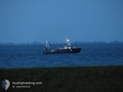
FRITZ REUTER
Reserved

Current Trip
OWP RIFFGAT.
| Time Travelled | 5 h, 16 mins |
|---|---|
| Remaining Time | --- |
| Distance Travelled | 0.59 nm |
| Remaining Distance | --- |
| AVG Speed | 4.8 Knop |
| MAX Speed | 5.8 Knop |
| AVG Wind | 15.7 knots |
| MAX Wind | 15.8 knots |
| MIN Temp | 5.9°C / 42.62°F |
| MAX Temp | 5.9°C / 42.62°F |
| Djupgående | 2.8 m |
| Position mottagen | 2 h, 11 m sen |
Current Position
| Longitud | --- |
|---|---|
| Latitude | --- |
| Status | Under way using engine |
| Fart | 5.6 Knop |
| Kurs | 69.8° |
| Område | North Sea |
| Station | T-AIS |
| Position mottagen | 2 h, 11 m sen |
Information
The current position of FRITZ REUTER is in North Sea with coordinates 53.69833° / 6.52048° as reported on 2025-03-27 06:57 by AIS to our vessel tracker app. The vessel's current speed is 5.6 Knop
The vessel FRITZ REUTER (MMSI: 211223180) is a Reserved It's sailing under the flag of [DE] Germany.
In this page you can find informations about the vessels current position, last detected port calls, and current voyage information. If the vessels is not in coverage by AIS you will find the latest position.
The current position of FRITZ REUTER is detected by our AIS receivers and we are not responsible for the reliability of the data. The last position was recorded while the vessel was in Coverage by the Ais receivers of our vessel tracking app.
The current draught of FRITZ REUTER as reported by AIS is 2.8 meters
Weather
| Temperature | 6°C / 42.8°F |
|---|---|
| Wind Speed | 15 knots |
| Direction | 218° SW |
| Pressure | 1021.4 hPa |
| Humidity | 91.2 % |
| Cloud Coverage | 35 % |


Featured Company
Last Port Calls
| Port | Arrival | Departure | Time In Port |
|---|---|---|---|
| 2025-03-27 04:52 | |||
| 2025-03-24 14:11 | 2025-03-25 21:50 | 1 d | |
| 2025-03-21 16:00 | 2025-03-24 01:49 | 2 d | |
| 2025-03-20 06:03 | 2025-03-20 23:40 | 17 h | |
| 2025-03-17 06:12 | 2025-03-18 18:55 | 1 d | |
| 2025-03-15 13:05 | |||
| 2025-01-13 01:14 |
Most Visited Ports (Last year)
| Port | Arrivals | |
|---|---|---|
| 11 | ||
| 8 | ||
| 7 | ||
| 6 | ||
| 4 | ||
| 3 |
Events
| Tid | Event | Detaljer | Position / Dest | Information |
|---|---|---|---|---|
| 2025-03-27 06:57 | UTANFÖR täckningsområde |
53.69833 / 6.52048
North Sea
|
Fart: 5.6 kn Kurs: 69.8° |
|
| 2025-03-27 06:49 | I täckningsområde |
53.69727 / 6.50520
North Sea
|
Fart: 4 kn Kurs: 273.5° |
|
| 2025-03-27 03:52 | AVGÅTT HAMN |
|
53.69727 / 6.50549
OWP RIFFGAT.
|
Fart: 5 kn Kurs: 219.1° |
| 2025-03-26 21:56 | UTANFÖR täckningsområde |
53.55759 / 6.74928
North Sea
[DE] BORKUM
|
Fart: 5 kn Kurs: 219.1° |
|
| 2025-03-26 21:56 | I täckningsområde |
53.55759 / 6.74928
North Sea
[DE] BORKUM
|
Fart: 5 kn Kurs: 219.1° |
|
| 2025-03-25 21:15 | UTANFÖR täckningsområde |
53.91398 / 8.68591
North Sea
OWP RIFFGAT.
|
Fart: 6.9 kn Kurs: 333.8° |
|
| 2025-03-25 21:06 | Status ändrad | Under way using engine Moored |
53.89965 / 8.70004
OWP RIFFGAT.
|
Fart: 6.8 kn Kurs: 325.1° |
| 2025-03-25 20:50 | AVGÅTT HAMN |
|
53.87289 / 8.71488
OWP RIFFGAT.
|
Fart: 6.7 kn Kurs: 13° |
| 2025-03-25 20:46 | STARTAR förflyttning |
53.86754 / 8.71070
[DE] CUXHAVEN
|
Fart: 4.6 kn Kurs: 8° |
|
| 2025-03-25 20:25 | STOPPAR förflyttning |
53.86572 / 8.71038
[DE] CUXHAVEN
|
Fart: 0.1 kn Kurs: 13° |