
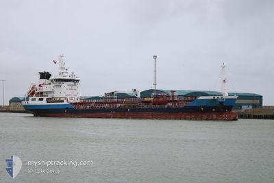
FOYLE
Oil/Chemical Tanker
Current Trip
| Time Travelled | 4 h, 25 mins |
|---|---|
| Remaining Time | 1 h, 46 mins |
| Distance Travelled | 45.01 nm |
| Remaining Distance | 21.25 nm |
| AVG Speed | 10.6 Knop |
| MAX Speed | 11.4 Knop |
| AVG Wind | 6.4 knots |
| MAX Wind | 8 knots |
| MIN Temp | 4.7°C / 40.46°F |
| MAX Temp | 5.3°C / 41.54°F |
| Djupgående | 5 m |
| Position mottagen | 38 m sen |
Current Position
| Longitud | --- |
|---|---|
| Latitude | --- |
| Status | Under way using engine |
| Fart | 9.9 Knop |
| Kurs | 171.1° |
| Område | Baltic Sea |
| Station | T-AIS |
| Position mottagen | 38 m sen |
Info
Information
The current position of FOYLE is in Baltic Sea with coordinates 54.74585° / 10.23315° as reported on 2025-12-05 16:03 by AIS to our vessel tracker app. The vessel's current speed is 9.9 Knop and is heading at the port of KIEL. The estimated time of arrival as calculated by MyShipTracking vessel tracking app is 2025-12-05 19:27 LT
The vessel FOYLE (IMO: 9317676, MMSI: 215584000) is a Oil/Chemical Tanker that was built in 2005 ( 20 År gammal ). It's sailing under the flag of [MT] Malta.
In this page you can find informations about the vessels current position, last detected port calls, and current voyage information. If the vessels is not in coverage by AIS you will find the latest position.
The current position of FOYLE is detected by our AIS receivers and we are not responsible for the reliability of the data. The last position was recorded while the vessel was in Coverage by the Ais receivers of our vessel tracking app.
The current draught of FOYLE as reported by AIS is 5 meters
Weather
| Temperature | 4.8°C / 40.64°F |
|---|---|
| Wind Speed | 7 knots |
| Direction | 172° S |
| Pressure | 1011.2 hPa |
| Humidity | 85 % |
| Cloud Coverage | 100 % |
Featured Company
Last Port Calls
| Port | Arrival | Departure | Time In Port |
|---|---|---|---|
| 2025-12-04 19:40 | 2025-12-05 13:16 | 17 h | |
| 2025-12-01 05:36 | 2025-12-02 16:34 | 1 d | |
| 2025-11-21 00:56 | 2025-11-21 12:25 | 11 h | |
| 2025-11-13 02:51 | 2025-11-14 15:44 | 1 d | |
| 2025-11-09 18:52 | 2025-11-10 22:30 | 1 d | |
| 2025-11-06 06:02 | 2025-11-07 11:27 | 1 d | |
| 2025-10-31 16:06 | 2025-11-01 16:31 | 1 d | |
| 2025-10-25 08:53 | 2025-10-26 10:07 | 1 d | |
| 2025-10-20 14:32 | 2025-10-21 14:29 | 23 h | |
| 2025-10-17 15:07 | 2025-10-18 13:18 | 22 h |
Most Visited Ports (Last year)
| Port | Arrivals | |
|---|---|---|
| 30 | ||
| 22 | ||
| 6 | ||
| 6 | ||
| 5 | ||
| 4 |
Last Trips
| Origin | Departure | Destination | Arrival | Distance | |
|---|---|---|---|---|---|
| 2025-12-02 16:34 | 2025-12-04 19:40 | 462.53 nm | |||
| 2025-11-21 12:25 | 2025-12-01 05:36 | 408.96 nm | |||
| 2025-11-14 15:44 | 2025-11-21 00:56 | 60.78 nm | |||
| 2025-11-10 22:30 | 2025-11-13 02:51 | 302.33 nm | |||
| 2025-11-07 11:27 | 2025-11-09 18:52 | 86.96 nm | |||
| 2025-11-01 16:31 | 2025-11-06 06:02 | 261.98 nm | |||
| 2025-10-26 10:07 | 2025-10-31 16:06 | 273.65 nm | |||
| 2025-10-21 14:29 | 2025-10-25 08:53 | 243.40 nm | |||
| 2025-10-18 13:18 | 2025-10-20 14:32 | 244.23 nm | |||
| 2025-10-15 22:21 | 2025-10-17 15:07 | 241.21 nm |
Events
| Tid | Event | Detaljer | Position / Dest | Information |
|---|---|---|---|---|
| 2025-12-05 16:09 | Status ändrad | Default Under way using engine |
54.72954 / 10.23780
KIEL
|
Fart: 9.9 kn Kurs: 171.1° |
| 2025-12-05 16:03 | Status ändrad | Under way using engine Default |
54.74585 / 10.23315
KIEL
|
Fart: 9.9 kn Kurs: 171° |
| 2025-12-05 15:55 | Status ändrad | Default Under way using engine |
54.76782 / 10.22729
KIEL
|
Fart: 9.5 kn Kurs: 169.8° |
| 2025-12-05 15:43 | Byter havsområde | Danish part of the Baltic Sea Danish part of the Kattegat |
54.79763 / 10.21815
Baltic Sea
KIEL
|
Fart: 9.6 kn Kurs: 170.1° |
| 2025-12-05 15:43 | Status ändrad | Under way using engine Default |
54.79763 / 10.21815
KIEL
|
Fart: 9.7 kn Kurs: 170° |
| 2025-12-05 15:37 | Status ändrad | Default Under way using engine |
54.81461 / 10.21305
KIEL
|
Fart: 9.6 kn Kurs: 169.6° |
| 2025-12-05 15:02 | Status ändrad | Under way using engine Default |
54.89491 / 10.14288
KIEL
|
Fart: 10.9 kn Kurs: 145° |
| 2025-12-05 14:57 | Status ändrad | Default Under way using engine |
54.90785 / 10.12713
KIEL
|
Fart: 10.9 kn Kurs: 144.1° |
| 2025-12-05 13:34 | Status ändrad | Under way using engine Default |
55.08481 / 9.81912
KIEL
|
Fart: 11.3 kn Kurs: 118° |
| 2025-12-05 13:33 | Status ändrad | Default Under way using engine |
55.08579 / 9.81592
KIEL
|
Fart: 11.1 kn Kurs: 118.1° |