
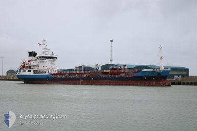
FOYLE
Oil/Chemical Tanker
Current Trip
| Time Travelled | 15 h, 17 mins |
|---|---|
| Remaining Time | 1 day |
| Distance Travelled | 112.22 nm |
| Remaining Distance | 280.97 nm |
| AVG Speed | 7.4 Knopen |
| MAX Speed | 11.4 Knopen |
| AVG Wind | 5.7 knots |
| MAX Wind | 8.2 knots |
| MIN Temp | 0.6°C / 33.08°F |
| MAX Temp | 5.3°C / 41.54°F |
| Diepgang | 5 M |
| Positie ontvangen | 21 m geleden |
Current Position
| Lengtegraad | --- |
|---|---|
| Breedtegraat | --- |
| Status | Under way using engine |
| Snelheid | 6.8 Knopen |
| Koers | 188.7° |
| Gebied | Baltic Sea |
| Station | T-AIS |
| Positie ontvangen | 21 m geleden |
Info
Information
The current position of FOYLE is in Baltic Sea with coordinates 54.01423° / 9.29675° as reported on 2025-12-06 03:12 by AIS to our vessel tracker app. The vessel's current speed is 6.8 Knopen and is heading at the port of ROTTERDAM. The estimated time of arrival as calculated by MyShipTracking vessel tracking app is 2025-12-07 22:30 LT
The vessel FOYLE (IMO: 9317676, MMSI: 215584000) is a Oil/Chemical Tanker that was built in 2005 ( 20 Jaar oud ). It's sailing under the flag of [MT] Malta.
In this page you can find informations about the vessels current position, last detected port calls, and current voyage information. If the vessels is not in coverage by AIS you will find the latest position.
The current position of FOYLE is detected by our AIS receivers and we are not responsible for the reliability of the data. The last position was recorded while the vessel was in Coverage by the Ais receivers of our vessel tracking app.
The current draught of FOYLE as reported by AIS is 5 meters
Weather
| Temperature | 2.8°C / 37.04°F |
|---|---|
| Wind Speed | 8 knots |
| Direction | 150° SSE |
| Pressure | 1007.9 hPa |
| Humidity | 94.1 % |
| Cloud Coverage | 100 % |
Featured Company
Last Port Calls
| Port | Arrival | Departure | Time In Port |
|---|---|---|---|
| 2025-12-04 19:40 | 2025-12-05 13:16 | 17 h | |
| 2025-12-01 05:36 | 2025-12-02 16:34 | 1 d | |
| 2025-11-21 00:56 | 2025-11-21 12:25 | 11 h | |
| 2025-11-13 02:51 | 2025-11-14 15:44 | 1 d | |
| 2025-11-09 18:52 | 2025-11-10 22:30 | 1 d | |
| 2025-11-06 06:02 | 2025-11-07 11:27 | 1 d | |
| 2025-10-31 16:06 | 2025-11-01 16:31 | 1 d | |
| 2025-10-25 08:53 | 2025-10-26 10:07 | 1 d | |
| 2025-10-20 14:32 | 2025-10-21 14:29 | 23 h | |
| 2025-10-17 15:07 | 2025-10-18 13:18 | 22 h |
Most Visited Ports (Last year)
| Port | Arrivals | |
|---|---|---|
| 30 | ||
| 22 | ||
| 6 | ||
| 6 | ||
| 5 | ||
| 4 |
Last Trips
| Origin | Departure | Destination | Arrival | Distance | |
|---|---|---|---|---|---|
| 2025-12-02 16:34 | 2025-12-04 19:40 | 462.53 nm | |||
| 2025-11-21 12:25 | 2025-12-01 05:36 | 408.96 nm | |||
| 2025-11-14 15:44 | 2025-11-21 00:56 | 60.78 nm | |||
| 2025-11-10 22:30 | 2025-11-13 02:51 | 302.33 nm | |||
| 2025-11-07 11:27 | 2025-11-09 18:52 | 86.96 nm | |||
| 2025-11-01 16:31 | 2025-11-06 06:02 | 261.98 nm | |||
| 2025-10-26 10:07 | 2025-10-31 16:06 | 273.65 nm | |||
| 2025-10-21 14:29 | 2025-10-25 08:53 | 243.40 nm | |||
| 2025-10-18 13:18 | 2025-10-20 14:32 | 244.23 nm | |||
| 2025-10-15 22:21 | 2025-10-17 15:07 | 241.21 nm |
Events
| Tijd | Evenement | Details | Positie / Bestemming | Info |
|---|---|---|---|---|
| 2025-12-06 03:17 | Status Changed | Default Under way using engine |
54.00501 / 9.29447
NLRTM
|
Snelheid: 6.8 kn Koers: 188.7° |
| 2025-12-06 03:10 | Status Changed | Under way using engine Default |
54.01764 / 9.29765
NLRTM
|
Snelheid: 6.8 kn Koers: 190° |
| 2025-12-06 03:05 | Status Changed | Default Under way using engine |
54.02768 / 9.30022
NLRTM
|
Snelheid: 7 kn Koers: 189.6° |
| 2025-12-06 02:54 | Status Changed | Under way using engine Default |
54.04862 / 9.30544
NLRTM
|
Snelheid: 6.9 kn Koers: 192° |
| 2025-12-06 02:53 | Status Changed | Default Under way using engine |
54.05118 / 9.30626
NLRTM
|
Snelheid: 6.9 kn Koers: 192.7° |
| 2025-12-06 02:47 | Status Changed | Under way using engine Default |
54.06088 / 9.30983
NLRTM
|
Snelheid: 6.7 kn Koers: 194° |
| 2025-12-06 02:45 | Status Changed | Default Under way using engine |
54.06542 / 9.31167
NLRTM
|
Snelheid: 6.7 kn Koers: 196.7° |
| 2025-12-06 02:33 | Status Changed | Under way using engine Default |
54.08712 / 9.32287
NLRTM
|
Snelheid: 6.6 kn Koers: 196° |
| 2025-12-06 02:16 | Status Changed | Default Under way using engine |
54.11826 / 9.32809
NLRTM
|
Snelheid: 6.6 kn Koers: 193.3° |
| 2025-12-06 02:10 | Status Changed | Under way using engine Default |
54.12898 / 9.33132
NLRTM
|
Snelheid: 6.1 kn Koers: 203° |