
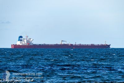
EVREN
Crude Oil Tanker
Current Trip
| Time Travelled | 5 days |
|---|---|
| Remaining Time | --- |
| Distance Travelled | 810.26 nm |
| Remaining Distance | --- |
| AVG Speed | 10 Knop |
| MAX Speed | 12.2 Knop |
| AVG Wind | 11.8 knots |
| MAX Wind | 21 knots |
| MIN Temp | 16.8°C / 62.24°F |
| MAX Temp | 24.8°C / 76.64°F |
| Djupgående | 13 m |
| Position mottagen | 1 m sen |
Current Position
| Longitud | 10.99279° |
|---|---|
| Latitude | 55.07802° |
| Status | Constrained by her draught |
| Fart | 10.4 Knop |
| Kurs | 350.6° |
| Område | Kattegat |
| Station | T-AIS |
| Position mottagen | 1 m sen |
Info
Information
The current position of EVREN is in Kattegat with coordinates 55.07802° / 10.99279° as reported on 2024-09-09 07:58 by AIS to our vessel tracker app. The vessel's current speed is 10.4 Knop and is heading at the port of EREGLI. The estimated time of arrival as calculated by MyShipTracking vessel tracking app is 2024-09-22 20:00 LT
The vessel EVREN (IMO: 9430313, MMSI: 271051306) is a Crude Oil Tanker that was built in 2010 ( 14 År gammal ). It's sailing under the flag of [TR] Turkey.
In this page you can find informations about the vessels current position, last detected port calls, and current voyage information. If the vessels is not in coverage by AIS you will find the latest position.
The current position of EVREN is detected by our AIS receivers and we are not responsible for the reliability of the data. The last position was recorded while the vessel was in Coverage by the Ais receivers of our vessel tracking app.
The current draught of EVREN as reported by AIS is 13 meters
Weather
| Temperature | --- |
|---|---|
| Wind Speed | --- |
| Direction | --- |
| Pressure | --- |
| Humidity | --- |
| Cloud Coverage | --- |
Featured Company
Last Port Calls
| Port | Arrival | Departure | Time In Port |
|---|---|---|---|
| 2024-09-03 11:24 | 2024-09-04 05:26 | 18 h | |
| 2024-08-29 15:43 | 2024-08-31 02:00 | 1 d | |
| 2024-07-20 12:40 | 2024-07-21 13:43 | 1 d | |
| 2024-07-16 10:26 | 2024-07-16 11:41 | 1 h | |
| 2024-07-09 17:05 | 2024-07-13 00:36 | 3 d | |
| 2024-07-08 10:29 | 2024-07-08 17:13 | 6 h | |
| 2024-07-08 10:10 | 2024-07-08 10:21 | 11 m | |
| 2024-07-05 10:25 | 2024-07-08 08:02 | 2 d |
Last Trips
| Origin | Departure | Destination | Arrival | Distance | |
|---|---|---|---|---|---|
| 2024-08-31 05:00 | 2024-09-03 14:24 | 3.50 nm | |||
| 2024-07-21 16:43 | 2024-08-29 18:43 | 5828.47 nm | |||
| 2024-07-16 14:41 | 2024-07-20 15:40 | 65.29 nm | |||
| 2024-07-13 03:36 | 2024-07-16 13:26 | 475.24 nm | |||
| 2024-07-08 20:13 | 2024-07-09 20:05 | 185.88 nm | |||
| 2024-07-08 13:21 | 2024-07-08 13:29 | 0.56 nm | |||
| 2024-07-08 11:02 | 2024-07-08 13:10 | 2.28 nm |
Events
| Tid | Event | Detaljer | Position / Dest | Information |
|---|---|---|---|---|
| 2024-09-09 05:40 | Byter havsområde | Danish part of the Kattegat Danish part of the Baltic Sea |
54.73739 / 10.78133
Kattegat
TR MAR
|
Fart: 9.2 kn Kurs: 20.2° |
| 2024-09-09 04:49 | Byter havsområde | Danish part of the Baltic Sea German part of the Baltic Sea |
54.63775 / 10.89587
Baltic Sea
TR MAR
|
Fart: 10.4 kn Kurs: 299.3° |
| 2024-09-09 03:19 | Upptäckt i hav | German part of the Baltic Sea |
54.56277 / 11.33136
Baltic Sea
TR MAR
|
Fart: 10.7 kn Kurs: 296.1° |
| 2024-09-09 00:21 | Byter havsområde | Danish part of the Baltic Sea German part of the Baltic Sea |
54.44253 / 12.14272
Baltic Sea
TR MAR
|
Fart: 9.5 kn Kurs: 261° |
| 2024-09-09 00:01 | Byter havsområde | German part of the Baltic Sea Danish part of the Baltic Sea |
54.48050 / 12.20158
Baltic Sea
TR MAR
|
Fart: 10.6 kn Kurs: 193.7° |
| 2024-09-08 22:41 | Byter havsområde | Danish part of the Baltic Sea German part of the Baltic Sea |
54.65108 / 12.39250
Baltic Sea
TR MAR
|
Fart: 10.1 kn Kurs: 234.2° |
| 2024-09-08 21:49 | Byter havsområde | German part of the Baltic Sea Danish part of the Baltic Sea |
54.72663 / 12.60848
Baltic Sea
TR MAR
|
Fart: 10.3 kn Kurs: 240.6° |
| 2024-09-08 21:04 | Upptäckt i hav | Danish part of the Baltic Sea |
54.78668 / 12.80548
Baltic Sea
TR MAR
|
Fart: 10.6 kn Kurs: 247.5° |
| 2024-09-08 20:33 | Status ändrad | Constrained by her draught Under way using engine |
54.82359 / 12.95822
TR MAR
|
Fart: 11.1 kn Kurs: 247.3° |
| 2024-09-08 17:52 | Byter havsområde | German part of the Baltic Sea Swedish part of the Baltic Sea |
55.00740 / 13.80933
Baltic Sea
TR MAR
|
Fart: 11.8 kn Kurs: 249.2° |