

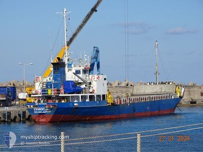
EVANGELIA
General Cargo

Current Trip
| Time Travelled | 17 h, 38 mins |
|---|---|
| Remaining Time | --- |
| Distance Travelled | 97.37 nm |
| Remaining Distance | --- |
| AVG Speed | 8 Knop |
| MAX Speed | 9.8 Knop |
| AVG Wind | 7.6 knots |
| MAX Wind | 13 knots |
| MIN Temp | 9.9°C / 49.82°F |
| MAX Temp | 15.6°C / 60.08°F |
| Djupgående | 3.1 m |
| Position mottagen | 28 m sen |
Current Position
| Longitud | --- |
|---|---|
| Latitude | --- |
| Status | Under way using engine |
| Fart | 7.6 Knop |
| Kurs | 154.4° |
| Område | Aegean Sea |
| Station | T-AIS |
| Position mottagen | 28 m sen |
Information
The current position of EVANGELIA is in Aegean Sea with coordinates 35.23254° / 26.12392° as reported on 2025-02-15 11:52 by AIS to our vessel tracker app. The vessel's current speed is 7.6 Knop and is heading at the port of RIO. The estimated time of arrival as calculated by MyShipTracking vessel tracking app is 2025-02-15 06:00 LT
The vessel EVANGELIA (IMO: 9078531, MMSI: 511100588) is a General Cargo that was built in 1993 ( 32 År gammal ). It's sailing under the flag of [PW] Palau.
In this page you can find informations about the vessels current position, last detected port calls, and current voyage information. If the vessels is not in coverage by AIS you will find the latest position.
The current position of EVANGELIA is detected by our AIS receivers and we are not responsible for the reliability of the data. The last position was recorded while the vessel was in Coverage by the Ais receivers of our vessel tracking app.
The current draught of EVANGELIA as reported by AIS is 3.1 meters
Weather
| Temperature | 15.5°C / 59.9°F |
|---|---|
| Wind Speed | 6 knots |
| Direction | 197° SSW |
| Pressure | 1017.3 hPa |
| Humidity | 57.3 % |
| Cloud Coverage | 100 % |


Featured Company
Last Port Calls
| Port | Arrival | Departure | Time In Port |
|---|---|---|---|
| 2025-02-13 10:44 | 2025-02-14 18:43 | 1 d | |
| 2025-02-03 06:30 | 2025-02-04 22:20 | 1 d | |
| 2025-02-01 05:25 | 2025-02-01 12:16 | 6 h | |
| 2025-01-29 09:35 | 2025-01-30 16:45 | 1 d | |
| 2025-01-26 05:53 | 2025-01-27 17:02 | 1 d | |
| 2025-01-24 12:13 | 2025-01-24 12:25 | 11 m | |
| 2025-01-21 17:27 | 2025-01-23 18:26 | 2 d | |
| 2025-01-16 08:24 | 2025-01-18 00:14 | 1 d | |
| 2025-01-14 05:13 | 2025-01-14 11:22 | 6 h | |
| 2025-01-07 11:43 | 2025-01-12 07:46 | 4 d |
Last Trips
| Origin | Departure | Destination | Arrival | Distance | |
|---|---|---|---|---|---|
| 2025-02-05 01:20 | 2025-02-13 12:44 | 336.78 nm | |||
| 2025-02-01 14:16 | 2025-02-03 09:30 | 328.12 nm | |||
| 2025-01-30 18:45 | 2025-02-01 07:25 | 86.45 nm | |||
| 2025-01-27 20:02 | 2025-01-29 11:35 | 302.24 nm | |||
| 2025-01-24 14:25 | 2025-01-26 08:53 | 326.59 nm | |||
| 2025-01-23 20:26 | 2025-01-24 14:13 | 96.38 nm | |||
| 2025-01-18 03:14 | 2025-01-21 19:27 | 301.46 nm | |||
| 2025-01-14 13:22 | 2025-01-16 11:24 | 352.30 nm | |||
| 2025-01-12 09:46 | 2025-01-14 07:13 | 84.39 nm | |||
| 2025-01-05 23:51 | 2025-01-07 13:43 | 306.57 nm |
Events
| Tid | Event | Detaljer | Position / Dest | Information |
|---|---|---|---|---|
| 2025-02-15 09:56 | STARTAR förflyttning | 0.69 nm, South West of ALTSI |
35.16902 / 25.88066
GR :ATS,.^ _-
|
Fart: 3.1 kn Kurs: 355.5° |
| 2025-02-15 09:47 | Status ändrad | Under way using engine Moored |
35.16602 / 25.88139
GR :ATS,.^ _-
|
Fart: 0.4 kn Kurs: 511° |
| 2025-02-15 05:22 | Status ändrad | Moored Under way using engine |
35.16539 / 25.88269
GR :ATS,.^ _-
|
Fart: Kurs: 511° |
| 2025-02-15 04:57 | STOPPAR förflyttning | 0.75 nm, South West of ALTSI |
35.16583 / 25.88183
GR :ATS,.^ _-
|
Fart: 0.3 kn Kurs: 511° |
| 2025-02-15 04:51 | STARTAR förflyttning | 0.81 nm, South West of ALTSI |
35.16864 / 25.87814
GR :ATS,.^ _-
|
Fart: 3.2 kn Kurs: 151.4° |
| 2025-02-15 04:36 | STOPPAR förflyttning | 0.87 nm, West of ALTSI |
35.16998 / 25.87609
GR :ATS,.^ _-
|
Fart: 0.3 kn Kurs: 511° |
| 2025-02-15 01:52 | Status ändrad | Under way using engine Default |
35.36384 / 25.80583
GR :ATS,.^ _-
|
Fart: 9.7 kn Kurs: 105° |
| 2025-02-15 01:52 | I täckningsområde |
35.36384 / 25.80583
Aegean Sea
GR :ATS,.^ _-
|
Fart: 8.8 kn Kurs: 163.2° |
|
| 2025-02-15 00:46 | Status ändrad | Default Under way using engine |
35.41170 / 25.59848
GR :ATS,.^ _-
|
Fart: 9.6 kn Kurs: 104.2° |
| 2025-02-15 00:41 | UTANFÖR täckningsområde |
35.41451 / 25.58240
Aegean Sea
GR :ATS,.^ _-
|
Fart: 9.6 kn Kurs: 104.2° |