

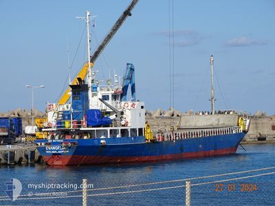
EVANGELIA
General Cargo

Current Trip
| Trip Time | 2 days |
|---|---|
| Trip Distance | 295.33 nm |
| AVG Speed | 7.1 Noeuds |
| MAX Speed | 8.4 Noeuds |
| Tirant d eau | 5.9 m |
| AVG Wind | 10.4 knots |
| MAX Wind | 20.7 knots |
| MIN Temp | 13.7°C / 56.66°F |
| MAX Temp | 22.2°C / 71.96°F |
| Position reçue | 10 m depuis |
Current Position
| Longitude | --- |
|---|---|
| Latitude | --- |
| Etat | At anchor |
| Vitesse | 2.9 Noeuds |
| Parcours | --- |
| Zone | Aegean Sea |
| Station | T-AIS |
| Position reçue | 10 m depuis |
Information
The current position of EVANGELIA is in Aegean Sea with coordinates 35.37253° / 24.48227° as reported on 2025-03-28 06:37 by AIS to our vessel tracker app. The vessel's current speed is 2.9 Noeuds and is currently inside the port of RETHYMNO.
The vessel EVANGELIA (IMO: 9078531, MMSI: 511100588) is a General Cargo that was built in 1993 ( 32 Age ). It's sailing under the flag of [PW] Palau.
In this page you can find informations about the vessels current position, last detected port calls, and current voyage information. If the vessels is not in coverage by AIS you will find the latest position.
The current position of EVANGELIA is detected by our AIS receivers and we are not responsible for the reliability of the data. The last position was recorded while the vessel was in Coverage by the Ais receivers of our vessel tracking app.
The current draught of EVANGELIA as reported by AIS is 5.9 meters
Weather
| Temperature | 13.2°C / 55.76°F |
|---|---|
| Wind Speed | 4 knots |
| Direction | 209° SSW |
| Pressure | 1007 hPa |
| Humidity | 74.1 % |
| Cloud Coverage | 55 % |

Featured Company
Last Port Calls
| Port | Arrival | Departure | Time In Port |
|---|---|---|---|
| 2025-03-28 08:35 | |||
| 2025-03-24 04:22 | 2025-03-25 19:15 | 1 d | |
| 2025-03-15 14:28 | 2025-03-16 19:36 | 1 d | |
| 2025-03-10 09:47 | 2025-03-12 10:43 | 2 d | |
| 2025-03-08 07:21 | 2025-03-08 13:07 | 5 h | |
| 2025-03-08 07:00 | 2025-03-08 07:13 | 13 m | |
| 2025-03-06 15:24 | 2025-03-07 21:14 | 1 d | |
| 2025-03-01 09:50 | 2025-03-03 15:51 | 2 d | |
| 2025-02-27 07:24 | 2025-02-27 13:37 | 6 h | |
| 2025-02-24 07:50 | 2025-02-26 16:20 | 2 d |
Last Trips
| Origin | Departure | Destination | Arrival | Distance | |
|---|---|---|---|---|---|
| 2025-03-25 19:15 | 2025-03-28 08:35 | 295.33 nm | |||
| 2025-03-16 19:36 | 2025-03-24 04:22 | 420.52 nm | |||
| 2025-03-12 10:43 | 2025-03-15 14:28 | 331.53 nm | |||
| 2025-03-08 13:07 | 2025-03-10 09:47 | 304.64 nm | |||
| 2025-03-08 07:13 | 2025-03-08 07:21 | 0.09 nm | |||
| 2025-03-07 21:14 | 2025-03-08 07:00 | 82.85 nm | |||
| 2025-03-03 15:51 | 2025-03-06 15:24 | 345.77 nm | |||
| 2025-02-27 13:37 | 2025-03-01 09:50 | 332.23 nm | |||
| 2025-02-26 16:20 | 2025-02-27 07:24 | 85.61 nm | |||
| 2025-02-19 11:29 | 2025-02-24 07:50 | 335.06 nm |
Events
| Heure | Evenement | Détails | Position/ Destination | Info |
|---|---|---|---|---|
| 2025-03-28 06:35 | Port d'arrivée |
|
35.37299 / 24.48438
[GR] RETHYMNO
|
Vitesse: 3.2 kn Parcours: 251.3° |
| 2025-03-28 05:41 | Démarrage | 1.02 nm, North of RETHYMNO |
35.38580 / 24.48271
GR :RET,.^ _-
|
Vitesse: 3.7 kn Parcours: 147.5° |
| 2025-03-27 12:31 | Etat Changé | At anchor Default |
35.38699 / 24.47840
GR :RET,.^ _-
|
Vitesse: 0.1 kn Parcours: -1° |
| 2025-03-27 12:25 | Etat Changé | Default At anchor |
35.38697 / 24.47815
GR :RET,.^ _-
|
Vitesse: 0.3 kn Parcours: 511° |
| 2025-03-27 07:25 | Etat Changé | At anchor Under way using engine |
35.38552 / 24.47782
GR :RET,.^ _-
|
Vitesse: 0.7 kn Parcours: 511° |
| 2025-03-27 07:22 | Arret | 0.97 nm, North of RETHYMNO |
35.38486 / 24.47750
GR :RET,.^ _-
|
Vitesse: 0.3 kn Parcours: 511° |
| 2025-03-27 06:59 | Démarrage | 0.9 nm, North East of RETHYMNO |
35.38173 / 24.48973
GR :RET,.^ _-
|
Vitesse: 3.1 kn Parcours: 30.2° |
| 2025-03-27 06:43 | Arret | 0.68 nm, North East of RETHYMNO |
35.37737 / 24.48955
GR :RET,.^ _-
|
Vitesse: 0.1 kn Parcours: 511° |
| 2025-03-27 05:31 | Etat Changé | Under way using engine Default |
35.47601 / 24.56223
GR :RET,.^ _-
|
Vitesse: 7.3 kn Parcours: 212° |
| 2025-03-27 05:30 | Dans la zone couverte |
35.47490 / 24.56134
Aegean Sea
GR :RET,.^ _-
|
Vitesse: 7.1 kn Parcours: 211.1° |