
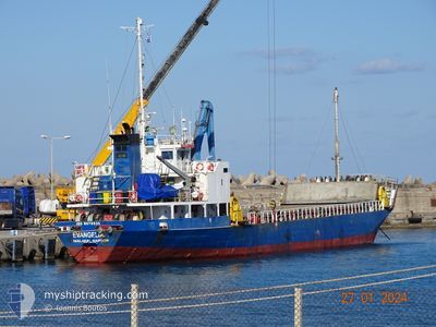
EVANGELIA
General Cargo
Current Trip
| Trip Time | 2 days |
|---|---|
| Trip Distance | 380.64 nm |
| AVG Speed | 8.4 Knopen |
| MAX Speed | 10.7 Knopen |
| Diepgang | 5.9 M |
| AVG Wind | 13.1 knots |
| MAX Wind | 22 knots |
| MIN Temp | 10.9°C / 51.62°F |
| MAX Temp | 18.7°C / 65.66°F |
| Positie ontvangen | 23 h, 36 m geleden |
Current Position
| Lengtegraad | --- |
|---|---|
| Breedtegraat | --- |
| Status | Under way using engine |
| Snelheid | 8.2 Knopen |
| Koers | 15° |
| Gebied | Aegean Sea |
| Station | T-AIS |
| Positie ontvangen | 23 h, 36 m geleden |
Info
Information
The current position of EVANGELIA is in Aegean Sea with coordinates 39.79132° / 26.10853° as reported on 2025-12-05 02:33 by AIS to our vessel tracker app. The vessel's current speed is 8.2 Knopen and is currently inside the port of AKCANSA.
The vessel EVANGELIA (IMO: 9078531, MMSI: 511100588) is a General Cargo that was built in 1993 ( 32 Jaar oud ). It's sailing under the flag of [PW] Palau.
In this page you can find informations about the vessels current position, last detected port calls, and current voyage information. If the vessels is not in coverage by AIS you will find the latest position.
The current position of EVANGELIA is detected by our AIS receivers and we are not responsible for the reliability of the data. The last position was recorded while the vessel was in Coverage by the Ais receivers of our vessel tracking app.
The current draught of EVANGELIA as reported by AIS is 5.9 meters
Weather
| Temperature | 14.5°C / 58.1°F |
|---|---|
| Wind Speed | 13 knots |
| Direction | 133° SE |
| Pressure | 1004.9 hPa |
| Humidity | 75 % |
| Cloud Coverage | 100 % |
Featured Company
Last Port Calls
| Port | Arrival | Departure | Time In Port |
|---|---|---|---|
| 2025-12-05 06:48 | |||
| 2025-12-02 22:01 | |||
| 2025-11-27 08:16 | 2025-11-30 01:46 | 2 d | |
| 2025-11-20 16:45 | 2025-11-24 21:51 | 4 d | |
| 2025-11-17 07:06 | 2025-11-18 23:40 | 1 d | |
| 2025-11-06 15:45 | 2025-11-14 22:13 | 8 d | |
| 2025-11-03 14:44 | 2025-11-04 02:36 | 11 h | |
| 2025-11-02 03:44 | 2025-11-03 05:31 | 1 d | |
| 2025-10-31 15:29 | 2025-10-31 15:42 | 12 m | |
| 2025-10-30 22:17 |
Last Trips
| Origin | Departure | Destination | Arrival | Distance | |
|---|---|---|---|---|---|
| 2025-12-02 22:01 | 2025-12-05 06:48 | 380.64 nm | |||
| 2025-11-24 21:51 | 2025-11-27 08:16 | 392.83 nm | |||
| 2025-11-18 23:40 | 2025-11-20 16:45 | 316.16 nm | |||
| 2025-11-14 22:13 | 2025-11-17 07:06 | 375.65 nm | |||
| 2025-11-04 02:36 | 2025-11-06 15:45 | 262.65 nm | |||
| 2025-11-03 05:31 | 2025-11-03 14:44 | 89.29 nm | |||
| 2025-10-31 15:42 | 2025-11-02 03:44 | 286.62 nm | |||
| 2025-10-30 22:17 | 2025-10-31 15:29 | 93.20 nm | |||
| 2025-10-27 04:12 | 2025-10-27 14:56 | 89.44 nm | |||
| 2025-10-23 22:04 | 2025-10-26 01:17 | 383.00 nm |
Events
| Tijd | Evenement | Details | Positie / Bestemming | Info |
|---|---|---|---|---|
| 2025-12-05 03:48 | Stop beweging |
39.87856 / 26.15416
[TR] AKCANSA
|
Snelheid: 0.1 kn Koers: -1° |
|
| 2025-12-05 03:48 | Aankomsthaven |
|
39.87856 / 26.15416
[TR] AKCANSA
|
Snelheid: 3 kn Koers: -1° |
| 2025-12-05 02:37 | Status Changed | Default Under way using engine |
39.79967 / 26.10945
TR_AKC;^
|
Snelheid: 8.2 kn Koers: 15° |
| 2025-12-05 02:33 | Buitenbereik |
39.79132 / 26.10853
Aegean Sea
TR_AKC;^
|
Snelheid: 8.2 kn Koers: 15° |
|
| 2025-12-05 02:10 | Status Changed | Under way using engine Default |
39.74127 / 26.08907
TR_AKC;^
|
Snelheid: 8.1 kn Koers: 28° |
| 2025-12-05 01:36 | Status Changed | Default Under way using engine |
39.67202 / 26.04641
TR_AKC;^
|
Snelheid: 8.4 kn Koers: 21° |
| 2025-12-04 23:59 | Wijzig zee gebeid | Turkish part of the Aegean Sea Greek part of the Aegean Sea |
39.46546 / 25.93046
Aegean Sea
TR_AKC;^
|
Snelheid: 7.9 kn Koers: 23° |
| 2025-12-04 21:30 | ETA Changed | 2025/12/05 06:30 2025/12/05 02:30 |
39.14771 / 25.79493
TR_AKC;^
|
Snelheid: 8.3 kn Koers: 358° |
| 2025-12-04 21:14 | Status Changed | Under way using engine Default |
39.11160 / 25.79472
TR_AKC;^
|
Snelheid: 7.8 kn Koers: 358° |
| 2025-12-04 20:53 | Status Changed | Default Under way using engine |
39.06698 / 25.79311
TR_AKC;^
|
Snelheid: 7.9 kn Koers: 357° |