
EVA RICHMOND
Cargo
Current Trip
| Time Travelled | --- |
|---|---|
| Remaining Time | --- |
| Distance Travelled | --- |
| Remaining Distance | --- |
| AVG Speed | --- |
| MAX Speed | --- |
| AVG Wind | --- |
| MAX Wind | --- |
| MIN Temp | --- |
| MAX Temp | --- |
| Djupgående | 7.3 m |
| Position mottagen | 33 m sen |
Current Position
| Longitud | --- |
|---|---|
| Latitude | --- |
| Status | At anchor |
| Fart | 0.2 Knop |
| Kurs | 243° |
| Område | South Atlantic Ocean |
| Station | T-AIS |
| Position mottagen | 33 m sen |
Info
Information
The current position of EVA RICHMOND is in South Atlantic Ocean with coordinates -23.12470° / -43.93689° as reported on 2024-10-18 07:20 by AIS to our vessel tracker app. The vessel's current speed is 0.2 Knop
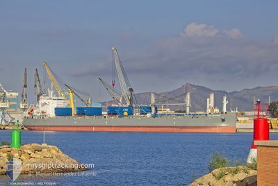
The vessel EVA RICHMOND (IMO: 9972634, MMSI: 352003657) is a Cargo It's sailing under the flag of [PA] Panama.
In this page you can find informations about the vessels current position, last detected port calls, and current voyage information. If the vessels is not in coverage by AIS you will find the latest position.
The current position of EVA RICHMOND is detected by our AIS receivers and we are not responsible for the reliability of the data. The last position was recorded while the vessel was in Coverage by the Ais receivers of our vessel tracking app.
The current draught of EVA RICHMOND as reported by AIS is 7.3 meters
Weather
| Temperature | 20.1°C / 68.18°F |
|---|---|
| Wind Speed | 3 knots |
| Direction | 327° NNW |
| Pressure | 1014 hPa |
| Humidity | 85.1 % |
| Cloud Coverage | 100 % |
Featured Company
Events
| Tid | Event | Detaljer | Position / Dest | Information |
|---|---|---|---|---|
| 2024-10-18 06:41 | I täckningsområde |
-23.12448 / -43.93704
South Atlantic Ocean
|
Fart: 0.1 kn Kurs: 155.7° |
|
| 2024-10-18 05:23 | UTANFÖR täckningsområde |
-23.12398 / -43.93749
South Atlantic Ocean
|
Fart: Kurs: 166.5° |
|
| 2024-10-18 05:20 | I täckningsområde |
-23.12398 / -43.93749
South Atlantic Ocean
|
Fart: Kurs: 166.5° |
|
| 2024-10-18 03:23 | UTANFÖR täckningsområde |
-23.12421 / -43.93717
South Atlantic Ocean
|
Fart: 0.2 kn Kurs: 169.9° |
|
| 2024-10-18 01:53 | I täckningsområde |
-23.12468 / -43.93689
South Atlantic Ocean
|
Fart: 0.3 kn Kurs: 351.8° |
|
| 2024-10-17 18:50 | UTANFÖR täckningsområde |
-23.12381 / -43.93751
South Atlantic Ocean
|
Fart: 0.1 kn Kurs: 281.1° |
|
| 2024-10-17 14:52 | Djupgående ändrat | 7.3 7.2 |
-23.12360 / -43.93776
BRSPB
|
Fart: 0.1 kn Kurs: 201° |
| 2024-10-17 14:08 | I täckningsområde |
-23.12371 / -43.93756
South Atlantic Ocean
|
Fart: 0.1 kn Kurs: 117.1° |
|
| 2024-10-17 11:56 | UTANFÖR täckningsområde |
-23.12407 / -43.93721
South Atlantic Ocean
|
Fart: 0.2 kn Kurs: 117.3° |
|
| 2024-10-17 11:38 | Status ändrad | At anchor Under way using engine |
-23.12410 / -43.93729
BRSPB
|
Fart: 0.1 kn Kurs: 230° |