
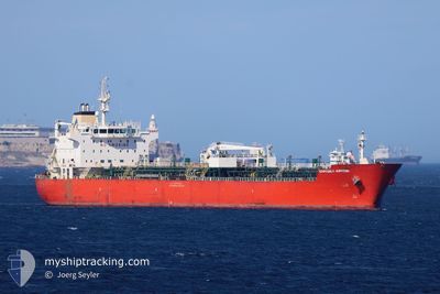
EASTERLY JUPITER
Oil/Chemical Tanker
Current Trip
| Time Travelled | 1 day |
|---|---|
| Remaining Time | 16 h, 5 mins |
| Distance Travelled | 449.74 nm |
| Remaining Distance | 226.25 nm |
| AVG Speed | 11.9 Knop |
| MAX Speed | 12.9 Knop |
| AVG Wind | 9.3 knots |
| MAX Wind | 20.1 knots |
| MIN Temp | 18.4°C / 65.12°F |
| MAX Temp | 23.2°C / 73.76°F |
| Djupgående | 11.1 m |
| Position mottagen | 7 h, 12 m sen |
Current Position
| Longitud | 29.24311° |
|---|---|
| Latitude | 35.43417° |
| Status | Under way using engine |
| Fart | 12.4 Knop |
| Kurs | 80.8° |
| Område | Mediterranean Sea - Eastern Basin |
| Station | T-AIS |
| Position mottagen | 7 h, 12 m sen |
Info
Information
The current position of EASTERLY JUPITER is in Mediterranean Sea - Eastern Basin with coordinates 35.43417° / 29.24311° as reported on 2024-05-14 17:39 by AIS to our vessel tracker app. The vessel's current speed is 12.4 Knop and is heading at the port of MERSIN. The estimated time of arrival as calculated by MyShipTracking vessel tracking app is 2024-05-15 16:56 LT
The vessel EASTERLY JUPITER (IMO: 9383962, MMSI: 538010209) is a Oil/Chemical Tanker that was built in 2009 ( 15 År gammal ). It's sailing under the flag of [MH] Marshall Is.
In this page you can find informations about the vessels current position, last detected port calls, and current voyage information. If the vessels is not in coverage by AIS you will find the latest position.
The current position of EASTERLY JUPITER is detected by our AIS receivers and we are not responsible for the reliability of the data. The last position was recorded while the vessel was in Coverage by the Ais receivers of our vessel tracking app.
The current draught of EASTERLY JUPITER as reported by AIS is 11.1 meters
Weather
| Temperature | 20°C / 68°F |
|---|---|
| Wind Speed | 8 knots |
| Direction | 254° WSW |
| Pressure | 1012.1 hPa |
| Humidity | 67 % |
| Cloud Coverage | 100 % |
Featured Company
Last Port Calls
| Port | Arrival | Departure | Time In Port |
|---|---|---|---|
| 2024-05-11 20:32 | 2024-05-13 09:31 | 1 d | |
| 2024-05-05 09:49 | 2024-05-07 08:41 | 1 d | |
| 2024-04-29 10:42 | 2024-05-01 04:15 | 1 d | |
| 2024-04-23 17:21 | 2024-04-25 10:03 | 1 d | |
| 2024-04-15 13:18 | 2024-04-20 20:08 | 5 d | |
| 2024-03-20 19:53 | 2024-03-23 12:32 | 2 d |
Most Visited Ports (Last year)
| Port | Arrivals | |
|---|---|---|
| 3 | ||
| 3 | ||
| 2 | ||
| 2 | ||
| 2 | ||
| 2 |
Last Trips
| Origin | Departure | Destination | Arrival | Distance | |
|---|---|---|---|---|---|
| 2024-05-07 10:41 | 2024-05-11 23:32 | 964.02 nm | |||
| 2024-05-01 07:15 | 2024-05-05 11:49 | 926.29 nm | |||
| 2024-04-25 12:03 | 2024-04-29 13:42 | 1060.40 nm | |||
| 2024-04-20 22:08 | 2024-04-23 19:21 | 699.02 nm | |||
| 2024-03-23 13:32 | 2024-04-15 15:18 | 3884.98 nm | |||
| 2024-02-18 05:33 | 2024-03-20 20:53 | 4045.28 nm |
Events
| Tid | Event | Detaljer | Position / Dest | Information |
|---|---|---|---|---|
| 2024-05-14 17:43 | Status ändrad | Default Under way using engine |
35.43610 / 29.25925
GR AGT>TR MER
|
Fart: 12.4 kn Kurs: 80.8° |
| 2024-05-14 17:39 | UTANFÖR täckningsområde |
35.43417 / 29.24311
Mediterranean Sea - Eastern Basin
GR AGT>TR MER
|
Fart: 12.4 kn Kurs: 80.8° |
|
| 2024-05-14 16:28 | Byter havsområde | Greek part of the Mediterranean Sea - Eastern Basin Turkish part of the Mediterranean Sea - Eastern Basin |
35.40150 / 28.94103
Mediterranean Sea - Eastern Basin
GR AGT>TR MER
|
Fart: 12.5 kn Kurs: 84.3° |
| 2024-05-14 16:10 | Byter havsområde | Turkish part of the Mediterranean Sea - Eastern Basin Greek part of the Mediterranean Sea - Eastern Basin |
35.39485 / 28.86497
Mediterranean Sea - Eastern Basin
GR AGT>TR MER
|
Fart: 12.4 kn Kurs: 83.1° |
| 2024-05-14 14:46 | Status ändrad | Under way using engine Default |
35.36343 / 28.51412
GR AGT>TR MER
|
Fart: 11.8 kn Kurs: 80° |
| 2024-05-14 14:41 | Status ändrad | Default Under way using engine |
35.36137 / 28.49529
GR AGT>TR MER
|
Fart: 11.9 kn Kurs: 82.5° |
| 2024-05-14 06:28 | Byter havsområde | Greek part of the Mediterranean Sea - Eastern Basin Greek part of the Aegean Sea |
35.30973 / 26.51146
Mediterranean Sea - Eastern Basin
GR AGT>TR MER
|
Fart: 12.4 kn Kurs: 118.9° |
| 2024-05-13 19:09 | Status ändrad | Under way using engine Default |
36.47111 / 23.99197
GR AGT>TR MER
|
Fart: 12.6 kn Kurs: 133° |
| 2024-05-13 18:51 | Status ändrad | Default Under way using engine |
36.51399 / 23.93505
GR AGT>TR MER
|
Fart: 12.5 kn Kurs: 132.3° |
| 2024-05-13 17:20 | Status ändrad | Under way using engine Default |
36.77573 / 23.74109
GR AGT>TR MER
|
Fart: 12 kn Kurs: 159° |