
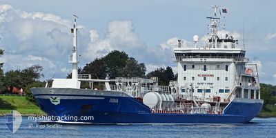
DONIA
Oil/Chemical Tanker
Current Trip
| Time Travelled | 1 day |
|---|---|
| Remaining Time | 2 days |
| Distance Travelled | 541.96 nm |
| Remaining Distance | 797.66 nm |
| AVG Speed | 13.1 Knop |
| MAX Speed | 14.4 Knop |
| AVG Wind | 12.7 knots |
| MAX Wind | 23.6 knots |
| MIN Temp | 2°C / 35.6°F |
| MAX Temp | 7.6°C / 45.68°F |
| Djupgående | 6.2 m |
| Position mottagen | 1 m sen |
Current Position
| Longitud | 13.04206° |
|---|---|
| Latitude | 54.86111° |
| Status | Under way using engine |
| Fart | 12.9 Knop |
| Kurs | 249.6° |
| Område | Baltic Sea |
| Station | T-AIS |
| Position mottagen | 1 m sen |
Info
Information
The current position of DONIA is in Baltic Sea with coordinates 54.86111° / 13.04206° as reported on 2024-04-26 15:41 by AIS to our vessel tracker app. The vessel's current speed is 12.9 Knop and is heading at the port of ROTTERDAM. The estimated time of arrival as calculated by MyShipTracking vessel tracking app is 2024-04-29 07:00 LT
The vessel DONIA (IMO: 9442914, MMSI: 266454000) is a Oil/Chemical Tanker that was built in 2008 ( 16 År gammal ). It's sailing under the flag of [SE] Sweden.
In this page you can find informations about the vessels current position, last detected port calls, and current voyage information. If the vessels is not in coverage by AIS you will find the latest position.
The current position of DONIA is detected by our AIS receivers and we are not responsible for the reliability of the data. The last position was recorded while the vessel was in Coverage by the Ais receivers of our vessel tracking app.
The current draught of DONIA as reported by AIS is 6.2 meters
Weather
| Temperature | 7.5°C / 45.5°F |
|---|---|
| Wind Speed | 7 knots |
| Direction | 229° SW |
| Pressure | 1005.4 hPa |
| Humidity | 91.9 % |
| Cloud Coverage | 100 % |
Featured Company
Last Port Calls
| Port | Arrival | Departure | Time In Port |
|---|---|---|---|
| 2024-04-24 05:05 | 2024-04-24 22:05 | 16 h | |
| 2024-04-21 21:32 | 2024-04-22 04:40 | 7 h | |
| 2024-04-21 07:28 | 2024-04-21 08:45 | 1 h | |
| 2024-04-20 17:44 | 2024-04-21 02:48 | 9 h | |
| 2024-04-20 13:02 | 2024-04-20 13:40 | 38 m | |
| 2024-04-19 19:27 | 2024-04-20 01:24 | 5 h | |
| 2024-04-13 16:23 | 2024-04-17 00:49 | 3 d | |
| 2024-04-12 02:10 | 2024-04-12 02:56 | 45 m | |
| 2024-04-08 21:13 | 2024-04-09 20:04 | 22 h | |
| 2024-03-31 22:04 | 2024-04-01 13:20 | 15 h |
Most Visited Ports (Last year)
| Port | Arrivals | |
|---|---|---|
| 20 | ||
| 15 | ||
| 11 | ||
| 7 | ||
| 7 | ||
| 4 |
Last Trips
| Origin | Departure | Destination | Arrival | Distance | |
|---|---|---|---|---|---|
| 2024-04-22 06:40 | 2024-04-24 08:05 | 406.89 nm | |||
| 2024-04-21 10:45 | 2024-04-21 23:32 | 162.22 nm | |||
| 2024-04-21 04:48 | 2024-04-21 09:28 | 48.64 nm | |||
| 2024-04-20 15:40 | 2024-04-20 19:44 | 49.03 nm | |||
| 2024-04-20 03:24 | 2024-04-20 15:02 | 107.85 nm | |||
| 2024-04-17 02:49 | 2024-04-19 21:27 | 777.87 nm | |||
| 2024-04-12 04:56 | 2024-04-13 18:23 | 398.67 nm | |||
| 2024-04-09 23:04 | 2024-04-12 04:10 | 670.51 nm | |||
| 2024-04-01 15:20 | 2024-04-09 00:13 | 791.84 nm | |||
| 2024-03-29 08:17 | 2024-04-01 00:04 | 710.67 nm |
Events
| Tid | Event | Detaljer | Position / Dest | Information |
|---|---|---|---|---|
| 2024-04-26 13:38 | Byter havsområde | German part of the Baltic Sea Swedish part of the Baltic Sea |
55.01837 / 13.75713
Baltic Sea
NL RTM
|
Fart: 12.9 kn Kurs: 242.5° |
| 2024-04-26 10:25 | Byter havsområde | Swedish part of the Baltic Sea Danish part of the Kattegat |
55.43771 / 14.64550
Baltic Sea
NL RTM
|
Fart: 12.9 kn Kurs: 244.2° |
| 2024-04-26 08:41 | Byter havsområde | Danish part of the Kattegat Swedish part of the Baltic Sea |
55.63686 / 15.24111
Kattegat
NL RTM
|
Fart: 14.1 kn Kurs: 238.6° |
| 2024-04-26 03:48 | Status ändrad | Under way using engine Default |
56.18529 / 16.86034
NL RTM
|
Fart: 13 kn Kurs: 234° |
| 2024-04-26 03:45 | Status ändrad | Default Under way using engine |
56.19223 / 16.87775
NL RTM
|
Fart: 13.1 kn Kurs: 234.4° |
| 2024-04-26 03:38 | Status ändrad | Under way using engine Default |
56.20527 / 16.91058
NL RTM
|
Fart: 13 kn Kurs: 235° |
| 2024-04-26 03:28 | Status ändrad | Default Under way using engine |
56.22630 / 16.96380
NL RTM
|
Fart: 13.1 kn Kurs: 233.8° |
| 2024-04-26 03:13 | Byter havsområde | Swedish part of the Baltic Sea Estonian part of the Baltic Sea |
56.25908 / 17.04555
Baltic Sea
NL RTM
|
Fart: 13.1 kn Kurs: 234° |
| 2024-04-26 03:12 | Status ändrad | Under way using engine Default |
56.26146 / 17.05147
NL RTM
|
Fart: 13.1 kn Kurs: 234° |
| 2024-04-26 03:01 | I täckningsområde |
56.25908 / 17.04555
Baltic Sea
NL RTM
|
Fart: 13.1 kn Kurs: 234° |