
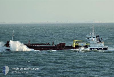
DC BRUGGE
General Cargo
Current Trip
| Time Travelled | 1 day |
|---|---|
| Remaining Time | 13 mins |
| Distance Travelled | 279.98 nm |
| Remaining Distance | 4.46 nm |
| AVG Speed | 8.9 Knop |
| MAX Speed | 13.2 Knop |
| AVG Wind | 8.9 knots |
| MAX Wind | 14.9 knots |
| MIN Temp | 8.1°C / 46.58°F |
| MAX Temp | 16°C / 60.8°F |
| Djupgående | 6.5 m |
| Position mottagen | 1 m sen |
Current Position
| Longitud | 3.55286° |
|---|---|
| Latitude | 51.44554° |
| Status | Under way using engine |
| Fart | 11.3 Knop |
| Kurs | 109.9° |
| Område | North Sea |
| Station | T-AIS |
| Position mottagen | 1 m sen |
Info
Information
The current position of DC BRUGGE is in North Sea with coordinates 51.44554° / 3.55286° as reported on 2024-04-30 15:58 by AIS to our vessel tracker app. The vessel's current speed is 11.3 Knop and is heading at the port of BRESKENS. The estimated time of arrival as calculated by MyShipTracking vessel tracking app is 2024-04-30 16:13 LT
The vessel DC BRUGGE (IMO: 7365851, MMSI: 245239000) is a General Cargo that was built in 1974 ( 50 År gammal ). It's sailing under the flag of [NL] Netherlands.
In this page you can find informations about the vessels current position, last detected port calls, and current voyage information. If the vessels is not in coverage by AIS you will find the latest position.
The current position of DC BRUGGE is detected by our AIS receivers and we are not responsible for the reliability of the data. The last position was recorded while the vessel was in Coverage by the Ais receivers of our vessel tracking app.
The current draught of DC BRUGGE as reported by AIS is 6.5 meters
Weather
| Temperature | 16°C / 60.8°F |
|---|---|
| Wind Speed | 7 knots |
| Direction | 158° SSE |
| Pressure | 1011.8 hPa |
| Humidity | 71.3 % |
| Cloud Coverage | 92 % |
Featured Company
Last Port Calls
| Port | Arrival | Departure | Time In Port |
|---|---|---|---|
| 2024-04-26 17:12 | 2024-04-28 19:54 | 2 d | |
| 2024-04-19 19:05 | 2024-04-21 16:41 | 1 d | |
| 2024-04-18 02:07 | 2024-04-18 04:39 | 2 h | |
| 2024-04-18 01:23 | 2024-04-18 01:39 | 15 m | |
| 2024-04-17 17:22 | 2024-04-17 19:51 | 2 h | |
| 2024-04-14 12:33 | 2024-04-14 14:15 | 1 h | |
| 2024-04-14 03:26 | 2024-04-14 03:38 | 12 m | |
| 2024-04-13 22:09 | 2024-04-14 02:48 | 4 h | |
| 2024-04-13 12:34 | 2024-04-13 15:08 | 2 h | |
| 2024-04-13 08:18 | 2024-04-13 10:27 | 2 h |
Most Visited Ports (Last year)
| Port | Arrivals | |
|---|---|---|
| 39 | ||
| 35 | ||
| 14 | ||
| 13 | ||
| 9 | ||
| 6 |
Last Trips
| Origin | Departure | Destination | Arrival | Distance | |
|---|---|---|---|---|---|
| 2024-04-21 18:41 | 2024-04-26 19:12 | 534.57 nm | |||
| 2024-04-18 06:39 | 2024-04-19 21:05 | 189.77 nm | |||
| 2024-04-18 03:39 | 2024-04-18 04:07 | 2.36 nm | |||
| 2024-04-17 21:51 | 2024-04-18 03:23 | 2.50 nm | |||
| 2024-04-14 16:15 | 2024-04-17 19:22 | 279.52 nm | |||
| 2024-04-14 05:38 | 2024-04-14 14:33 | 5.30 nm | |||
| 2024-04-14 04:48 | 2024-04-14 05:26 | 2.35 nm | |||
| 2024-04-13 17:08 | 2024-04-14 00:09 | 47.84 nm | |||
| 2024-04-13 12:27 | 2024-04-13 14:34 | 1.46 nm | |||
| 2024-04-13 05:44 | 2024-04-13 10:18 | 2.31 nm |
Events
| Tid | Event | Detaljer | Position / Dest | Information |
|---|---|---|---|---|
| 2024-04-30 10:26 | STARTAR förflyttning | 1.19 nm, South East of BRESKENS |
51.38849 / 3.59506
DREDGE AREA - NLBRS
|
Fart: 7.3 kn Kurs: 244.8° |
| 2024-04-30 09:10 | STOPPAR förflyttning | 1.21 nm, South East of BRESKENS |
51.38999 / 3.59694
DREDGE AREA - NLBRS
|
Fart: 0.3 kn Kurs: 108° |
| 2024-04-30 08:47 | Djupgående ändrat | 6.5 0 |
51.41271 / 3.55804
DREDGE AREA - NLBRS
|
Fart: 7.8 kn Kurs: 172.2° |
| 2024-04-30 08:41 | Djupgående ändrat | 0 6.5 |
51.42780 / 3.56177
|
Fart: 7.6 kn Kurs: 188.9° |
| 2024-04-30 02:54 | STARTAR förflyttning | 1.76 nm, South East of BRESKENS |
51.38598 / 3.61016
DREDGE AREA - NLBRS
|
Fart: 5.5 kn Kurs: 300.8° |
| 2024-04-30 01:36 | STOPPAR förflyttning | 1.87 nm, South East of BRESKENS |
51.38611 / 3.61334
DREDGE AREA - NLBRS
|
Fart: 0.3 kn Kurs: 236° |
| 2024-04-30 00:26 | Byter havsområde | Dutch part of the North Sea Belgian part of the North Sea |
51.40093 / 3.34889
North Sea
DREDGE AREA - NLBRS
|
Fart: 10 kn Kurs: 91.4° |
| 2024-04-29 18:32 | Byter havsområde | Belgian part of the North Sea Dutch part of the North Sea |
51.41452 / 3.31308
North Sea
DREDGE AREA - NLBRS
|
Fart: 11.6 kn Kurs: 270.7° |
| 2024-04-29 17:29 | STARTAR förflyttning | 2.11 nm, East of BRESKENS |
51.38789 / 3.62109
DREDGE AREA - NLBRS
|
Fart: 3.2 kn Kurs: 298° |
| 2024-04-29 13:26 | STOPPAR förflyttning | 2.22 nm, East of BRESKENS |
51.38773 / 3.62417
DREDGE AREA - NLBRS
|
Fart: 0.3 kn Kurs: 269° |