
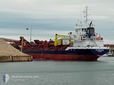
DC BRUGGE
General Cargo
Current Trip
| Time Travelled | 9 days |
|---|---|
| Remaining Time | 6 mins |
| Distance Travelled | 667.21 nm |
| Remaining Distance | 2.47 nm |
| AVG Speed | 9.3 Noeuds |
| MAX Speed | 14.7 Noeuds |
| AVG Wind | 13.9 knots |
| MAX Wind | 21 knots |
| MIN Temp | -0.6°C / 30.92°F |
| MAX Temp | 12.6°C / 54.68°F |
| Tirant d eau | 6.5 m |
| Position reçue | Maintenant |
Current Position
| Longitude | --- |
|---|---|
| Latitude | --- |
| Etat | Under way using engine |
| Vitesse | 7.6 Noeuds |
| Parcours | 164.3° |
| Zone | North Sea |
| Station | T-AIS |
| Position reçue | Maintenant |
Info
Information
The current position of DC BRUGGE is in North Sea with coordinates 51.40763° / 3.55972° as reported on 2025-02-26 03:23 by AIS to our vessel tracker app. The vessel's current speed is 7.6 Noeuds and is heading at the port of BRESKENS. The estimated time of arrival as calculated by MyShipTracking vessel tracking app is 2025-02-26 03:29 LT
The vessel DC BRUGGE (IMO: 7365851, MMSI: 245239000) is a General Cargo that was built in 1974 ( 51 Age ). It's sailing under the flag of [NL] Netherlands.
In this page you can find informations about the vessels current position, last detected port calls, and current voyage information. If the vessels is not in coverage by AIS you will find the latest position.
The current position of DC BRUGGE is detected by our AIS receivers and we are not responsible for the reliability of the data. The last position was recorded while the vessel was in Coverage by the Ais receivers of our vessel tracking app.
The current draught of DC BRUGGE as reported by AIS is 6.5 meters
Weather
| Temperature | 6.7°C / 44.06°F |
|---|---|
| Wind Speed | 7 knots |
| Direction | 289° WNW |
| Pressure | 1016 hPa |
| Humidity | 84 % |
| Cloud Coverage | 69 % |
Featured Company
Last Port Calls
| Port | Arrival | Departure | Time In Port |
|---|---|---|---|
| 2025-02-16 15:59 | 2025-02-16 17:20 | 1 h | |
| 2025-02-15 07:23 | 2025-02-16 07:14 | 23 h | |
| 2025-02-15 05:15 | 2025-02-15 06:22 | 1 h | |
| 2025-02-14 09:43 | 2025-02-14 09:48 | 5 m | |
| 2025-01-28 06:22 | 2025-01-28 12:04 | 5 h | |
| 2025-01-25 10:26 | 2025-01-26 04:06 | 17 h | |
| 2025-01-14 17:58 | 2025-01-15 06:16 | 12 h | |
| 2025-01-14 06:12 | 2025-01-14 14:17 | 8 h | |
| 2025-01-12 21:09 | 2025-01-12 21:47 | 37 m | |
| 2025-01-12 06:05 | 2025-01-12 11:53 | 5 h |
Most Visited Ports (Last year)
| Port | Arrivals | |
|---|---|---|
| 36 | ||
| 28 | ||
| 23 | ||
| 18 | ||
| 11 | ||
| 10 |
Last Trips
| Origin | Departure | Destination | Arrival | Distance | |
|---|---|---|---|---|---|
| 2025-02-16 08:14 | 2025-02-16 16:59 | 5.12 nm | |||
| 2025-02-15 07:22 | 2025-02-15 08:23 | 2.86 nm | |||
| 2025-02-14 10:48 | 2025-02-15 06:15 | 87.76 nm | |||
| 2025-01-28 13:04 | 2025-02-14 10:43 | 1412.62 nm | |||
| 2025-01-26 05:06 | 2025-01-28 07:22 | 175.61 nm | |||
| 2025-01-15 07:16 | 2025-01-25 11:26 | 964.21 nm | |||
| 2025-01-14 15:17 | 2025-01-14 18:58 | 12.52 nm | |||
| 2025-01-12 22:47 | 2025-01-14 07:12 | 149.66 nm | |||
| 2025-01-12 12:53 | 2025-01-12 22:09 | 6.18 nm | |||
| 2025-01-12 06:21 | 2025-01-12 07:05 | 1.92 nm |
Events
| Heure | Evenement | Détails | Position/ Destination | Info |
|---|---|---|---|---|
| 2025-02-25 20:59 | Démarrage | 2.69 nm, East of BRESKENS |
51.38652 / 3.63652
DREDGE AREA - NLBRS
|
Vitesse: 4.7 kn Parcours: 271° |
| 2025-02-25 09:52 | Arret | 2.79 nm, East of BRESKENS |
51.38709 / 3.63951
DREDGE AREA - NLBRS
|
Vitesse: 0.3 kn Parcours: 277° |
| 2025-02-25 09:28 | Démarrage | 0.52 nm, East of BRESKENS |
51.39495 / 3.58037
DREDGE AREA - NLBRS
|
Vitesse: 4.7 kn Parcours: 132° |
| 2025-02-25 08:33 | Arret | 0.45 nm, East of BRESKENS |
51.39671 / 3.57915
DREDGE AREA - NLBRS
|
Vitesse: 0.3 kn Parcours: 325° |
| 2025-02-25 07:31 | Changement de zone | Dutch part of the North Sea Belgian part of the North Sea |
51.39760 / 3.35199
North Sea
DREDGE AREA - NLBRS
|
Vitesse: 9.9 kn Parcours: 88° |
| 2025-02-25 05:44 | Changement de destination | DREDGE AREA - NLBRS NLVLI |
51.45894 / 2.94247
DREDGE AREA - NLBRS
|
Vitesse: 9.4 kn Parcours: 144.8° |
| 2025-02-25 05:44 | Changement d'ETA | 2025/02/25 10:00 2025/02/21 21:00 |
51.45894 / 2.94247
DREDGE AREA - NLBRS
|
Vitesse: 9.4 kn Parcours: 144.8° |
| 2025-02-25 01:05 | Detecté en mer | Belgian part of the North Sea |
51.40914 / 3.32893
North Sea
|
Vitesse: 11.6 kn Parcours: 268.4° |
| 2025-02-25 00:05 | Démarrage | 2.39 nm, East of BRESKENS |
51.38778 / 3.62900
NLVLI
|
Vitesse: 5.3 kn Parcours: 269.1° |
| 2025-02-24 22:22 | Arret | 2.51 nm, East of BRESKENS |
51.38775 / 3.63217
NLVLI
|
Vitesse: 0.3 kn Parcours: 253° |