
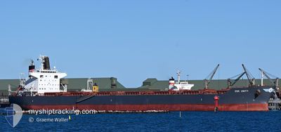
CSK UNITY
Cargo
Current Trip
CN ZOS >> CA VAN
| Time Travelled | 2 days |
|---|---|
| Remaining Time | --- |
| Distance Travelled | 811.75 nm |
| Remaining Distance | --- |
| AVG Speed | 12 Knop |
| MAX Speed | 13.4 Knop |
| AVG Wind | 13.7 knots |
| MAX Wind | 21 knots |
| MIN Temp | 9.4°C / 48.92°F |
| MAX Temp | 20.5°C / 68.9°F |
| Djupgående | 13.7 m |
| Position mottagen | 9 d sen |
Current Position
| Longitud | --- |
|---|---|
| Latitude | --- |
| Status | Under way using engine |
| Fart | 9.1 Knop |
| Kurs | 260.3° |
| Område | North Pacific Ocean |
| Station | T-AIS |
| Position mottagen | 9 d sen |
Info
Information
The current position of CSK UNITY is in North Pacific Ocean with coordinates 41.63606° / 140.84854° as reported on 2025-12-09 09:46 by AIS to our vessel tracker app. The vessel's current speed is 9.1 Knop
The vessel CSK UNITY (IMO: 9727314, MMSI: 566365000) is a Cargo It's sailing under the flag of [SG] Singapore.
In this page you can find informations about the vessels current position, last detected port calls, and current voyage information. If the vessels is not in coverage by AIS you will find the latest position.
The current position of CSK UNITY is detected by our AIS receivers and we are not responsible for the reliability of the data. The last position was recorded while the vessel was in Coverage by the Ais receivers of our vessel tracking app.
The current draught of CSK UNITY as reported by AIS is 13.7 meters
Weather
| Temperature | 17.7°C / 63.86°F |
|---|---|
| Wind Speed | 18 knots |
| Direction | 22° NNE |
| Pressure | 1019.5 hPa |
| Humidity | 90.1 % |
| Cloud Coverage | 100 % |
Featured Company
Last Port Calls
| Port | Arrival | Departure | Time In Port |
|---|---|---|---|
| 2025-12-15 01:46 | 2025-12-16 15:02 | 1 d | |
| 2025-11-20 12:51 | 2025-11-21 01:14 | 12 h | |
| 2025-11-16 02:13 | 2025-11-18 15:15 | 2 d | |
| 2025-10-05 10:24 | 2025-10-06 10:06 | 23 h |
Last Trips
| Origin | Departure | Destination | Arrival | Distance | |
|---|---|---|---|---|---|
| 2025-11-21 01:14 | 2025-12-15 01:46 | 5272.31 nm | |||
| 2025-11-18 15:15 | 2025-11-20 12:51 | 109.79 nm | |||
| 2025-10-06 10:06 | 2025-11-16 02:13 | 10070.04 nm | |||
| 2025-09-20 03:52 | 2025-10-05 10:24 | 4524.17 nm |
Events
| Tid | Event | Detaljer | Position / Dest | Information |
|---|---|---|---|---|
| 2025-12-16 07:02 | AVGÅTT HAMN |
|
35.56027 / 119.80177
CN ZOS >> CA VAN
|
Fart: 9 kn Kurs: 180° |
| 2025-12-16 06:46 | STARTAR förflyttning |
35.59858 / 119.79961
[CN] DONGJIAKOU
|
Fart: 4.4 kn Kurs: 166° |
|
| 2025-12-14 18:37 | STOPPAR förflyttning |
35.60447 / 119.79375
[CN] DONGJIAKOU
|
Fart: Kurs: 237° |
|
| 2025-12-14 17:46 | ANLÄNDER HAMN |
|
35.58540 / 119.80284
[CN] DONGJIAKOU
|
Fart: 5.8 kn Kurs: 1° |
| 2025-12-12 21:01 | STARTAR förflyttning | 17.92 nm, South East of YEOSU |
34.60458 / 127.99048
CN ZOS >> CA VAN
|
Fart: 4.2 kn Kurs: 190° |
| 2025-12-12 16:25 | STOPPAR förflyttning | 17.49 nm, South East of YEOSU |
34.61118 / 127.98463
CN ZOS >> CA VAN
|
Fart: 0.1 kn Kurs: 80° |
| 2025-12-09 09:49 | Status ändrad | Default Under way using engine |
41.63488 / 140.83841
CN ZOS >> CA VAN
|
Fart: 9.1 kn Kurs: 260.3° |
| 2025-12-09 09:46 | UTANFÖR täckningsområde |
41.63606 / 140.84854
North Pacific Ocean
|
Fart: 9.1 kn Kurs: 260.3° |
|
| 2025-12-09 09:45 | Status ändrad | Under way using engine Default |
41.63641 / 140.85132
CN ZOS >> CA VAN
|
Fart: 8.9 kn Kurs: 258° |
| 2025-12-09 09:37 | I täckningsområde |
41.63606 / 140.84854
North Pacific Ocean
|
Fart: 9.1 kn Kurs: 260.3° |