
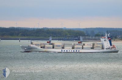
COOL MAGNUS
Reefer
Current Trip
| Trip Time | 6 days |
|---|---|
| Trip Distance | 1842.37 nm |
| AVG Speed | 17.5 Knop |
| MAX Speed | 20 Knop |
| Djupgående | 9.1 m |
| AVG Wind | 11.7 knots |
| MAX Wind | 28.7 knots |
| MIN Temp | 21.4°C / 70.52°F |
| MAX Temp | 28.5°C / 83.3°F |
| Position mottagen | 5 d sen |
Current Position
| Longitud | --- |
|---|---|
| Latitude | --- |
| Status | At anchor |
| Fart | |
| Kurs | 145° |
| Område | South Atlantic Ocean |
| Station | T-AIS |
| Position mottagen | 5 d sen |
Info
Information
The current position of COOL MAGNUS is in South Atlantic Ocean with coordinates -25.68554° / -48.21506° as reported on 2026-01-02 19:03 by AIS to our vessel tracker app. The vessel's current speed is 0 Knop and is currently inside the port of PARANAGUA.
The vessel COOL MAGNUS (IMO: 9167801, MMSI: 311001083) is a Reefer that was built in 2000 ( 26 År gammal ). It's sailing under the flag of [BS] Bahamas.
In this page you can find informations about the vessels current position, last detected port calls, and current voyage information. If the vessels is not in coverage by AIS you will find the latest position.
The current position of COOL MAGNUS is detected by our AIS receivers and we are not responsible for the reliability of the data. The last position was recorded while the vessel was in Coverage by the Ais receivers of our vessel tracking app.
The current draught of COOL MAGNUS as reported by AIS is 9.1 meters
Weather
| Temperature | 26.1°C / 78.98°F |
|---|---|
| Wind Speed | 1 knots |
| Direction | 318° NW |
| Pressure | 1014.1 hPa |
| Humidity | 70.1 % |
| Cloud Coverage | 84 % |
Featured Company
Last Port Calls
| Port | Arrival | Departure | Time In Port |
|---|---|---|---|
| 2026-01-04 15:41 | |||
| 2025-12-25 15:48 | 2025-12-29 03:32 | 3 d | |
| 2025-12-10 07:23 | 2025-12-11 22:01 | 1 d | |
| 2025-12-09 01:50 | 2025-12-09 21:11 | 19 h | |
| 2025-12-06 11:32 | 2025-12-08 20:53 | 2 d | |
| 2025-12-06 09:38 | |||
| 2025-12-04 20:36 | |||
| 2025-12-01 02:23 | 2025-12-02 14:19 | 1 d | |
| 2025-11-24 10:57 | 2025-11-30 20:37 | 6 d | |
| 2025-11-07 05:26 | 2025-11-07 11:17 | 5 h |
Most Visited Ports (Last year)
| Port | Arrivals | |
|---|---|---|
| 12 | ||
| 5 | ||
| 3 | ||
| 1 | ||
| 1 | ||
| 1 |
Last Trips
| Origin | Departure | Destination | Arrival | Distance | |
|---|---|---|---|---|---|
| 2025-12-29 03:32 | 2026-01-04 15:41 | 1842.37 nm | |||
| 2025-12-11 22:01 | 2025-12-25 15:48 | 5444.93 nm | |||
| 2025-12-09 21:11 | 2025-12-10 07:23 | 16.15 nm | |||
| 2025-12-08 20:53 | 2025-12-09 01:50 | 49.00 nm | |||
| 2025-12-06 09:38 | 2025-12-06 11:32 | 7.47 nm | |||
| 2025-11-30 20:37 | 2025-12-01 02:23 | 26.66 nm | |||
| 2025-11-07 11:17 | 2025-11-24 10:57 | 6411.73 nm | |||
| 2025-11-02 12:08 | 2025-11-07 05:26 | 1035.21 nm |
Events
| Tid | Event | Detaljer | Position / Dest | Information |
|---|---|---|---|---|
| 2026-01-04 19:01 | STOPPAR förflyttning |
-25.50186 / -48.52385
[BR] PARANAGUA
|
Fart: Kurs: 96° |
|
| 2026-01-04 18:41 | ANLÄNDER HAMN |
|
-25.49882 / -48.51574
[BR] PARANAGUA
|
Fart: 6 kn Kurs: 258° |
| 2026-01-04 16:08 | STARTAR förflyttning | 9.89 nm, South East of ILHA DO MEL |
-25.68414 / -48.21069
BRPNG
|
Fart: 4.1 kn Kurs: 25° |
| 2026-01-02 19:10 | Status ändrad | Default At anchor |
-25.68555 / -48.21510
BRPNG
|
Fart: Kurs: 145° |
| 2026-01-02 19:03 | UTANFÖR täckningsområde |
-25.68554 / -48.21506
South Atlantic Ocean
|
Fart: Kurs: 194.1° |
|
| 2026-01-02 18:59 | Status ändrad | At anchor Default |
-25.68549 / -48.21506
BRPNG
|
Fart: Kurs: 146° |
| 2026-01-02 18:58 | Status ändrad | Default At anchor |
-25.68548 / -48.21506
BRPNG
|
Fart: Kurs: 145° |
| 2026-01-02 18:46 | Status ändrad | At anchor Default |
-25.68554 / -48.21505
BRPNG
|
Fart: Kurs: 147° |
| 2026-01-02 18:30 | I täckningsområde |
-25.68554 / -48.21505
South Atlantic Ocean
|
Fart: Kurs: 288.8° |
|
| 2026-01-02 11:37 | STOPPAR förflyttning | 9.92 nm, South East of ILHA DO MEL |
-25.68600 / -48.21287
BRPNG
|
Fart: 0.2 kn Kurs: 239° |