
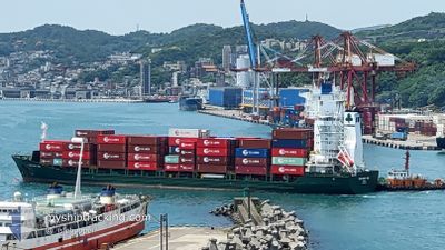
CONTSHIP UNO
General Cargo
Current Trip
| Trip Time | 1 day |
|---|---|
| Trip Distance | 421.90 nm |
| AVG Speed | 12.1 Knop |
| MAX Speed | 14.1 Knop |
| Djupgående | 8.1 m |
| AVG Wind | 9.4 knots |
| MAX Wind | 18 knots |
| MIN Temp | 25.2°C / 77.36°F |
| MAX Temp | 28.5°C / 83.3°F |
| Position mottagen | 23 d sen |
Current Position
| Longitud | --- |
|---|---|
| Latitude | --- |
| Status | Under way using engine |
| Fart | 13.4 Knop |
| Kurs | 133° |
| Område | Gulf of Oman |
| Station | T-AIS |
| Position mottagen | 23 d sen |
Info
Information
The current position of CONTSHIP UNO is in Gulf of Oman with coordinates 24.71223° / 57.25001° as reported on 2024-11-11 13:17 by AIS to our vessel tracker app. The vessel's current speed is 13.4 Knop and is currently inside the port of MUNDRA.
The vessel CONTSHIP UNO (IMO: 9379026, MMSI: 636018001) is a General Cargo that was built in 2007 ( 17 År gammal ). It's sailing under the flag of [LR] Liberia.
In this page you can find informations about the vessels current position, last detected port calls, and current voyage information. If the vessels is not in coverage by AIS you will find the latest position.
The current position of CONTSHIP UNO is detected by our AIS receivers and we are not responsible for the reliability of the data. The last position was recorded while the vessel was in Coverage by the Ais receivers of our vessel tracking app.
The current draught of CONTSHIP UNO as reported by AIS is 8.1 meters
Weather
| Temperature | 25.1°C / 77.18°F |
|---|---|
| Wind Speed | 11 knots |
| Direction | 34° NE |
| Pressure | 1014.2 hPa |
| Humidity | 43.7 % |
| Cloud Coverage | 1 % |
Featured Company
Last Port Calls
| Port | Arrival | Departure | Time In Port |
|---|---|---|---|
| 2024-12-04 14:04 | |||
| 2024-12-02 17:28 | 2024-12-03 03:53 | 10 h | |
| 2024-11-21 15:11 | 2024-11-23 05:31 | 1 d | |
| 2024-11-04 04:30 | 2024-11-04 15:43 | 11 h | |
| 2024-10-27 15:39 | 2024-10-28 01:50 | 10 h | |
| 2024-10-24 01:55 | 2024-10-24 12:47 | 10 h | |
| 2024-10-10 18:52 | 2024-10-12 04:28 | 1 d |
Last Trips
| Origin | Departure | Destination | Arrival | Distance | |
|---|---|---|---|---|---|
| 2024-12-03 09:23 | 2024-12-04 19:34 | 421.90 nm | |||
| 2024-11-23 08:31 | 2024-12-02 22:58 | 2687.48 nm | |||
| 2024-11-04 19:43 | 2024-11-21 18:11 | 3158.09 nm | |||
| 2024-10-28 07:20 | 2024-11-04 08:30 | 1043.67 nm | |||
| 2024-10-24 18:17 | 2024-10-27 21:09 | 427.24 nm | |||
| 2024-10-12 07:28 | 2024-10-24 07:25 | 2754.04 nm | |||
| 2024-09-28 22:24 | 2024-10-10 21:52 | 3211.70 nm |
Events
| Tid | Event | Detaljer | Position / Dest | Information |
|---|---|---|---|---|
| 2024-12-04 14:35 | STOPPAR förflyttning |
22.74775 / 69.70676
[IN] MUNDRA
|
Fart: Kurs: 305° |
|
| 2024-12-04 14:04 | ANLÄNDER HAMN |
|
22.74385 / 69.71558
[IN] MUNDRA
|
Fart: 6.5 kn Kurs: 334° |
| 2024-12-03 03:53 | AVGÅTT HAMN |
|
18.94798 / 72.93689
KEMBA
|
Fart: 4.2 kn Kurs: 228° |
| 2024-12-03 03:49 | STARTAR förflyttning |
18.95048 / 72.93980
[IN] NHAVA SHEVA
|
Fart: 4.2 kn Kurs: 228° |
|
| 2024-12-02 17:50 | STOPPAR förflyttning |
18.95419 / 72.94597
[IN] NHAVA SHEVA
|
Fart: Kurs: 204° |
|
| 2024-12-02 17:28 | ANLÄNDER HAMN |
|
18.95474 / 72.94435
[IN] NHAVA SHEVA
|
Fart: 5.1 kn Kurs: 61° |
| 2024-12-02 14:40 | STARTAR förflyttning | 19.4 nm, South West of MUMBAI |
18.79310 / 72.59656
KEMBA
|
Fart: 5.7 kn Kurs: 9° |
| 2024-12-02 03:20 | STOPPAR förflyttning | 19.49 nm, South West of MUMBAI |
18.79113 / 72.59612
KEMBA
|
Fart: 0.2 kn Kurs: 341° |