
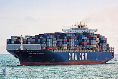
CMA CGM LA TRAVIATA
Container Ship
Current Trip
| Time Travelled | 15 h, 12 mins |
|---|---|
| Remaining Time | 7 days |
| Distance Travelled | 254.79 nm |
| Remaining Distance | 3339.12 nm |
| AVG Speed | 17.8 Knop |
| MAX Speed | 19.6 Knop |
| AVG Wind | 7.7 knots |
| MAX Wind | 12.9 knots |
| MIN Temp | 13.6°C / 56.48°F |
| MAX Temp | 18.6°C / 65.48°F |
| Djupgående | 14.2 m |
| Position mottagen | Nu |
Current Position
| Longitud | -2.52833° |
|---|---|
| Latitude | 36.41367° |
| Status | Under way using engine |
| Fart | 18.4 Knop |
| Kurs | 261.4° |
| Område | Alboran Sea |
| Station | T-AIS |
| Position mottagen | Nu |
Info
Information
The current position of CMA CGM LA TRAVIATA is in Alboran Sea with coordinates 36.41367° / -2.52833° as reported on 2024-05-03 21:04 by AIS to our vessel tracker app. The vessel's current speed is 18.4 Knop and is heading at the port of NEW YORK. The estimated time of arrival as calculated by MyShipTracking vessel tracking app is 2024-05-11 10:27 LT
The vessel CMA CGM LA TRAVIATA (IMO: 9299795, MMSI: 228340900) is a Container Ship that was built in 2006 ( 18 År gammal ). It's sailing under the flag of [FR] France.
In this page you can find informations about the vessels current position, last detected port calls, and current voyage information. If the vessels is not in coverage by AIS you will find the latest position.
The current position of CMA CGM LA TRAVIATA is detected by our AIS receivers and we are not responsible for the reliability of the data. The last position was recorded while the vessel was in Coverage by the Ais receivers of our vessel tracking app.
The current draught of CMA CGM LA TRAVIATA as reported by AIS is 14.2 meters
Weather
| Temperature | 17.2°C / 62.96°F |
|---|---|
| Wind Speed | 5 knots |
| Direction | 227° SW |
| Pressure | 1019.3 hPa |
| Humidity | 64.9 % |
| Cloud Coverage | 43 % |
Featured Company
Last Port Calls
| Port | Arrival | Departure | Time In Port |
|---|---|---|---|
| 2024-05-02 07:00 | 2024-05-03 05:52 | 22 h | |
| 2024-04-30 03:58 | 2024-05-01 03:15 | 23 h | |
| 2024-04-27 09:48 | 2024-04-29 12:25 | 2 d | |
| 2024-04-24 03:27 | 2024-04-26 16:03 | 2 d | |
| 2024-04-21 10:21 | 2024-04-23 06:08 | 1 d | |
| 2024-04-17 20:22 | 2024-04-19 02:15 | 1 d | |
| 2024-03-28 21:57 | 2024-03-29 23:44 | 1 d | |
| 2024-03-26 09:39 | 2024-03-27 18:32 | 1 d | |
| 2024-03-23 14:00 | 2024-03-24 21:09 | 1 d | |
| 2024-03-20 08:52 | 2024-03-20 10:43 | 1 h |
Last Trips
| Origin | Departure | Destination | Arrival | Distance | |
|---|---|---|---|---|---|
| 2024-05-01 05:15 | 2024-05-02 09:00 | 201.07 nm | |||
| 2024-04-29 14:25 | 2024-04-30 05:58 | 192.23 nm | |||
| 2024-04-26 18:03 | 2024-04-27 11:48 | 223.25 nm | |||
| 2024-04-23 08:08 | 2024-04-24 05:27 | 109.03 nm | |||
| 2024-04-19 04:15 | 2024-04-21 12:21 | 908.75 nm | |||
| 2024-03-29 19:44 | 2024-04-17 22:22 | 4328.28 nm | |||
| 2024-03-27 14:32 | 2024-03-28 17:57 | 425.63 nm | |||
| 2024-03-24 17:09 | 2024-03-26 05:39 | 537.24 nm | |||
| 2024-03-20 06:43 | 2024-03-23 10:00 | 336.78 nm | |||
| 2024-03-10 14:48 | 2024-03-20 04:52 | 3638.74 nm |
Events
| Tid | Event | Detaljer | Position / Dest | Information |
|---|---|---|---|---|
| 2024-05-03 19:41 | Byter havsområde | Spanish part of the Alboran Sea Spanish part of the Mediterranean Sea - Western Basin |
36.50933 / -2.02342
Alboran Sea
USNYC
|
Fart: 19.3 kn Kurs: 228.9° |
| 2024-05-03 17:52 | Status ändrad | Under way using engine Default |
36.91332 / -1.50117
USNYC
|
Fart: 19.4 kn Kurs: 227° |
| 2024-05-03 17:50 | Status ändrad | Default Under way using engine |
36.91907 / -1.49311
USNYC
|
Fart: 19.3 kn Kurs: 225.6° |
| 2024-05-03 17:16 | Status ändrad | Under way using engine Default |
37.05060 / -1.33162
USNYC
|
Fart: 19.2 kn Kurs: 231° |
| 2024-05-03 17:12 | Status ändrad | Default Under way using engine |
37.06460 / -1.31323
USNYC
|
Fart: 19.1 kn Kurs: 230.4° |
| 2024-05-03 15:59 | Status ändrad | Under way using engine Default |
37.31094 / -.93140
USNYC
|
Fart: 18.9 kn Kurs: 226° |
| 2024-05-03 15:58 | Status ändrad | Default Under way using engine |
37.31325 / -.92853
USNYC
|
Fart: 19.1 kn Kurs: 232.2° |
| 2024-05-03 15:48 | Djupgående ändrat | 14.2 14 |
37.35032 / -.87656
USNYC
|
Fart: 19.1 kn Kurs: 229.4° |
| 2024-05-03 15:48 | ETA ändrat | 2024/05/12 02:30 |
37.35032 / -.87656
USNYC
|
Fart: 19.1 kn Kurs: 229.4° |
| 2024-05-03 13:48 | Djupgående ändrat | 14 14.2 |
37.82370 / -.36243
USNYC
|
Fart: 18.9 kn Kurs: 214° |