
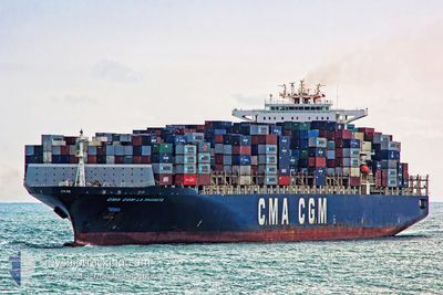
CMA CGM LA TRAVIATA
Container Ship
Current Trip
| Time Travelled | 8 days |
|---|---|
| Remaining Time | --- |
| Distance Travelled | 3508.06 nm |
| Remaining Distance | 120.90 nm |
| AVG Speed | 17.1 Knots |
| MAX Speed | 20 Knots |
| AVG Wind | 14 knots |
| MAX Wind | 32.8 knots |
| MIN Temp | 7.1°C / 44.78°F |
| MAX Temp | 18.6°C / 65.48°F |
| Dybgang | 14.2 m |
| Position Modtaget | 4 d siden |
Current Position
| Longitude | -30.04005° |
|---|---|
| Latitude | 40.82366° |
| Status | Under way using engine |
| Fart | 15.4 Knots |
| Kurs | 279.9° |
| Område | North Atlantic Ocean |
| Station | T-AIS |
| Position Modtaget | 4 d siden |
Info
Information
The current position of CMA CGM LA TRAVIATA is in North Atlantic Ocean with coordinates 40.82366° / -30.04005° as reported on 2024-05-06 21:56 by AIS to our vessel tracker app. The vessel's current speed is 15.4 Knots and is heading at the port of NEW YORK. The estimated time of arrival as calculated by MyShipTracking vessel tracking app is 2024-05-12 02:30 LT
The vessel CMA CGM LA TRAVIATA (IMO: 9299795, MMSI: 228340900) is a Container Ship that was built in 2006 ( 18 år gamle ). It's sailing under the flag of [FR] France.
In this page you can find informations about the vessels current position, last detected port calls, and current voyage information. If the vessels is not in coverage by AIS you will find the latest position.
The current position of CMA CGM LA TRAVIATA is detected by our AIS receivers and we are not responsible for the reliability of the data. The last position was recorded while the vessel was in Coverage by the Ais receivers of our vessel tracking app.
The current draught of CMA CGM LA TRAVIATA as reported by AIS is 14.2 meters
Weather
| Temperature | 9.3°C / 48.74°F |
|---|---|
| Wind Speed | 13 knots |
| Direction | 69° ENE |
| Pressure | 1010.2 hPa |
| Humidity | 80 % |
| Cloud Coverage | 76 % |
Featured Company
Last Port Calls
| Port | Arrival | Departure | Time In Port |
|---|---|---|---|
| 2024-05-02 07:00 | 2024-05-03 05:52 | 22 h | |
| 2024-04-30 03:58 | 2024-05-01 03:15 | 23 h | |
| 2024-04-27 09:48 | 2024-04-29 12:25 | 2 d | |
| 2024-04-24 03:27 | 2024-04-26 16:03 | 2 d | |
| 2024-04-21 10:21 | 2024-04-23 06:08 | 1 d | |
| 2024-04-17 20:22 | 2024-04-19 02:15 | 1 d | |
| 2024-03-28 21:57 | 2024-03-29 23:44 | 1 d | |
| 2024-03-26 09:39 | 2024-03-27 18:32 | 1 d | |
| 2024-03-23 14:00 | 2024-03-24 21:09 | 1 d | |
| 2024-03-20 08:52 | 2024-03-20 10:43 | 1 h |
Last Trips
| Origin | Departure | Destination | Arrival | Distance | |
|---|---|---|---|---|---|
| 2024-05-01 05:15 | 2024-05-02 09:00 | 201.07 nm | |||
| 2024-04-29 14:25 | 2024-04-30 05:58 | 192.23 nm | |||
| 2024-04-26 18:03 | 2024-04-27 11:48 | 223.25 nm | |||
| 2024-04-23 08:08 | 2024-04-24 05:27 | 109.03 nm | |||
| 2024-04-19 04:15 | 2024-04-21 12:21 | 908.75 nm | |||
| 2024-03-29 19:44 | 2024-04-17 22:22 | 4328.28 nm | |||
| 2024-03-27 14:32 | 2024-03-28 17:57 | 425.63 nm | |||
| 2024-03-24 17:09 | 2024-03-26 05:39 | 537.24 nm | |||
| 2024-03-20 06:43 | 2024-03-23 10:00 | 336.78 nm | |||
| 2024-03-10 14:48 | 2024-03-20 04:52 | 3638.74 nm |
Events
| Tid | Hændelsen | Detaljer | Position / Dest | Info |
|---|---|---|---|---|
| 2024-05-06 22:00 | Status er ændret | Default Under way using engine |
40.82667 / -30.06167
USNYC
|
Fart: 15.4 kn Kurs: 279.9° |
| 2024-05-06 21:56 | Udenfor Dækning |
40.82366 / -30.04005
North Atlantic Ocean
USNYC
|
Fart: 15.4 kn Kurs: 279.9° |
|
| 2024-05-06 21:52 | Ændre havområde | Portuguese (Azores) part of the North Atlantic Ocean Portuguese part of the North Atlantic Ocean |
40.82104 / -30.02129
North Atlantic Ocean
USNYC
|
Fart: 15.2 kn Kurs: 280.5° |
| 2024-05-06 21:52 | Status er ændret | Under way using engine Default |
40.82098 / -30.02083
USNYC
|
Fart: 15 kn Kurs: 281° |
| 2024-05-06 21:52 | Indenfor Dækning |
40.82104 / -30.02129
North Atlantic Ocean
USNYC
|
Fart: 15.2 kn Kurs: 280.5° |
|
| 2024-05-04 16:26 | Status er ændret | Default Under way using engine |
36.14237 / -9.67605
USNYC
|
Fart: 19.2 kn Kurs: 289.4° |
| 2024-05-04 16:17 | Status er ændret | Under way using engine Default |
36.12524 / -9.61726
USNYC
|
Fart: 19.2 kn Kurs: 291° |
| 2024-05-04 16:17 | Udenfor Dækning |
36.12524 / -9.61726
North Atlantic Ocean
USNYC
|
Fart: 19.2 kn Kurs: 289.4° |
|
| 2024-05-04 15:53 | Status er ændret | Default Under way using engine |
36.08333 / -9.47166
USNYC
|
Fart: 19.2 kn Kurs: 286.6° |
| 2024-05-04 15:47 | Status er ændret | Under way using engine Default |
36.07341 / -9.43267
USNYC
|
Fart: 19.2 kn Kurs: 289° |