
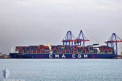
CMA CGM ADONIS
Cargo
Current Trip
| Time Travelled | 23 days |
|---|---|
| Remaining Time | --- |
| Distance Travelled | 8958.84 nm |
| Remaining Distance | --- |
| AVG Speed | 16 Knop |
| MAX Speed | 21.2 Knop |
| AVG Wind | 13.2 knots |
| MAX Wind | 25.3 knots |
| MIN Temp | 12.8°C / 55.04°F |
| MAX Temp | 29.6°C / 85.28°F |
| Djupgående | 13.9 m |
| Position mottagen | 10 d sen |
Current Position
| Longitud | 19.08904° |
|---|---|
| Latitude | -34.92583° |
| Status | Under way using engine |
| Fart | 14.7 Knop |
| Kurs | 108.8° |
| Område | South Atlantic Ocean |
| Station | T-AIS |
| Position mottagen | 10 d sen |
Info
Information
The current position of CMA CGM ADONIS is in South Atlantic Ocean with coordinates -34.92583° / 19.08904° as reported on 2024-05-11 10:39 by AIS to our vessel tracker app. The vessel's current speed is 14.7 Knop and is heading at the port of PORT KLANG. The estimated time of arrival as calculated by MyShipTracking vessel tracking app is 2024-05-27 08:00 LT
The vessel CMA CGM ADONIS (IMO: 9882528, MMSI: 229752000) is a Cargo It's sailing under the flag of [MT] Malta.
In this page you can find informations about the vessels current position, last detected port calls, and current voyage information. If the vessels is not in coverage by AIS you will find the latest position.
The current position of CMA CGM ADONIS is detected by our AIS receivers and we are not responsible for the reliability of the data. The last position was recorded while the vessel was in Coverage by the Ais receivers of our vessel tracking app.
The current draught of CMA CGM ADONIS as reported by AIS is 13.9 meters
Weather
| Temperature | 27.8°C / 82.04°F |
|---|---|
| Wind Speed | 15 knots |
| Direction | 132° SE |
| Pressure | 1008 hPa |
| Humidity | 82 % |
| Cloud Coverage | 25 % |
Featured Company
Last Port Calls
| Port | Arrival | Departure | Time In Port |
|---|---|---|---|
| 2024-04-27 15:39 | 2024-04-28 23:08 | 1 d | |
| 2024-04-22 16:23 | 2024-04-25 03:22 | 2 d | |
| 2024-04-15 08:17 | 2024-04-17 06:19 | 1 d | |
| 2024-04-13 02:38 | 2024-04-14 17:11 | 1 d | |
| 2024-04-10 19:05 | 2024-04-12 07:07 | 1 d | |
| 2024-04-05 04:43 | 2024-04-06 18:06 | 1 d | |
| 2024-03-09 00:28 | 2024-03-11 00:40 | 2 d | |
| 2024-03-04 06:27 | 2024-03-05 07:09 | 1 d | |
| 2024-03-03 00:51 | 2024-03-03 18:30 | 17 h |
Most Visited Ports (Last year)
| Port | Arrivals | |
|---|---|---|
| 4 | ||
| 4 | ||
| 3 | ||
| 3 | ||
| 3 | ||
| 2 |
Last Trips
| Origin | Departure | Destination | Arrival | Distance | |
|---|---|---|---|---|---|
| 2024-04-25 05:22 | 2024-04-27 16:39 | 1053.00 nm | |||
| 2024-04-17 08:19 | 2024-04-22 18:23 | 792.70 nm | |||
| 2024-04-14 19:11 | 2024-04-15 10:17 | 237.85 nm | |||
| 2024-04-12 09:07 | 2024-04-13 04:38 | 198.16 nm | |||
| 2024-04-06 20:06 | 2024-04-10 21:05 | 304.43 nm | |||
| 2024-03-11 08:40 | 2024-04-05 06:43 | 11198.85 nm | |||
| 2024-03-05 15:09 | 2024-03-09 08:28 | 1434.59 nm | |||
| 2024-03-04 02:30 | 2024-03-04 14:27 | 107.36 nm | |||
| 2024-02-28 02:34 | 2024-03-03 08:51 | 1026.24 nm |
Events
| Tid | Event | Detaljer | Position / Dest | Information |
|---|