
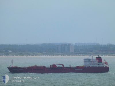
CHARLOTTE THERESA
Oil/Chemical Tanker
Current Trip
| Time Travelled | 12 days |
|---|---|
| Remaining Time | --- |
| Distance Travelled | 2731.16 nm |
| Remaining Distance | --- |
| AVG Speed | 9.8 Knop |
| MAX Speed | 15.8 Knop |
| AVG Wind | 9.2 knots |
| MAX Wind | 29 knots |
| MIN Temp | -3.1°C / 26.42°F |
| MAX Temp | 17.1°C / 62.78°F |
| Djupgående | 8.7 m |
| Position mottagen | 2 m sen |
Current Position
| Longitud | --- |
|---|---|
| Latitude | --- |
| Status | At anchor |
| Fart | |
| Kurs | 239° |
| Område | Balearic Sea |
| Station | T-AIS |
| Position mottagen | 2 m sen |
Information
The current position of CHARLOTTE THERESA is in Balearic Sea with coordinates 41.31770° / 2.20364° as reported on 2025-02-24 13:55 by AIS to our vessel tracker app. The vessel's current speed is 0 Knop
The vessel CHARLOTTE THERESA (IMO: 9400708, MMSI: 220625000) is a Oil/Chemical Tanker that was built in 2008 ( 17 År gammal ). It's sailing under the flag of [DK] Denmark.
In this page you can find informations about the vessels current position, last detected port calls, and current voyage information. If the vessels is not in coverage by AIS you will find the latest position.
The current position of CHARLOTTE THERESA is detected by our AIS receivers and we are not responsible for the reliability of the data. The last position was recorded while the vessel was in Coverage by the Ais receivers of our vessel tracking app.
The current draught of CHARLOTTE THERESA as reported by AIS is 8.7 meters
Weather
| Temperature | 13.3°C / 55.94°F |
|---|---|
| Wind Speed | 17 knots |
| Direction | 235° SW |
| Pressure | 1026 hPa |
| Humidity | 84.9 % |
| Cloud Coverage | 100 % |
Featured Company
Last Port Calls
| Port | Arrival | Departure | Time In Port |
|---|---|---|---|
| 2025-02-11 08:29 | 2025-02-12 07:25 | 22 h | |
| 2025-02-09 06:53 | 2025-02-10 10:52 | 1 d | |
| 2025-02-02 06:33 | 2025-02-02 22:30 | 15 h | |
| 2025-01-24 02:27 | 2025-01-25 13:38 | 1 d | |
| 2025-01-19 16:07 | 2025-01-20 23:37 | 1 d | |
| 2025-01-18 06:31 | 2025-01-19 16:05 | 1 d | |
| 2024-12-24 23:00 | 2024-12-27 06:03 | 2 d | |
| 2024-12-12 06:52 | 2024-12-13 09:32 | 1 d | |
| 2024-12-09 02:00 | 2024-12-11 15:25 | 2 d | |
| 2024-12-02 01:20 |
Most Visited Ports (Last year)
| Port | Arrivals | |
|---|---|---|
| 6 | ||
| 4 | ||
| 3 | ||
| 3 | ||
| 3 | ||
| 2 |
Last Trips
| Origin | Departure | Destination | Arrival | Distance | |
|---|---|---|---|---|---|
| 2025-02-10 12:52 | 2025-02-11 10:29 | 228.29 nm | |||
| 2025-02-02 22:30 | 2025-02-09 08:53 | 1308.65 nm | |||
| 2025-01-25 14:38 | 2025-02-02 06:33 | 1052.42 nm | |||
| 2025-01-21 00:37 | 2025-01-24 03:27 | 791.42 nm | |||
| 2025-01-19 17:05 | 2025-01-19 17:07 | 0.55 nm | |||
| 2024-12-27 07:03 | 2025-01-18 07:31 | 244.39 nm | |||
| 2024-12-13 10:32 | 2024-12-25 00:00 | 2490.37 nm | |||
| 2024-12-11 16:25 | 2024-12-12 07:52 | 7.25 nm | |||
| 2024-12-02 02:20 | 2024-12-09 03:00 | 1127.02 nm |
Events
| Tid | Event | Detaljer | Position / Dest | Information |
|---|---|---|---|---|
| 2025-02-23 11:31 | Status ändrad | At anchor Under way using engine |
41.31623 / 2.20169
ES BCN
|
Fart: 0.6 kn Kurs: 11° |
| 2025-02-23 11:28 | STOPPAR förflyttning | 2.12 nm, South East of BARCELONA |
41.31648 / 2.20181
ES BCN
|
Fart: 0.3 kn Kurs: 25° |
| 2025-02-23 11:07 | Destination ändrad | ES BCN GI GIB FOR ORDERS |
41.30221 / 2.20416
ES BCN
|
Fart: 5 kn Kurs: 20.5° |
| 2025-02-23 11:07 | ETA ändrat | 2025/02/23 11:00 2025/02/21 05:00 |
41.30221 / 2.20416
ES BCN
|
Fart: 5 kn Kurs: 20.5° |
| 2025-02-23 08:05 | Byter havsområde | Spanish part of the Balearic Sea Spanish part of the Mediterranean Sea - Western Basin |
40.84424 / 1.90657
Balearic Sea
|
Fart: 10.6 kn Kurs: 24.6° |
| 2025-02-23 08:05 | I täckningsområde |
40.84424 / 1.90657
Balearic Sea
|
Fart: 10.6 kn Kurs: 24.6° |
|
| 2025-02-22 16:53 | Status ändrad | Default Under way using engine |
38.53253 / .34188
GI GIB FOR ORDERS
|
Fart: 11.3 kn Kurs: 29.4° |
| 2025-02-22 16:46 | UTANFÖR täckningsområde |
38.51194 / .32764
Mediterranean Sea - Western Basin
|
Fart: 11.3 kn Kurs: 29.4° |
|
| 2025-02-22 16:42 | Status ändrad | Under way using engine Default |
38.49998 / .31886
GI GIB FOR ORDERS
|
Fart: 11.2 kn Kurs: 29° |
| 2025-02-22 16:42 | I täckningsområde |
38.49998 / .31886
Mediterranean Sea - Western Basin
|
Fart: 11.4 kn Kurs: 30.9° |