
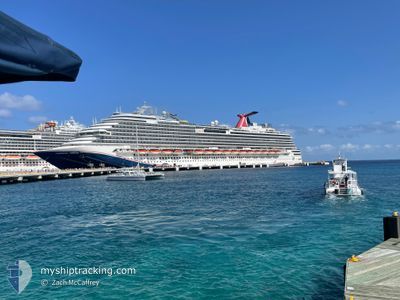
CARNIVAL DREAM
Passengers Ship
Current Trip
| Trip Time | 13 h, 33 mins |
|---|---|
| Trip Distance | 231.24 nm |
| AVG Speed | 17.1 Knop |
| MAX Speed | 18.8 Knop |
| Djupgående | 8.4 m |
| AVG Wind | 11.3 knots |
| MAX Wind | 15.7 knots |
| MIN Temp | 22.2°C / 71.96°F |
| MAX Temp | 22.7°C / 72.86°F |
| Position mottagen | 11 m sen |
Current Position
| Longitud | --- |
|---|---|
| Latitude | --- |
| Status | Under way using engine |
| Fart | |
| Kurs | 39° |
| Område | North Atlantic Ocean |
| Station | T-AIS |
| Position mottagen | 11 m sen |
Info
Information
The current position of CARNIVAL DREAM is in North Atlantic Ocean with coordinates 24.57561° / -75.96131° as reported on 2025-02-26 18:14 by AIS to our vessel tracker app. The vessel's current speed is 0 Knop and is currently inside the port of HALF MOON CAY.
The vessel CARNIVAL DREAM (IMO: 9378474, MMSI: 370490000) is a Passengers Ship that was built in 2009 ( 16 År gammal ). It's sailing under the flag of [PA] Panama.
In this page you can find informations about the vessels current position, last detected port calls, and current voyage information. If the vessels is not in coverage by AIS you will find the latest position.
The current position of CARNIVAL DREAM is detected by our AIS receivers and we are not responsible for the reliability of the data. The last position was recorded while the vessel was in Coverage by the Ais receivers of our vessel tracking app.
The current draught of CARNIVAL DREAM as reported by AIS is 8.4 meters
Weather
| Temperature | 23°C / 73.4°F |
|---|---|
| Wind Speed | 7 knots |
| Direction | 54° NE |
| Pressure | 1016.2 hPa |
| Humidity | 72 % |
| Cloud Coverage | 2 % |
Featured Company
Last Port Calls
| Port | Arrival | Departure | Time In Port |
|---|---|---|---|
| 2025-02-26 08:00 | |||
| 2025-02-25 08:09 | 2025-02-25 18:27 | 10 h | |
| 2025-02-22 06:31 | 2025-02-22 15:45 | 9 h | |
| 2025-02-20 09:05 | 2025-02-20 18:02 | 8 h | |
| 2025-02-19 07:28 | 2025-02-19 16:33 | 9 h | |
| 2025-02-18 13:28 | 2025-02-18 21:00 | 7 h | |
| 2025-02-16 06:10 | 2025-02-16 15:50 | 9 h | |
| 2025-02-13 07:27 | 2025-02-13 17:51 | 10 h | |
| 2025-02-12 07:52 | 2025-02-12 17:15 | 9 h | |
| 2025-02-11 08:11 | 2025-02-11 17:15 | 9 h |
Most Visited Ports (Last year)
| Port | Arrivals | |
|---|---|---|
| 52 | ||
| 26 | ||
| 24 | ||
| 24 | ||
| 23 | ||
| 22 |
Last Trips
| Origin | Departure | Destination | Arrival | Distance | |
|---|---|---|---|---|---|
| 2025-02-25 18:27 | 2025-02-26 08:00 | 231.24 nm | |||
| 2025-02-22 15:45 | 2025-02-25 08:09 | 1023.36 nm | |||
| 2025-02-20 18:02 | 2025-02-22 06:31 | 720.23 nm | |||
| 2025-02-19 16:33 | 2025-02-20 09:05 | 273.84 nm | |||
| 2025-02-18 21:00 | 2025-02-19 07:28 | 169.89 nm | |||
| 2025-02-16 15:50 | 2025-02-18 13:28 | 835.66 nm | |||
| 2025-02-13 17:51 | 2025-02-16 06:10 | 1117.67 nm | |||
| 2025-02-12 17:15 | 2025-02-13 07:27 | 158.13 nm | |||
| 2025-02-11 17:15 | 2025-02-12 07:52 | 229.98 nm | |||
| 2025-02-10 19:07 | 2025-02-11 08:11 | 237.12 nm |
Events
| Tid | Event | Detaljer | Position / Dest | Information |
|---|---|---|---|---|
| 2025-02-26 18:13 | Status ändrad | Under way using engine Default |
24.57564 / -75.96127
[BS] HALF MOON CAY
|
Fart: 0.1 kn Kurs: 49° |
| 2025-02-26 18:13 | I täckningsområde |
24.57564 / -75.96127
North Atlantic Ocean
[BS] HALF MOON CAY
|
Fart: Kurs: 257° |
|
| 2025-02-26 13:00 | ANLÄNDER HAMN |
|
24.57604 / -75.96149
[BS] HALF MOON CAY
|
Fart: 11 kn Kurs: 186° |
| 2025-02-26 12:34 | UTANFÖR täckningsområde |
24.61130 / -76.03970
North Atlantic Ocean
|
Fart: 11 kn Kurs: 186° |
|
| 2025-02-26 12:31 | Status ändrad | Under way using engine Default |
24.62029 / -76.03737
US EYW>BS FPO
|
Fart: 10.6 kn Kurs: 200° |
| 2025-02-26 12:16 | I täckningsområde |
24.62029 / -76.03737
North Atlantic Ocean
|
Fart: 11 kn Kurs: 200° |
|
| 2025-02-26 00:24 | Status ändrad | Default Under way using engine |
26.37021 / -78.59795
US EYW>BS FPO
|
Fart: 17 kn Kurs: 117° |
| 2025-02-26 00:18 | UTANFÖR täckningsområde |
26.38368 / -78.62665
North Atlantic Ocean
|
Fart: 17 kn Kurs: 117° |
|
| 2025-02-26 00:12 | Status ändrad | Under way using engine Default |
26.39629 / -78.65322
US EYW>BS FPO
|
Fart: 17.2 kn Kurs: 120° |
| 2025-02-26 00:08 | Status ändrad | Default Under way using engine |
26.40668 / -78.67380
US EYW>BS FPO
|
Fart: 16 kn Kurs: 120° |