
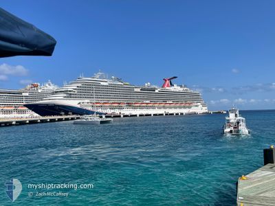
CARNIVAL DREAM
Passengers Ship
Current Trip
| Time Travelled | 10 h, 51 mins |
|---|---|
| Remaining Time | 1 day |
| Distance Travelled | 168.17 nm |
| Remaining Distance | 699.69 nm |
| AVG Speed | 17.6 Knopen |
| MAX Speed | 21.5 Knopen |
| AVG Wind | 9.5 knots |
| MAX Wind | 10 knots |
| MIN Temp | 15.8°C / 60.44°F |
| MAX Temp | 21.3°C / 70.34°F |
| Diepgang | 8.4 M |
| Positie ontvangen | 5 h, 37 m geleden |
Current Position
| Lengtegraad | --- |
|---|---|
| Breedtegraat | --- |
| Status | Under way using engine |
| Snelheid | 18.9 Knopen |
| Koers | 124.4° |
| Gebied | Gulf of Mexico |
| Station | T-AIS |
| Positie ontvangen | 5 h, 37 m geleden |
Info
Information
The current position of CARNIVAL DREAM is in Gulf of Mexico with coordinates 28.55240° / -93.42654° as reported on 2024-12-01 03:47 by AIS to our vessel tracker app. The vessel's current speed is 18.9 Knopen and is heading at the port of KEY WEST. The estimated time of arrival as calculated by MyShipTracking vessel tracking app is 2024-12-02 18:00 LT
The vessel CARNIVAL DREAM (IMO: 9378474, MMSI: 370490000) is a Passengers Ship that was built in 2009 ( 15 Jaar oud ). It's sailing under the flag of [PA] Panama.
In this page you can find informations about the vessels current position, last detected port calls, and current voyage information. If the vessels is not in coverage by AIS you will find the latest position.
The current position of CARNIVAL DREAM is detected by our AIS receivers and we are not responsible for the reliability of the data. The last position was recorded while the vessel was in Coverage by the Ais receivers of our vessel tracking app.
The current draught of CARNIVAL DREAM as reported by AIS is 8.4 meters
Weather
| Temperature | 21.2°C / 70.16°F |
|---|---|
| Wind Speed | 9 knots |
| Direction | 87° E |
| Pressure | 1021.3 hPa |
| Humidity | 62.6 % |
| Cloud Coverage | 100 % |
Featured Company
Last Port Calls
| Port | Arrival | Departure | Time In Port |
|---|---|---|---|
| 2024-11-30 12:08 | 2024-11-30 22:33 | 10 h | |
| 2024-11-28 14:13 | 2024-11-28 23:15 | 9 h | |
| 2024-11-27 13:10 | 2024-11-28 00:15 | 11 h | |
| 2024-11-26 20:25 | 2024-11-27 02:24 | 5 h | |
| 2024-11-24 13:03 | 2024-11-24 22:44 | 9 h | |
| 2024-11-21 11:02 | 2024-11-21 23:06 | 12 h | |
| 2024-11-20 13:10 | 2024-11-20 22:07 | 8 h | |
| 2024-11-19 13:16 | 2024-11-19 22:14 | 8 h | |
| 2024-11-18 15:06 | 2024-11-19 00:09 | 9 h | |
| 2024-11-16 12:14 | 2024-11-16 22:20 | 10 h |
Most Visited Ports (Last year)
| Port | Arrivals | |
|---|---|---|
| 57 | ||
| 25 | ||
| 25 | ||
| 25 | ||
| 24 | ||
| 19 |
Last Trips
| Origin | Departure | Destination | Arrival | Distance | |
|---|---|---|---|---|---|
| 2024-11-28 18:15 | 2024-11-30 06:08 | 720.22 nm | |||
| 2024-11-27 18:15 | 2024-11-28 09:13 | 217.23 nm | |||
| 2024-11-26 21:24 | 2024-11-27 07:10 | 141.17 nm | |||
| 2024-11-24 16:44 | 2024-11-26 15:25 | 836.23 nm | |||
| 2024-11-21 18:06 | 2024-11-24 07:03 | 1104.14 nm | |||
| 2024-11-20 17:07 | 2024-11-21 06:02 | 169.67 nm | |||
| 2024-11-19 17:14 | 2024-11-20 08:10 | 234.94 nm | |||
| 2024-11-18 19:09 | 2024-11-19 08:16 | 239.55 nm | |||
| 2024-11-16 16:20 | 2024-11-18 10:06 | 788.92 nm | |||
| 2024-11-14 18:13 | 2024-11-16 06:14 | 719.82 nm |
Events
| Tijd | Evenement | Details | Positie / Bestemming | Info |
|---|---|---|---|---|
| 2024-12-01 03:51 | Status Changed | Default Under way using engine |
28.53795 / -93.40377
USGLS>USEYW
|
Snelheid: 18.9 kn Koers: 124.4° |
| 2024-12-01 03:47 | Status Changed | Under way using engine Default |
28.55240 / -93.42654
USGLS>USEYW
|
Snelheid: 18.9 kn Koers: 125° |
| 2024-12-01 03:47 | Buitenbereik |
28.55240 / -93.42654
Gulf of Mexico
USGLS>USEYW
|
Snelheid: 18.9 kn Koers: 124.4° |
|
| 2024-12-01 03:31 | Binnenbereik |
28.55240 / -93.42654
Gulf of Mexico
USGLS>USEYW
|
Snelheid: 18.9 kn Koers: 124.4° |
|
| 2024-12-01 02:24 | Status Changed | Default Under way using engine |
28.80136 / -93.82901
USGLS>USEYW
|
Snelheid: 18.5 kn Koers: 125° |
| 2024-12-01 02:19 | Status Changed | Under way using engine Default |
28.81438 / -93.85012
USGLS>USEYW
|
Snelheid: 18.5 kn Koers: 125° |
| 2024-12-01 02:19 | Buitenbereik |
28.81438 / -93.85012
Gulf of Mexico
USGLS>USEYW
|
Snelheid: 18.5 kn Koers: 125° |
|
| 2024-12-01 01:57 | Status Changed | Default Under way using engine |
28.88054 / -93.95718
USGLS>USEYW
|
Snelheid: 18.4 kn Koers: 125.1° |
| 2024-12-01 01:29 | Status Changed | Under way using engine Default |
28.96389 / -94.09207
USGLS>USEYW
|
Snelheid: 18.3 kn Koers: 125° |
| 2024-12-01 01:26 | Status Changed | Default Under way using engine |
28.97088 / -94.10334
USGLS>USEYW
|
Snelheid: 18.1 kn Koers: 125° |