
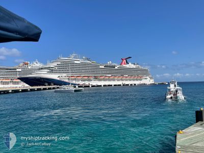
CARNIVAL DREAM
Passengers Ship
Current Trip
| Time Travelled | 18 h, 6 mins |
|---|---|
| Remaining Time | 1 day |
| Distance Travelled | 334.44 nm |
| Remaining Distance | 842.70 nm |
| AVG Speed | 18.6 Knots |
| MAX Speed | 20.6 Knots |
| AVG Wind | 12.3 knots |
| MAX Wind | 14.9 knots |
| MIN Temp | 23°C / 73.4°F |
| MAX Temp | 25.3°C / 77.54°F |
| Dybgang | 8.4 m |
| Position Modtaget | 7 h, 57 m siden |
Current Position
| Longitude | -79.78296° |
|---|---|
| Latitude | 25.37718° |
| Status | Under way using engine |
| Fart | 18.2 Knots |
| Kurs | 213.3° |
| Område | North Atlantic Ocean |
| Station | T-AIS |
| Position Modtaget | 7 h, 57 m siden |
Info
Information
The current position of CARNIVAL DREAM is in North Atlantic Ocean with coordinates 25.37718° / -79.78296° as reported on 2024-04-26 07:14 by AIS to our vessel tracker app. The vessel's current speed is 18.2 Knots and is heading at the port of GALVESTON. The estimated time of arrival as calculated by MyShipTracking vessel tracking app is 2024-04-28 09:07 LT
The vessel CARNIVAL DREAM (IMO: 9378474, MMSI: 370490000) is a Passengers Ship that was built in 2009 ( 15 år gamle ). It's sailing under the flag of [PA] Panama.
In this page you can find informations about the vessels current position, last detected port calls, and current voyage information. If the vessels is not in coverage by AIS you will find the latest position.
The current position of CARNIVAL DREAM is detected by our AIS receivers and we are not responsible for the reliability of the data. The last position was recorded while the vessel was in Coverage by the Ais receivers of our vessel tracking app.
The current draught of CARNIVAL DREAM as reported by AIS is 8.4 meters
Weather
| Temperature | 25.3°C / 77.54°F |
|---|---|
| Wind Speed | 15 knots |
| Direction | 87° E |
| Pressure | 1019 hPa |
| Humidity | 61.4 % |
| Cloud Coverage | --- |
Featured Company
Last Port Calls
| Port | Arrival | Departure | Time In Port |
|---|---|---|---|
| 2024-04-25 10:58 | 2024-04-25 21:06 | 10 h | |
| 2024-04-24 12:13 | 2024-04-24 21:10 | 8 h | |
| 2024-04-23 12:26 | 2024-04-23 22:09 | 9 h | |
| 2024-04-22 14:10 | 2024-04-22 23:06 | 8 h | |
| 2024-04-20 11:00 | 2024-04-20 21:27 | 10 h | |
| 2024-04-18 13:13 | 2024-04-18 22:03 | 8 h | |
| 2024-04-17 12:29 | 2024-04-17 21:19 | 8 h | |
| 2024-04-16 17:38 | 2024-04-17 01:02 | 7 h | |
| 2024-04-14 10:40 | 2024-04-14 20:46 | 10 h | |
| 2024-04-11 11:08 | 2024-04-11 21:24 | 10 h |
Most Visited Ports (Last year)
| Port | Arrivals | |
|---|---|---|
| 58 | ||
| 25 | ||
| 24 | ||
| 24 | ||
| 22 | ||
| 20 |
Last Trips
| Origin | Departure | Destination | Arrival | Distance | |
|---|---|---|---|---|---|
| 2024-04-24 17:10 | 2024-04-25 06:58 | 165.67 nm | |||
| 2024-04-23 18:09 | 2024-04-24 08:13 | 233.95 nm | |||
| 2024-04-22 19:06 | 2024-04-23 08:26 | 236.30 nm | |||
| 2024-04-20 16:27 | 2024-04-22 10:10 | 788.33 nm | |||
| 2024-04-18 17:03 | 2024-04-20 06:00 | 720.24 nm | |||
| 2024-04-17 15:19 | 2024-04-18 08:13 | 273.70 nm | |||
| 2024-04-16 20:02 | 2024-04-17 06:29 | 171.30 nm | |||
| 2024-04-14 15:46 | 2024-04-16 12:38 | 836.44 nm | |||
| 2024-04-11 17:24 | 2024-04-14 05:40 | 1102.91 nm | |||
| 2024-04-10 18:44 | 2024-04-11 07:08 | 169.89 nm |
Events
| Tid | Hændelsen | Detaljer | Position / Dest | Info |
|---|---|---|---|---|
| 2024-04-26 07:25 | Status er ændret | Default Under way using engine |
25.33000 / -79.81834
US GLS
|
Fart: 18.2 kn Kurs: 213.3° |
| 2024-04-26 07:14 | Udenfor Dækning |
25.37718 / -79.78296
North Atlantic Ocean
US GLS
|
Fart: 18.2 kn Kurs: 213.3° |
|
| 2024-04-26 06:49 | Ændre havområde | United States part of the North Atlantic Ocean Bahamas part of the North Atlantic Ocean |
25.48144 / -79.70721
North Atlantic Ocean
US GLS
|
Fart: 18.4 kn Kurs: 213.5° |
| 2024-04-26 06:26 | Destination er ændret | US GLS BS FPO |
25.58358 / -79.63305
US GLS
|
Fart: 18.4 kn Kurs: 213.7° |
| 2024-04-26 06:26 | ETA er ændret | 2024/04/28 09:30 2024/04/23 11:48 |
25.58358 / -79.63305
US GLS
|
Fart: 18.4 kn Kurs: 213.7° |
| 2024-04-26 05:57 | Status er ændret | Under way using engine Default |
25.70821 / -79.54234
BS FPO
|
Fart: 18 kn Kurs: 214° |
| 2024-04-26 05:49 | Indenfor Dækning |
25.70138 / -79.54730
North Atlantic Ocean
|
Fart: 18.3 kn Kurs: 213.6° |
|
| 2024-04-26 01:33 | Status er ændret | Default Under way using engine |
26.02167 / -78.25333
BS FPO
|
Fart: 19.4 kn Kurs: 286.5° |
| 2024-04-26 01:28 | Udenfor Dækning |
26.01174 / -78.21960
North Atlantic Ocean
|
Fart: 19.4 kn Kurs: 286.5° |
|
| 2024-04-25 21:54 | Status er ændret | Under way using engine Default |
25.26248 / -77.41651
BS FPO
|
Fart: 18 kn Kurs: 344° |