
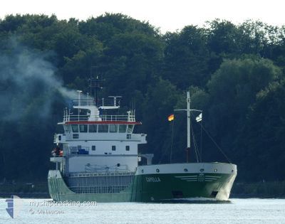
CAPELLA
General Cargo
Current Trip
| Time Travelled | 3 days |
|---|---|
| Remaining Time | 22 h, 9 mins |
| Distance Travelled | 738.14 nm |
| Remaining Distance | 212.48 nm |
| AVG Speed | 8.7 Knop |
| MAX Speed | 12.6 Knop |
| AVG Wind | 15.3 knots |
| MAX Wind | 23 knots |
| MIN Temp | 10.6°C / 51.08°F |
| MAX Temp | 17.5°C / 63.5°F |
| Djupgående | 3.8 m |
| Position mottagen | 1 m sen |
Current Position
| Longitud | 13.63995° |
|---|---|
| Latitude | 54.73669° |
| Status | Under way using engine |
| Fart | 9.6 Knop |
| Kurs | 110° |
| Område | Baltic Sea |
| Station | T-AIS |
| Position mottagen | 1 m sen |
Info
Information
The current position of CAPELLA is in Baltic Sea with coordinates 54.73669° / 13.63995° as reported on 2024-05-18 03:12 by AIS to our vessel tracker app. The vessel's current speed is 9.6 Knop and is heading at the port of GDYNIA. The estimated time of arrival as calculated by MyShipTracking vessel tracking app is 2024-05-19 01:22 LT
The vessel CAPELLA (IMO: 9190171, MMSI: 275511000) is a General Cargo that was built in 1999 ( 25 År gammal ). It's sailing under the flag of [LV] Latvia.
In this page you can find informations about the vessels current position, last detected port calls, and current voyage information. If the vessels is not in coverage by AIS you will find the latest position.
The current position of CAPELLA is detected by our AIS receivers and we are not responsible for the reliability of the data. The last position was recorded while the vessel was in Coverage by the Ais receivers of our vessel tracking app.
The current draught of CAPELLA as reported by AIS is 3.8 meters
Weather
| Temperature | 11.8°C / 53.24°F |
|---|---|
| Wind Speed | 13 knots |
| Direction | 95° E |
| Pressure | 1013.8 hPa |
| Humidity | 84.5 % |
| Cloud Coverage | 2 % |
Featured Company
Last Port Calls
| Port | Arrival | Departure | Time In Port |
|---|---|---|---|
| 2024-05-10 22:46 | 2024-05-14 15:08 | 3 d | |
| 2024-05-08 09:48 | 2024-05-08 10:32 | 43 m | |
| 2024-05-07 03:10 | 2024-05-08 01:48 | 22 h | |
| 2024-05-05 13:57 | 2024-05-06 15:40 | 1 d | |
| 2024-05-01 17:16 | 2024-05-03 10:25 | 1 d | |
| 2024-04-26 21:51 | 2024-04-30 20:30 | 3 d | |
| 2024-04-24 17:00 | 2024-04-25 15:59 | 22 h | |
| 2024-04-22 23:50 | 2024-04-23 00:09 | 19 m | |
| 2024-04-19 17:34 | 2024-04-19 20:54 | 3 h | |
| 2024-04-17 15:14 | 2024-04-18 13:13 | 21 h |
Last Trips
| Origin | Departure | Destination | Arrival | Distance | |
|---|---|---|---|---|---|
| 2024-05-08 12:32 | 2024-05-10 23:46 | 386.76 nm | |||
| 2024-05-08 03:48 | 2024-05-08 11:48 | 81.88 nm | |||
| 2024-05-06 17:40 | 2024-05-07 05:10 | 96.37 nm | |||
| 2024-05-03 12:25 | 2024-05-05 15:57 | 330.53 nm | |||
| 2024-04-30 22:30 | 2024-05-01 19:16 | 210.79 nm | |||
| 2024-04-25 17:59 | 2024-04-26 23:51 | 311.05 nm | |||
| 2024-04-23 02:09 | 2024-04-24 19:00 | 293.78 nm | |||
| 2024-04-19 23:54 | 2024-04-23 01:50 | 743.99 nm | |||
| 2024-04-18 16:13 | 2024-04-19 20:34 | 81.33 nm | |||
| 2024-04-15 18:27 | 2024-04-17 18:14 | 479.10 nm |
Events
| Tid | Event | Detaljer | Position / Dest | Information |
|---|---|---|---|---|
| 2024-05-18 00:59 | Byter havsområde | German part of the Baltic Sea Swedish part of the Baltic Sea |
55.01051 / 13.26761
Baltic Sea
GDYNIA
|
Fart: 9.9 kn Kurs: 145° |
| 2024-05-17 22:02 | Byter havsområde | Swedish part of the Baltic Sea Danish part of the Baltic Sea |
55.29308 / 12.65273
Baltic Sea
GDYNIA
|
Fart: 8.2 kn Kurs: 113° |
| 2024-05-17 21:49 | Byter havsområde | Danish part of the Baltic Sea Danish part of the Kattegat |
55.32167 / 12.63052
Baltic Sea
GDYNIA
|
Fart: 10 kn Kurs: 191° |
| 2024-05-17 21:41 | Byter havsområde | Danish part of the Kattegat Swedish part of the Kattegat |
55.34342 / 12.63735
Kattegat
GDYNIA
|
Fart: 9.9 kn Kurs: 192° |
| 2024-05-17 20:59 | Upptäckt i hav | Swedish part of the Kattegat |
55.46154 / 12.67555
Kattegat
GDYNIA
|
Fart: 10.4 kn Kurs: 191° |
| 2024-05-17 15:26 | Byter havsområde | Danish part of the Kattegat Swedish part of the Kattegat |
56.20697 / 12.37843
Kattegat
GDYNIA
|
Fart: 6.2 kn Kurs: 165° |
| 2024-05-17 05:56 | Upptäckt i hav | Swedish part of the Kattegat |
57.49323 / 11.35809
Kattegat
GDYNIA
|
Fart: 7.6 kn Kurs: 135° |
| 2024-05-17 02:53 | Byter havsområde | Danish part of the Kattegat Danish part of the Skaggerak |
57.77813 / 10.84383
Kattegat
GDYNIA
|
Fart: 7 kn Kurs: 138° |
| 2024-05-16 16:32 | Byter havsområde | Danish part of the Skaggerak Danish part of the North Sea |
57.19338 / 8.49991
Skaggerak
GDYNIA
|
Fart: 8 kn Kurs: 33° |
| 2024-05-16 02:57 | Status ändrad | Under way using engine Default |
55.52511 / 6.66691
GDYNIA
|
Fart: 8 kn Kurs: 28° |