
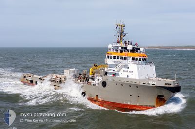
BEAR
Anchor Handling Vessel
Current Trip
REV OWF
| Time Travelled | 8 days |
|---|---|
| Remaining Time | --- |
| Distance Travelled | 193.89 nm |
| Remaining Distance | --- |
| AVG Speed | 8 Knop |
| MAX Speed | 12.5 Knop |
| AVG Wind | 10.8 knots |
| MAX Wind | 20.9 knots |
| MIN Temp | 3.9°C / 39.02°F |
| MAX Temp | 13°C / 55.4°F |
| Djupgående | 7.2 m |
| Position mottagen | 4 d sen |
Current Position
| Longitud | -71.06116° |
|---|---|
| Latitude | 41.22872° |
| Status | Restricted manoeuverability |
| Fart | 0.3 Knop |
| Kurs | 239° |
| Område | North Atlantic Ocean |
| Station | T-AIS |
| Position mottagen | 4 d sen |
Info
Information
The current position of BEAR is in North Atlantic Ocean with coordinates 41.22872° / -71.06116° as reported on 2024-04-27 16:32 by AIS to our vessel tracker app. The vessel's current speed is 0.3 Knop
The vessel BEAR (IMO: 9185932, MMSI: 205694000) is a Anchor Handling Vessel that was built in 1999 ( 25 År gammal ). It's sailing under the flag of [BE] Belgium.
In this page you can find informations about the vessels current position, last detected port calls, and current voyage information. If the vessels is not in coverage by AIS you will find the latest position.
The current position of BEAR is detected by our AIS receivers and we are not responsible for the reliability of the data. The last position was recorded while the vessel was in Coverage by the Ais receivers of our vessel tracking app.
The current draught of BEAR as reported by AIS is 7.2 meters
Weather
| Temperature | 9.2°C / 48.56°F |
|---|---|
| Wind Speed | 14 knots |
| Direction | 207° SSW |
| Pressure | 1015.4 hPa |
| Humidity | 94.4 % |
| Cloud Coverage | 18 % |
Featured Company
Last Port Calls
| Port | Arrival | Departure | Time In Port |
|---|---|---|---|
| 2024-04-22 12:13 | 2024-04-24 10:12 | 1 d | |
| 2024-04-08 04:20 | 2024-04-09 17:45 | 1 d | |
| 2024-04-06 06:59 | 2024-04-06 07:13 | 13 m | |
| 2024-03-17 19:02 | 2024-04-06 04:31 | 19 d | |
| 2024-03-17 07:22 | 2024-03-17 08:58 | 1 h | |
| 2024-03-16 13:02 | 2024-03-16 17:48 | 4 h | |
| 2024-03-06 06:23 | 2024-03-06 15:28 | 9 h | |
| 2024-03-05 16:39 | 2024-03-05 23:26 | 6 h | |
| 2024-03-04 21:27 | 2024-03-05 07:25 | 9 h | |
| 2024-03-04 09:05 | 2024-03-04 19:57 | 10 h |
Most Visited Ports (Last year)
| Port | Arrivals | |
|---|---|---|
| 9 | ||
| 5 | ||
| 2 | ||
| 2 | ||
| 2 | ||
| 2 |
Last Trips
| Origin | Departure | Destination | Arrival | Distance | |
|---|---|---|---|---|---|
| 2024-04-09 19:45 | 2024-04-22 08:13 | 3358.81 nm | |||
| 2024-04-06 09:13 | 2024-04-08 06:20 | 99.15 nm | |||
| 2024-04-06 06:31 | 2024-04-06 08:59 | 7.04 nm | |||
| 2024-03-17 09:58 | 2024-03-17 20:02 | 50.80 nm | |||
| 2024-03-16 18:48 | 2024-03-17 08:22 | 87.08 nm | |||
| 2024-03-06 16:28 | 2024-03-16 14:02 | 1784.11 nm | |||
| 2024-03-06 00:26 | 2024-03-06 07:23 | 87.27 nm | |||
| 2024-03-05 08:25 | 2024-03-05 17:39 | 48.52 nm | |||
| 2024-03-04 20:57 | 2024-03-04 22:27 | 17.06 nm | |||
| 2024-03-04 08:29 | 2024-03-04 10:05 | 16.81 nm |
Events
| Tid | Event | Detaljer | Position / Dest | Information |
|---|---|---|---|---|
| 2024-05-02 03:03 | STOPPAR förflyttning |
41.14859 / -71.03340
REV OWF
|
Fart: 0.3 kn Kurs: 99° |
|
| 2024-05-02 02:46 | STARTAR förflyttning |
41.16139 / -71.03996
REV OWF
|
Fart: 3.9 kn Kurs: 157° |
|
| 2024-05-02 01:41 | STOPPAR förflyttning |
41.16667 / -71.04333
REV OWF
|
Fart: Kurs: -1° |
|
| 2024-05-01 21:16 | STARTAR förflyttning | 8.78 nm, South of NEWPORT (RI) |
41.34717 / -71.25414
REV OWF
|
Fart: 3.7 kn Kurs: 227° |
| 2024-04-30 01:49 | STOPPAR förflyttning | 8.65 nm, South of NEWPORT (RI) |
41.35019 / -71.25158
REV OWF
|
Fart: 0.2 kn Kurs: 171° |
| 2024-04-29 23:05 | STARTAR förflyttning |
41.16167 / -71.04166
REV OWF
|
Fart: 5 kn Kurs: 326° |
|
| 2024-04-28 03:14 | STOPPAR förflyttning |
41.14648 / -71.03449
REV OWF
|
Fart: 0.3 kn Kurs: 60° |
|
| 2024-04-28 02:03 | STARTAR förflyttning | 19.41 nm, South East of NEWPORT (RI) |
41.22969 / -71.05668
REV OWF
|
Fart: 4.4 kn Kurs: 124° |
| 2024-04-27 16:38 | Status ändrad | Default Restricted manoeuverability |
41.22852 / -71.06158
REV OWF
|
Fart: 0.3 kn Kurs: 239° |
| 2024-04-27 16:32 | UTANFÖR täckningsområde |
41.22872 / -71.06116
North Atlantic Ocean
REV OWF
|
Fart: 0.3 kn Kurs: 244.6° |