
BEAR
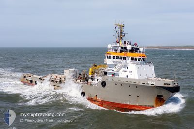
Anchor Handling Vessel
Current Trip
| Time Travelled | 10 days |
|---|---|
| Remaining Time | --- |
| Distance Travelled | 2829.05 nm |
| Remaining Distance | 535.88 nm |
| AVG Speed | 11.1 Knots |
| MAX Speed | 16.4 Knots |
| AVG Wind | 13.5 knots |
| MAX Wind | 32 knots |
| MIN Temp | 4.6°C / 40.28°F |
| MAX Temp | 14.8°C / 58.64°F |
| Draught | 7.1 m |
| Position Received | 8 d ago |
Current Position
| Longitude | -8.98085° |
|---|---|
| Latitude | 49.34618° |
| Status | Under way using engine |
| Speed | 11.8 Knots |
| Course | 258.3° |
| Area | Celtic Sea |
| Station | T-AIS |
| Position Received | 8 d ago |
Info
Information
The current position of BEAR is in Celtic Sea with coordinates 49.34618° / -8.98085° as reported on 2024-04-11 20:31 by AIS to our vessel tracker app. The vessel's current speed is 11.8 Knots and is heading at the port of PROVIDENCE. The estimated time of arrival as calculated by MyShipTracking vessel tracking app is 2024-04-22 12:00 LT
The vessel BEAR (IMO: 9185932, MMSI: 205694000) is a Anchor Handling Vessel that was built in 1999 ( 25 years old ). It's sailing under the flag of [BE] Belgium.
In this page you can find informations about the vessels current position, last detected port calls, and current voyage information. If the vessels is not in coverage by AIS you will find the latest position.
The current position of BEAR is detected by our AIS receivers and we are not responsible for the reliability of the data. The last position was recorded while the vessel was in Coverage by the Ais receivers of our vessel tracking app.
The current draught of BEAR as reported by AIS is 7.1 meters
Weather
| Temperature | 7.6°C / 45.68°F |
|---|---|
| Wind Speed | 10 knots |
| Direction | 43° NE |
| Pressure | 1020.5 hPa |
| Humidity | 74 % |
| Cloud Coverage | 57 % |
Featured Company
Last Port Calls
| Port | Arrival | Departure | Time In Port |
|---|---|---|---|
| 2024-04-08 04:20 | 2024-04-09 17:45 | 1 d | |
| 2024-04-06 06:59 | 2024-04-06 07:13 | 13 m | |
| 2024-03-17 19:02 | 2024-04-06 04:31 | 19 d | |
| 2024-03-17 07:22 | 2024-03-17 08:58 | 1 h | |
| 2024-03-16 13:02 | 2024-03-16 17:48 | 4 h | |
| 2024-03-06 06:23 | 2024-03-06 15:28 | 9 h | |
| 2024-03-05 16:39 | 2024-03-05 23:26 | 6 h | |
| 2024-03-04 21:27 | 2024-03-05 07:25 | 9 h | |
| 2024-03-04 09:05 | 2024-03-04 19:57 | 10 h | |
| 2024-02-27 08:47 | 2024-03-04 07:29 | 5 d |
Most Visited Ports (Last year)
| Port | Arrivals | |
|---|---|---|
| 10 | ||
| 4 | ||
| 2 | ||
| 2 | ||
| 2 | ||
| 2 |
Last Trips
| Origin | Departure | Destination | Arrival | Distance | |
|---|---|---|---|---|---|
| 2024-04-06 09:13 | 2024-04-08 06:20 | 99.15 nm | |||
| 2024-04-06 06:31 | 2024-04-06 08:59 | 7.04 nm | |||
| 2024-03-17 09:58 | 2024-03-17 20:02 | 50.80 nm | |||
| 2024-03-16 18:48 | 2024-03-17 08:22 | 87.08 nm | |||
| 2024-03-06 16:28 | 2024-03-16 14:02 | 1784.11 nm | |||
| 2024-03-06 00:26 | 2024-03-06 07:23 | 87.27 nm | |||
| 2024-03-05 08:25 | 2024-03-05 17:39 | 48.52 nm | |||
| 2024-03-04 20:57 | 2024-03-04 22:27 | 17.06 nm | |||
| 2024-03-04 08:29 | 2024-03-04 10:05 | 16.81 nm | |||
| 2024-02-22 22:25 | 2024-02-27 09:47 | 118.33 nm |
Events
| Time | Event | Details | Position / Dest | Info |
|---|---|---|---|---|
| 2024-04-11 20:33 | Status Changed | Default Under way using engine |
49.34571 / -8.98414
USPVD
|
Speed: 11.8 kn Course: 258.3° |
| 2024-04-11 20:31 | OUT of Coverage |
49.34618 / -8.98085
Celtic Sea
USPVD
|
Speed: 11.8 kn Course: 258.3° |
|
| 2024-04-11 20:10 | Status Changed | Under way using engine Default |
49.36138 / -8.87675
USPVD
|
Speed: 11 kn Course: 257° |
| 2024-04-11 19:57 | Status Changed | Default Under way using engine |
49.37017 / -8.81402
USPVD
|
Speed: 11.6 kn Course: 256° |
| 2024-04-11 18:50 | Status Changed | Under way using engine Default |
49.41880 / -8.49677
USPVD
|
Speed: 11.2 kn Course: 256° |
| 2024-04-11 18:36 | Status Changed | Default Under way using engine |
49.42847 / -8.43132
USPVD
|
Speed: 11 kn Course: 256.3° |
| 2024-04-11 18:29 | Change Sea Area | United Kingdom part of the Celtic Sea United Kingdom part of the English Channel |
49.43310 / -8.39903
Celtic Sea
USPVD
|
Speed: 10.8 kn Course: 256.6° |
| 2024-04-11 18:29 | Status Changed | Under way using engine Default |
49.43310 / -8.39903
USPVD
|
Speed: 10.9 kn Course: 258° |
| 2024-04-11 18:16 | IN Coverage |
49.43310 / -8.39903
Celtic Sea
USPVD
|
Speed: 10.8 kn Course: 256.6° |
|
| 2024-04-11 07:28 | OUT of Coverage |
49.93197 / -5.12347
English Channel
USPVD
|
Speed: 9.9 kn Course: 257.3° |