
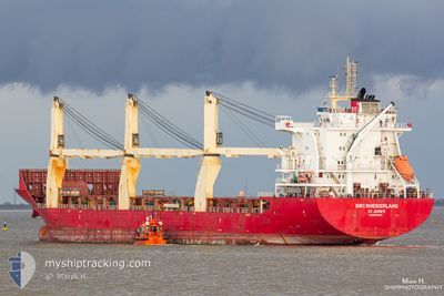
BBC RHEIDERLAND
General Cargo
Current Trip
| Time Travelled | 16 h, 16 mins |
|---|---|
| Remaining Time | --- |
| Distance Travelled | 205.39 nm |
| Remaining Distance | --- |
| AVG Speed | 12.7 Knop |
| MAX Speed | 14 Knop |
| AVG Wind | 14.5 knots |
| MAX Wind | 17 knots |
| MIN Temp | 25.2°C / 77.36°F |
| MAX Temp | 28°C / 82.4°F |
| Djupgående | 7.6 m |
| Position mottagen | 3 d sen |
Current Position
| Longitud | -61.70716° |
|---|---|
| Latitude | 10.55613° |
| Status | Under way using engine |
| Fart | 14.5 Knop |
| Kurs | 141° |
| Område | Caribbean Sea |
| Station | T-AIS |
| Position mottagen | 3 d sen |
Info
Information
The current position of BBC RHEIDERLAND is in Caribbean Sea with coordinates 10.55613° / -61.70716° as reported on 2024-04-29 11:42 by AIS to our vessel tracker app. The vessel's current speed is 14.5 Knop and is heading at the port of POINT LISAS. The estimated time of arrival as calculated by MyShipTracking vessel tracking app is 2024-04-28 18:00 LT
The vessel BBC RHEIDERLAND (IMO: 9614696, MMSI: 305276000) is a General Cargo that was built in 2013 ( 11 År gammal ). It's sailing under the flag of [AG] Antigua Barbuda.
In this page you can find informations about the vessels current position, last detected port calls, and current voyage information. If the vessels is not in coverage by AIS you will find the latest position.
The current position of BBC RHEIDERLAND is detected by our AIS receivers and we are not responsible for the reliability of the data. The last position was recorded while the vessel was in Coverage by the Ais receivers of our vessel tracking app.
The current draught of BBC RHEIDERLAND as reported by AIS is 7.6 meters
Weather
| Temperature | 27.3°C / 81.14°F |
|---|---|
| Wind Speed | 14 knots |
| Direction | 74° ENE |
| Pressure | 1010.1 hPa |
| Humidity | 85.2 % |
| Cloud Coverage | 39 % |
Featured Company
Last Port Calls
| Port | Arrival | Departure | Time In Port |
|---|---|---|---|
| 2024-05-01 01:45 | 2024-05-02 00:22 | 22 h | |
| 2024-04-29 13:26 | 2024-04-29 18:22 | 4 h | |
| 2024-04-21 14:15 | 2024-04-22 18:41 | 1 d | |
| 2024-04-19 03:49 | 2024-04-20 15:54 | 1 d | |
| 2024-04-01 15:23 | 2024-04-08 00:02 | 6 d | |
| 2024-03-13 20:45 | 2024-03-15 14:28 | 1 d | |
| 2024-03-10 05:50 |
Most Visited Ports (Last year)
| Port | Arrivals | |
|---|---|---|
| 3 | ||
| 3 | ||
| 2 | ||
| 2 | ||
| 2 | ||
| 2 |
Last Trips
| Origin | Departure | Destination | Arrival | Distance | |
|---|---|---|---|---|---|
| 2024-04-29 14:22 | 2024-04-30 21:45 | 400.91 nm | |||
| 2024-04-22 13:41 | 2024-04-29 09:26 | 2256.95 nm | |||
| 2024-04-20 10:54 | 2024-04-21 09:15 | 253.53 nm | |||
| 2024-04-07 19:02 | 2024-04-18 22:49 | 346.84 nm | |||
| 2024-03-15 15:28 | 2024-04-01 10:23 | 5616.83 nm | |||
| 2024-03-10 06:50 | 2024-03-13 21:45 | 676.72 nm |
Events
| Tid | Event | Detaljer | Position / Dest | Information |
|---|---|---|---|---|
| 2024-05-02 00:22 | AVGÅTT HAMN |
|
6.82560 / -58.17000
TTPTS
|
Fart: 6 kn Kurs: -1° |
| 2024-05-02 00:15 | STARTAR förflyttning |
6.81000 / -58.17166
[GY] GEORGETOWN
|
Fart: 6 kn Kurs: -1° |
|
| 2024-05-01 01:45 | ANLÄNDER HAMN |
|
6.80397 / -58.17043
[GY] GEORGETOWN
|
Fart: 0.8 kn Kurs: 46° |
| 2024-05-01 01:32 | STOPPAR förflyttning | 0.94 nm, North of GEORGETOWN |
6.80500 / -58.17333
TTPTS
|
Fart: Kurs: -1° |
| 2024-04-29 18:30 | STARTAR förflyttning | 1.02 nm, West of POINT LISAS |
10.38920 / -61.51218
TTPTS
|
Fart: 10.4 kn Kurs: 235° |
| 2024-04-29 18:22 | AVGÅTT HAMN |
|
10.38920 / -61.51218
TTPTS
|
Fart: Kurs: -1° |
| 2024-04-29 13:34 | STOPPAR förflyttning |
10.40821 / -61.49603
[TT] POINT LISAS
|
Fart: 0.2 kn Kurs: 121° |
|
| 2024-04-29 13:26 | ANLÄNDER HAMN |
|
10.40680 / -61.49705
[TT] POINT LISAS
|
Fart: 4.3 kn Kurs: 23° |
| 2024-04-29 11:51 | Status ändrad | Default Under way using engine |
10.53027 / -61.68460
TTPTS
|
Fart: 14.5 kn Kurs: 141° |
| 2024-04-29 11:42 | UTANFÖR täckningsområde |
10.55613 / -61.70716
Caribbean Sea
|
Fart: 14.5 kn Kurs: 141° |