

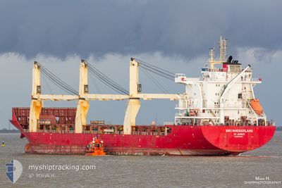
BBC RHEIDERLAND
General Cargo

Current Trip
| Time Travelled | 10 h, 26 mins |
|---|---|
| Remaining Time | 3 days |
| Distance Travelled | 118.45 nm |
| Remaining Distance | 1134.69 nm |
| AVG Speed | 11.4 Knots |
| MAX Speed | 14.4 Knots |
| AVG Wind | 10.2 knots |
| MAX Wind | 11.1 knots |
| MIN Temp | 21.3°C / 70.34°F |
| MAX Temp | 22.1°C / 71.78°F |
| Dybgang | 6.7 m |
| Position Modtaget | 9 h, 35 m siden |
Current Position
| Longitude | --- |
|---|---|
| Latitude | --- |
| Status | Under way using engine |
| Fart | 12.7 Knots |
| Kurs | 129.3° |
| Område | North Atlantic Ocean |
| Station | T-AIS |
| Position Modtaget | 9 h, 35 m siden |
Information
The current position of BBC RHEIDERLAND is in North Atlantic Ocean with coordinates 26.02407° / -80.00854° as reported on 2025-02-23 04:22 by AIS to our vessel tracker app. The vessel's current speed is 12.7 Knots and is heading at the port of ROAD TOWN. The estimated time of arrival as calculated by MyShipTracking vessel tracking app is 2025-02-27 01:41 LT
The vessel BBC RHEIDERLAND (IMO: 9614696, MMSI: 305276000) is a General Cargo that was built in 2013 ( 12 år gamle ). It's sailing under the flag of [AG] Antigua Barbuda.
In this page you can find informations about the vessels current position, last detected port calls, and current voyage information. If the vessels is not in coverage by AIS you will find the latest position.
The current position of BBC RHEIDERLAND is detected by our AIS receivers and we are not responsible for the reliability of the data. The last position was recorded while the vessel was in Coverage by the Ais receivers of our vessel tracking app.
The current draught of BBC RHEIDERLAND as reported by AIS is 6.7 meters
Weather
| Temperature | 22.1°C / 71.78°F |
|---|---|
| Wind Speed | 9 knots |
| Direction | 58° ENE |
| Pressure | 1021.1 hPa |
| Humidity | 70.2 % |
| Cloud Coverage | 75 % |


Featured Company
Last Port Calls
| Port | Arrival | Departure | Time In Port |
|---|---|---|---|
| 2025-02-22 13:57 | 2025-02-23 03:32 | 13 h | |
| 2025-02-22 13:32 | 2025-02-22 13:40 | 8 m | |
| 2025-02-17 01:25 | 2025-02-20 01:28 | 3 d | |
| 2025-02-13 21:31 | 2025-02-16 00:59 | 2 d | |
| 2025-01-30 22:09 | 2025-01-31 17:28 | 19 h | |
| 2025-01-25 17:31 | 2025-01-26 00:28 | 6 h | |
| 2025-01-08 16:57 | 2025-01-22 01:33 | 13 d | |
| 2024-12-21 02:04 | 2025-01-08 16:09 | 18 d | |
| 2024-12-14 04:27 | 2024-12-15 11:49 | 1 d |
Most Visited Ports (Last year)
| Port | Arrivals | |
|---|---|---|
| 2 | ||
| 2 | ||
| 2 | ||
| 1 | ||
| 1 | ||
| 1 |
Last Trips
| Origin | Departure | Destination | Arrival | Distance | |
|---|---|---|---|---|---|
| 2025-02-22 08:40 | 2025-02-22 08:57 | 0.70 nm | |||
| 2025-02-19 19:28 | 2025-02-22 08:32 | 881.84 nm | |||
| 2025-02-15 18:59 | 2025-02-16 19:25 | 298.20 nm | |||
| 2025-01-31 14:28 | 2025-02-13 15:31 | 4156.91 nm | |||
| 2025-01-25 21:28 | 2025-01-30 19:09 | 11.14 nm | |||
| 2025-01-21 22:33 | 2025-01-25 14:31 | 628.86 nm | |||
| 2025-01-08 13:09 | 2025-01-08 13:57 | 0.95 nm | |||
| 2024-12-15 06:49 | 2024-12-20 23:04 | 968.29 nm | |||
| 2024-11-24 23:00 | 2024-12-13 23:27 | 1854.41 nm |
Events
| Tid | Hændelsen | Detaljer | Position / Dest | Info |
|---|---|---|---|---|
| 2025-02-23 04:28 | Status er ændret | Default Under way using engine |
26.01480 / -79.99058
TORTOLA
|
Fart: 12.7 kn Kurs: 129.3° |
| 2025-02-23 04:22 | Udenfor Dækning |
26.02407 / -80.00854
North Atlantic Ocean
TORTOLA
|
Fart: 12.7 kn Kurs: 129.3° |
|
| 2025-02-23 04:00 | Dybgangen er ændret | 6.7 6.8 |
26.07412 / -80.07774
TORTOLA
|
Fart: 10.5 kn Kurs: 130.8° |
| 2025-02-23 04:00 | Destination er ændret | TORTOLA PORT EVERGLADES |
26.07412 / -80.07774
TORTOLA
|
Fart: 10.5 kn Kurs: 130.8° |
| 2025-02-23 04:00 | ETA er ændret | 2025/02/26 08:00 2025/02/22 17:00 |
26.07412 / -80.07774
TORTOLA
|
Fart: 10.5 kn Kurs: 130.8° |
| 2025-02-23 03:59 | Status er ændret | Under way using engine Moored |
26.07508 / -80.07896
PORT EVERGLADES
|
Fart: 9.9 kn Kurs: 131.6° |
| 2025-02-23 03:43 | Indenfor Dækning |
26.09378 / -80.10420
North Atlantic Ocean
|
Fart: 7.9 kn Kurs: 88.4° |
|
| 2025-02-23 03:32 | Afsejlet fra sidste havn |
|
26.09374 / -80.10545
PORT EVERGLADES
|
Fart: Kurs: 271° |
| 2025-02-23 02:42 | Status er ændret | Default Moored |
26.07464 / -80.12063
[US] FORT LAUDERDALE
|
Fart: Kurs: 271° |
| 2025-02-23 02:33 | Udenfor Dækning |
26.07462 / -80.12058
North Atlantic Ocean
[US] FORT LAUDERDALE
|
Fart: Kurs: 309.7° |