
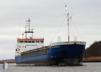
BALTIC CARRIER
General Cargo
Current Trip
| Time Travelled | 1 day |
|---|---|
| Remaining Time | 6 h, 21 mins |
| Distance Travelled | 341.20 nm |
| Remaining Distance | 61.66 nm |
| AVG Speed | 7.8 Knop |
| MAX Speed | 13.1 Knop |
| AVG Wind | 6.4 knots |
| MAX Wind | 15.2 knots |
| MIN Temp | 8°C / 46.4°F |
| MAX Temp | 13.6°C / 56.48°F |
| Djupgående | 4.9 m |
| Position mottagen | Nu |
Current Position
| Longitud | 10.32880° |
|---|---|
| Latitude | 54.75072° |
| Status | Under way using engine |
| Fart | 9.7 Knop |
| Kurs | 3.8° |
| Område | Baltic Sea |
| Station | T-AIS |
| Position mottagen | Nu |
Info
Information
The current position of BALTIC CARRIER is in Baltic Sea with coordinates 54.75072° / 10.32880° as reported on 2024-04-28 09:00 by AIS to our vessel tracker app. The vessel's current speed is 9.7 Knop and is heading at the port of KOLDING. The estimated time of arrival as calculated by MyShipTracking vessel tracking app is 2024-04-28 15:22 LT
The vessel BALTIC CARRIER (IMO: 9138197, MMSI: 275514000) is a General Cargo that was built in 1997 ( 27 År gammal ). It's sailing under the flag of [LV] Latvia.
In this page you can find informations about the vessels current position, last detected port calls, and current voyage information. If the vessels is not in coverage by AIS you will find the latest position.
The current position of BALTIC CARRIER is detected by our AIS receivers and we are not responsible for the reliability of the data. The last position was recorded while the vessel was in Coverage by the Ais receivers of our vessel tracking app.
The current draught of BALTIC CARRIER as reported by AIS is 4.9 meters
Weather
| Temperature | 9.3°C / 48.74°F |
|---|---|
| Wind Speed | 14 knots |
| Direction | 131° SE |
| Pressure | 1009.4 hPa |
| Humidity | 86.7 % |
| Cloud Coverage | 98 % |
Featured Company
Last Port Calls
| Port | Arrival | Departure | Time In Port |
|---|---|---|---|
| 2024-04-24 16:26 | 2024-04-26 14:51 | 1 d | |
| 2024-04-23 16:27 | 2024-04-24 15:14 | 22 h | |
| 2024-04-17 10:17 | 2024-04-18 06:13 | 19 h | |
| 2024-04-13 08:01 | 2024-04-15 13:10 | 2 d | |
| 2024-04-08 07:31 | 2024-04-10 13:30 | 2 d | |
| 2024-04-05 09:57 | 2024-04-06 16:02 | 1 d | |
| 2024-04-03 21:15 | 2024-04-04 14:13 | 16 h | |
| 2024-03-28 03:25 | 2024-04-01 10:37 | 4 d | |
| 2024-03-27 04:00 | 2024-03-27 10:43 | 6 h | |
| 2024-03-25 15:03 | 2024-03-26 14:21 | 23 h |
Most Visited Ports (Last year)
| Port | Arrivals | |
|---|---|---|
| 7 | ||
| 4 | ||
| 4 | ||
| 4 | ||
| 4 | ||
| 3 |
Last Trips
| Origin | Departure | Destination | Arrival | Distance | |
|---|---|---|---|---|---|
| 2024-04-24 17:14 | 2024-04-24 18:26 | 11.12 nm | |||
| 2024-04-18 09:13 | 2024-04-23 18:27 | 1115.03 nm | |||
| 2024-04-15 15:10 | 2024-04-17 13:17 | 305.15 nm | |||
| 2024-04-10 15:30 | 2024-04-13 10:01 | 591.50 nm | |||
| 2024-04-06 18:02 | 2024-04-08 09:31 | 369.85 nm | |||
| 2024-04-04 16:13 | 2024-04-05 11:57 | 187.25 nm | |||
| 2024-04-01 12:37 | 2024-04-03 23:15 | 268.20 nm | |||
| 2024-03-27 11:43 | 2024-03-28 04:25 | 125.10 nm | |||
| 2024-03-26 15:21 | 2024-03-27 05:00 | 141.06 nm | |||
| 2024-03-22 11:30 | 2024-03-25 16:03 | 478.33 nm |
Events
| Tid | Event | Detaljer | Position / Dest | Information |
|---|---|---|---|---|
| 2024-04-28 08:28 | Upptäckt i hav | Danish part of the Baltic Sea |
54.66543 / 10.32238
Baltic Sea
DKKOL
|
Fart: 9.6 kn Kurs: 2.2° |
| 2024-04-28 07:07 | Byter havsområde | German part of the Baltic Sea German part of the North Sea |
54.46510 / 10.26709
Baltic Sea
DKKOL
|
Fart: 9.3 kn Kurs: 33.1° |
| 2024-04-28 06:15 | STARTAR förflyttning | 1.29 nm, South West of STICKENHΟRN SPORT |
54.36544 / 10.14633
DKKOL
|
Fart: 4.1 kn Kurs: 101° |
| 2024-04-28 05:24 | STOPPAR förflyttning | 1.34 nm, South West of STICKENHΟRN SPORT |
54.36576 / 10.14321
DKKOL
|
Fart: 0.2 kn Kurs: 105° |
| 2024-04-28 01:16 | STARTAR förflyttning | 7.09 nm, North East of FISCHERHUTTE |
54.20090 / 9.55800
DKKOL
|
Fart: 3.8 kn Kurs: 46° |
| 2024-04-28 00:27 | STOPPAR förflyttning | 6.98 nm, North East of FISCHERHUTTE |
54.19964 / 9.55552
DKKOL
|
Fart: 0.3 kn Kurs: 56° |
| 2024-04-27 20:54 | STARTAR förflyttning | 2 nm, North East of OSTERMOOR |
53.94359 / 9.22686
DKKOL
|
Fart: 3.2 kn Kurs: 33° |
| 2024-04-27 19:46 | STOPPAR förflyttning | 1.82 nm, North East of OSTERMOOR |
53.94121 / 9.22410
DKKOL
|
Fart: 0.2 kn Kurs: 38° |
| 2024-04-27 19:03 | STARTAR förflyttning | 0.43 nm, North East of BRUNSBUETTEL |
53.90683 / 9.17011
DKKOL
|
Fart: 3.1 kn Kurs: 50° |
| 2024-04-27 17:47 | STOPPAR förflyttning | 0.83 nm, South West of BRUNSBUETTEL |
53.89318 / 9.14336
DKKOL
|
Fart: 0.3 kn Kurs: 52° |