
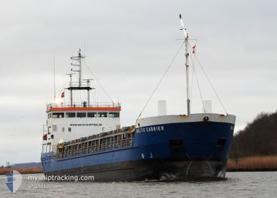
BALTIC CARRIER
General Cargo
Current Trip
| Trip Time | 5 days |
|---|---|
| Trip Distance | 779.48 nm |
| AVG Speed | 7.6 Noeuds |
| MAX Speed | 13.1 Noeuds |
| Tirant d eau | 4.3 m |
| AVG Wind | 14.6 knots |
| MAX Wind | 33 knots |
| MIN Temp | 8.4°C / 47.12°F |
| MAX Temp | 18.9°C / 66.02°F |
| Position reçue | 3 d depuis |
Current Position
| Longitude | --- |
|---|---|
| Latitude | --- |
| Etat | Under way using engine |
| Vitesse | 11.9 Noeuds |
| Parcours | 278.3° |
| Zone | North Sea |
| Station | T-AIS |
| Position reçue | 3 d depuis |
Info
Information
The current position of BALTIC CARRIER is in North Sea with coordinates 54.01584° / 8.23071° as reported on 2024-09-30 01:21 by AIS to our vessel tracker app. The vessel's current speed is 11.9 Noeuds and is currently inside the port of WISBECH.
The vessel BALTIC CARRIER (IMO: 9138197, MMSI: 275514000) is a General Cargo that was built in 1997 ( 27 Age ). It's sailing under the flag of [LV] Latvia.
In this page you can find informations about the vessels current position, last detected port calls, and current voyage information. If the vessels is not in coverage by AIS you will find the latest position.
The current position of BALTIC CARRIER is detected by our AIS receivers and we are not responsible for the reliability of the data. The last position was recorded while the vessel was in Coverage by the Ais receivers of our vessel tracking app.
The current draught of BALTIC CARRIER as reported by AIS is 4.3 meters
Weather
| Temperature | 12°C / 53.6°F |
|---|---|
| Wind Speed | 8 knots |
| Direction | 48° NE |
| Pressure | 1020.9 hPa |
| Humidity | 66.1 % |
| Cloud Coverage | 100 % |
Featured Company
Last Port Calls
| Port | Arrival | Departure | Time In Port |
|---|---|---|---|
| 2024-10-02 18:43 | |||
| 2024-09-27 05:51 | 2024-09-27 19:03 | 13 h | |
| 2024-09-24 16:39 | 2024-09-25 11:40 | 19 h | |
| 2024-09-18 15:16 | 2024-09-20 15:16 | 2 d | |
| 2024-09-09 07:21 | 2024-09-17 12:07 | 8 d | |
| 2024-09-02 06:18 | 2024-09-02 13:05 | 6 h | |
| 2024-08-31 00:54 | 2024-08-31 12:23 | 11 h | |
| 2024-08-28 21:13 | 2024-08-30 16:05 | 1 d | |
| 2024-08-24 21:55 | 2024-08-26 15:38 | 1 d | |
| 2024-08-24 20:30 | 2024-08-24 21:00 | 29 m |
Most Visited Ports (Last year)
| Port | Arrivals | |
|---|---|---|
| 10 | ||
| 3 | ||
| 3 | ||
| 3 | ||
| 3 | ||
| 3 |
Last Trips
| Origin | Departure | Destination | Arrival | Distance | |
|---|---|---|---|---|---|
| 2024-09-27 19:03 | 2024-10-02 18:43 | 779.48 nm | |||
| 2024-09-25 11:40 | 2024-09-27 05:51 | 167.44 nm | |||
| 2024-09-20 15:16 | 2024-09-24 16:39 | 489.15 nm | |||
| 2024-09-17 12:07 | 2024-09-18 15:16 | 259.36 nm | |||
| 2024-09-02 13:05 | 2024-09-09 07:21 | 250.10 nm | |||
| 2024-08-31 12:23 | 2024-09-02 06:18 | 188.17 nm | |||
| 2024-08-30 16:05 | 2024-08-31 00:54 | 80.56 nm | |||
| 2024-08-26 15:38 | 2024-08-28 21:13 | 523.04 nm | |||
| 2024-08-24 21:00 | 2024-08-24 21:55 | 9.22 nm | |||
| 2024-08-23 21:01 | 2024-08-24 20:30 | 197.75 nm |
Events
| Heure | Evenement | Détails | Position/ Destination | Info |
|---|---|---|---|---|
| 2024-10-02 17:43 | Port d'arrivée |
|
52.67337 / .15538
[GB] WISBECH
|
Vitesse: 1 kn Parcours: 324° |
| 2024-10-01 18:29 | Arret | 0.45 nm, North West of WISBECH |
52.67711 / .15292
GB WIS
|
Vitesse: 0.2 kn Parcours: 10° |
| 2024-10-01 15:09 | Démarrage | 10.18 nm, North of SUTTON BRIDGE |
52.93394 / .28339
GB WIS
|
Vitesse: 7 kn Parcours: 180° |
| 2024-10-01 11:05 | Arret | 10.45 nm, North of SUTTON BRIDGE |
52.93892 / .28208
GB WIS
|
Vitesse: 0.3 kn Parcours: 308° |
| 2024-09-30 01:29 | Etat Changé | Default Under way using engine |
54.01991 / 8.18460
GB WIS
|
Vitesse: 11.9 kn Parcours: 278.3° |
| 2024-09-30 01:21 | Hors de la zone couverte |
54.01584 / 8.23071
North Sea
GB WIS
|
Vitesse: 11.9 kn Parcours: 278.3° |
|
| 2024-09-29 21:40 | Démarrage | 1.19 nm, South West of BRUNSBUETTEL |
53.88892 / 9.13640
GB WIS
|
Vitesse: 6.2 kn Parcours: 226.2° |
| 2024-09-29 21:36 | Detecté en mer | German part of the North Sea |
53.89286 / 9.14356
North Sea
GB WIS
|
Vitesse: 3 kn Parcours: 227.3° |
| 2024-09-29 21:35 | Etat Changé | Under way using engine Default |
53.89352 / 9.14483
GB WIS
|
Vitesse: 1 kn Parcours: 226° |
| 2024-09-29 21:33 | Etat Changé | Default Under way using engine |
53.89428 / 9.14610
GB WIS
|
Vitesse: Parcours: 228° |