
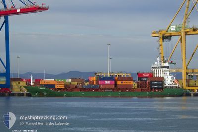
ANITA A
Container Ship
Current Trip
| Time Travelled | 6 h, 18 mins |
|---|---|
| Remaining Time | --- |
| Distance Travelled | 9.47 nm |
| Remaining Distance | --- |
| AVG Speed | 10.5 Knop |
| MAX Speed | 11.7 Knop |
| AVG Wind | 8.9 knots |
| MAX Wind | 9 knots |
| MIN Temp | 16.6°C / 61.88°F |
| MAX Temp | 19.3°C / 66.74°F |
| Djupgående | 7.4 m |
| Position mottagen | 5 h, 41 m sen |
Current Position
| Longitud | --- |
|---|---|
| Latitude | --- |
| Status | Under way using engine |
| Fart | 11.3 Knop |
| Kurs | 294.2° |
| Område | Mediterranean Sea - Eastern Basin |
| Station | T-AIS |
| Position mottagen | 5 h, 41 m sen |
Info
Information
The current position of ANITA A is in Mediterranean Sea - Eastern Basin with coordinates 31.88862° / 34.52559° as reported on 2024-12-22 08:13 by AIS to our vessel tracker app. The vessel's current speed is 11.3 Knop and is heading at the port of PORT SAID. The estimated time of arrival as calculated by MyShipTracking vessel tracking app is 2024-12-22 19:30 LT
The vessel ANITA A (IMO: 9532343, MMSI: 636021307) is a Container Ship that was built in 2009 ( 15 År gammal ). It's sailing under the flag of [LR] Liberia.
In this page you can find informations about the vessels current position, last detected port calls, and current voyage information. If the vessels is not in coverage by AIS you will find the latest position.
The current position of ANITA A is detected by our AIS receivers and we are not responsible for the reliability of the data. The last position was recorded while the vessel was in Coverage by the Ais receivers of our vessel tracking app.
The current draught of ANITA A as reported by AIS is 7.4 meters
Weather
| Temperature | 18.3°C / 64.94°F |
|---|---|
| Wind Speed | 8 knots |
| Direction | 241° WSW |
| Pressure | 1018.8 hPa |
| Humidity | 69.1 % |
| Cloud Coverage | 54 % |
Featured Company
Last Port Calls
| Port | Arrival | Departure | Time In Port |
|---|---|---|---|
| 2024-12-21 18:29 | 2024-12-22 07:37 | 13 h | |
| 2024-12-20 05:09 | 2024-12-20 14:52 | 9 h | |
| 2024-12-20 04:37 | 2024-12-20 04:57 | 20 m | |
| 2024-12-19 02:49 | 2024-12-19 18:12 | 15 h | |
| 2024-12-05 02:05 | 2024-12-06 01:10 | 23 h | |
| 2024-12-03 14:33 | 2024-12-04 15:14 | 1 d | |
| 2024-12-01 04:19 | 2024-12-01 13:44 | 9 h | |
| 2024-11-29 16:00 | 2024-11-30 04:15 | 12 h | |
| 2024-11-29 04:20 | 2024-11-29 13:09 | 8 h | |
| 2024-11-28 12:46 | 2024-11-29 04:15 | 15 h |
Last Trips
| Origin | Departure | Destination | Arrival | Distance | |
|---|---|---|---|---|---|
| 2024-12-20 17:52 | 2024-12-21 20:29 | 343.38 nm | |||
| 2024-12-20 07:57 | 2024-12-20 08:09 | 0.22 nm | |||
| 2024-12-19 21:12 | 2024-12-20 07:37 | 88.72 nm | |||
| 2024-12-06 03:10 | 2024-12-19 05:49 | 270.45 nm | |||
| 2024-12-04 17:14 | 2024-12-05 04:05 | 83.84 nm | |||
| 2024-11-30 06:15 | 2024-12-03 16:33 | 264.01 nm | |||
| 2024-11-30 06:15 | 2024-12-01 06:19 | 31.13 nm | |||
| 2024-11-29 06:15 | 2024-11-29 18:00 | 105.33 nm | |||
| 2024-11-29 06:15 | 2024-11-29 06:20 | 0.86 nm | |||
| 2024-11-27 16:09 | 2024-11-28 14:46 | 148.34 nm |
Events
| Tid | Event | Detaljer | Position / Dest | Information |
|---|---|---|---|---|
| 2024-12-22 08:16 | Status ändrad | Default Under way using engine |
31.89264 / 34.51537
EGPSD
|
Fart: 11.3 kn Kurs: 294.2° |
| 2024-12-22 08:13 | UTANFÖR täckningsområde |
31.88862 / 34.52559
Mediterranean Sea - Eastern Basin
EGPSD
|
Fart: 11.3 kn Kurs: 294.2° |
|
| 2024-12-22 07:41 | ETA ändrat | 2024/12/22 19:30 2024/12/22 17:00 |
31.85345 / 34.63308
EGPSD
|
Fart: 8.5 kn Kurs: 267° |
| 2024-12-22 07:37 | AVGÅTT HAMN |
|
31.85345 / 34.63308
EGPSD
|
Fart: 8.3 kn Kurs: 352° |
| 2024-12-22 07:25 | Status ändrad | Under way using engine Moored |
31.83300 / 34.64572
[IL] ASHDOD
|
Fart: 0.2 kn Kurs: 174° |
| 2024-12-22 07:25 | STARTAR förflyttning |
31.83300 / 34.64572
[IL] ASHDOD
|
Fart: 5.1 kn Kurs: 281° |
|
| 2024-12-22 07:07 | Djupgående ändrat | 7.4 7.3 |
31.83347 / 34.65023
[IL] ASHDOD
|
Fart: Kurs: 180° |
| 2024-12-22 07:07 | Destination ändrad | EGPSD ILASH |
31.83347 / 34.65023
[IL] ASHDOD
|
Fart: Kurs: 180° |
| 2024-12-22 07:07 | ETA ändrat | 2024/12/22 17:00 2024/12/21 15:00 |
31.83347 / 34.65023
[IL] ASHDOD
|
Fart: Kurs: 180° |
| 2024-12-22 06:37 | Status ändrad | Moored Default |
31.83339 / 34.65022
[IL] ASHDOD
|
Fart: Kurs: 180° |