

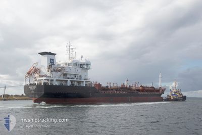
ANHOUT SWAN
Oil/Chemical Tanker

Current Trip
ES HUE
| Time Travelled | 9 h, 51 mins |
|---|---|
| Remaining Time | --- |
| Distance Travelled | 96.98 nm |
| Remaining Distance | --- |
| AVG Speed | 10.4 Knop |
| MAX Speed | 12.6 Knop |
| AVG Wind | 19.9 knots |
| MAX Wind | 22.8 knots |
| MIN Temp | 8.8°C / 47.84°F |
| MAX Temp | 14.7°C / 58.46°F |
| Djupgående | 5.5 m |
| Position mottagen | 2 m sen |
Current Position
| Longitud | --- |
|---|---|
| Latitude | --- |
| Status | Under way using engine |
| Fart | 11.6 Knop |
| Kurs | 330° |
| Område | North Atlantic Ocean |
| Station | T-AIS |
| Position mottagen | 2 m sen |
Information
The current position of ANHOUT SWAN is in North Atlantic Ocean with coordinates 36.61190° / -6.73732° as reported on 2025-03-09 10:20 by AIS to our vessel tracker app. The vessel's current speed is 11.6 Knop
The vessel ANHOUT SWAN (IMO: 9401300, MMSI: 219473000) is a Oil/Chemical Tanker that was built in 2008 ( 17 År gammal ). It's sailing under the flag of [DK] Denmark.
In this page you can find informations about the vessels current position, last detected port calls, and current voyage information. If the vessels is not in coverage by AIS you will find the latest position.
The current position of ANHOUT SWAN is detected by our AIS receivers and we are not responsible for the reliability of the data. The last position was recorded while the vessel was in Coverage by the Ais receivers of our vessel tracking app.
The current draught of ANHOUT SWAN as reported by AIS is 5.5 meters
Weather
| Temperature | 13.9°C / 57.02°F |
|---|---|
| Wind Speed | 22 knots |
| Direction | 246° WSW |
| Pressure | 1002.8 hPa |
| Humidity | 64.4 % |
| Cloud Coverage | 82 % |


Featured Company
Last Port Calls
| Port | Arrival | Departure | Time In Port |
|---|---|---|---|
| 2025-03-08 10:07 | 2025-03-09 00:31 | 14 h | |
| 2025-03-08 03:36 | 2025-03-08 08:19 | 4 h | |
| 2025-03-04 17:34 | 2025-03-05 23:29 | 1 d | |
| 2025-02-26 23:25 | 2025-02-28 08:12 | 1 d | |
| 2025-02-23 10:41 | 2025-02-25 02:25 | 1 d | |
| 2025-02-17 22:38 | 2025-02-19 17:53 | 1 d | |
| 2025-02-03 13:13 | 2025-02-04 11:39 | 22 h | |
| 2025-01-28 21:29 | 2025-01-29 02:43 | 5 h | |
| 2025-01-20 23:12 | 2025-01-21 18:42 | 19 h | |
| 2025-01-18 20:48 | 2025-01-18 21:07 | 18 m |
Last Trips
| Origin | Departure | Destination | Arrival | Distance | |
|---|---|---|---|---|---|
| 2025-03-08 09:19 | 2025-03-08 11:07 | 17.38 nm | |||
| 2025-03-06 00:29 | 2025-03-08 04:36 | 514.14 nm | |||
| 2025-02-28 09:12 | 2025-03-04 18:34 | 663.24 nm | |||
| 2025-02-25 02:25 | 2025-02-27 00:25 | 251.22 nm | |||
| 2025-02-19 18:53 | 2025-02-23 10:41 | 214.83 nm | |||
| 2025-02-04 14:39 | 2025-02-17 23:38 | 2337.03 nm | |||
| 2025-01-29 03:43 | 2025-02-03 16:13 | 1650.00 nm | |||
| 2025-01-21 19:42 | 2025-01-28 22:29 | 1495.69 nm | |||
| 2025-01-18 22:07 | 2025-01-21 00:12 | 354.01 nm | |||
| 2025-01-18 12:49 | 2025-01-18 21:48 | 51.45 nm |
Events
| Tid | Event | Detaljer | Position / Dest | Information |
|---|---|---|---|---|
| 2025-03-09 08:12 | Status ändrad | Under way using engine Default |
36.23438 / -6.55108
ES HUE
|
Fart: 11.5 kn Kurs: 343° |
| 2025-03-09 08:03 | Status ändrad | Default Under way using engine |
36.20682 / -6.54062
ES HUE
|
Fart: 11.5 kn Kurs: 340° |
| 2025-03-09 07:56 | Status ändrad | Under way using engine Default |
36.18597 / -6.53257
ES HUE
|
Fart: 11.3 kn Kurs: 342° |
| 2025-03-09 07:56 | I täckningsområde |
36.18953 / -6.53397
North Atlantic Ocean
ES HUE
|
Fart: 11.2 kn Kurs: 344° |
|
| 2025-03-09 05:57 | Status ändrad | Default Under way using engine |
35.96550 / -6.24813
ES HUE
|
Fart: 9.8 kn Kurs: 272° |
| 2025-03-09 05:43 | Status ändrad | Under way using engine Default |
35.96320 / -6.20148
ES HUE
|
Fart: 10 kn Kurs: 272° |
| 2025-03-09 05:43 | UTANFÖR täckningsområde |
35.96320 / -6.20148
North Atlantic Ocean
ES HUE
|
Fart: 9.8 kn Kurs: 272° |
|
| 2025-03-09 05:24 | Status ändrad | Default Under way using engine |
35.96183 / -6.14187
ES HUE
|
Fart: 9.5 kn Kurs: 274° |
| 2025-03-09 05:14 | Status ändrad | Under way using engine Default |
35.96005 / -6.10920
ES HUE
|
Fart: 9.4 kn Kurs: 267° |
| 2025-03-09 04:46 | Status ändrad | Default Under way using engine |
35.96152 / -6.01833
ES HUE
|
Fart: 9.7 kn Kurs: 269° |