
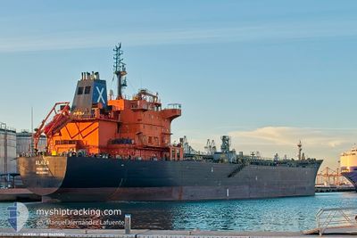
ALKEA
Oil/Chemical Tanker
Current Trip
| Time Travelled | 2 days |
|---|---|
| Remaining Time | 6 h, 28 mins |
| Distance Travelled | 624.46 nm |
| Remaining Distance | 88.81 nm |
| AVG Speed | 11.9 Knop |
| MAX Speed | 15.2 Knop |
| AVG Wind | 14.1 knots |
| MAX Wind | 22.9 knots |
| MIN Temp | 12.6°C / 54.68°F |
| MAX Temp | 19.7°C / 67.46°F |
| Djupgående | 11.4 m |
| Position mottagen | 7 m sen |
Current Position
| Longitud | --- |
|---|---|
| Latitude | --- |
| Status | Under way using engine |
| Fart | 12.8 Knop |
| Kurs | 126.8° |
| Område | Bay of Biscay |
| Station | T-AIS |
| Position mottagen | 7 m sen |
Information
The current position of ALKEA is in Bay of Biscay with coordinates 46.76787° / -3.06630° as reported on 2025-06-03 12:29 by AIS to our vessel tracker app. The vessel's current speed is 12.8 Knop and is heading at the port of LA PALLICE. The estimated time of arrival as calculated by MyShipTracking vessel tracking app is 2025-06-03 19:04 LT
The vessel ALKEA (IMO: 9425502, MMSI: 636021853) is a Oil/Chemical Tanker that was built in 2009 ( 16 År gammal ). It's sailing under the flag of [LR] Liberia.
In this page you can find informations about the vessels current position, last detected port calls, and current voyage information. If the vessels is not in coverage by AIS you will find the latest position.
The current position of ALKEA is detected by our AIS receivers and we are not responsible for the reliability of the data. The last position was recorded while the vessel was in Coverage by the Ais receivers of our vessel tracking app.
The current draught of ALKEA as reported by AIS is 11.4 meters
Weather
| Temperature | 16.4°C / 61.52°F |
|---|---|
| Wind Speed | 15 knots |
| Direction | 243° WSW |
| Pressure | 1015 hPa |
| Humidity | 73 % |
| Cloud Coverage | 35 % |
Featured Company
Last Port Calls
| Port | Arrival | Departure | Time In Port |
|---|---|---|---|
| 2025-05-29 16:55 | 2025-06-01 10:37 | 2 d | |
| 2025-05-24 22:31 | 2025-05-26 02:37 | 1 d | |
| 2025-05-08 09:24 | 2025-05-10 01:32 | 1 d | |
| 2025-04-29 11:25 | 2025-05-02 01:55 | 2 d | |
| 2025-04-25 11:48 | |||
| 2025-04-19 09:37 | 2025-04-21 00:41 | 1 d | |
| 2025-04-15 09:56 | 2025-04-17 15:17 | 2 d | |
| 2025-04-10 07:01 | 2025-04-12 02:01 | 1 d | |
| 2025-04-06 01:01 | 2025-04-07 00:35 | 23 h |
Last Trips
| Origin | Departure | Destination | Arrival | Distance | |
|---|---|---|---|---|---|
| 2025-05-26 04:37 | 2025-05-29 18:55 | 209.39 nm | |||
| 2025-05-10 03:32 | 2025-05-25 00:31 | 3304.22 nm | |||
| 2025-05-02 03:55 | 2025-05-08 11:24 | 389.31 nm | |||
| 2025-04-25 13:48 | 2025-04-29 13:25 | 944.95 nm | |||
| 2025-04-17 17:17 | 2025-04-19 11:37 | 393.32 nm | |||
| 2025-04-12 04:01 | 2025-04-15 11:56 | 395.82 nm | |||
| 2025-04-07 02:35 | 2025-04-10 09:01 | 461.79 nm | |||
| 2025-03-28 04:37 | 2025-04-06 03:01 | 11.72 nm |
Events
| Tid | Event | Detaljer | Position / Dest | Information |
|---|---|---|---|---|
| 2025-06-03 12:01 | Status ändrad | Under way using engine Default |
46.83111 / -3.18005
FRLPE
|
Fart: 13.4 kn Kurs: 127° |
| 2025-06-03 12:00 | Status ändrad | Default Under way using engine |
46.83339 / -3.18441
FRLPE
|
Fart: 13.4 kn Kurs: 127.4° |
| 2025-06-03 11:43 | Status ändrad | Under way using engine Default |
46.87237 / -3.26121
FRLPE
|
Fart: 13.4 kn Kurs: 126° |
| 2025-06-03 11:43 | I täckningsområde |
46.87237 / -3.26121
Bay of Biscay
FRLPE
|
Fart: 13.6 kn Kurs: 126.5° |
|
| 2025-06-03 10:26 | Status ändrad | Default Under way using engine |
47.02339 / -3.61521
FRLPE
|
Fart: 13.4 kn Kurs: 123.4° |
| 2025-06-03 10:26 | UTANFÖR täckningsområde |
47.02339 / -3.61521
Bay of Biscay
FRLPE
|
Fart: 13.4 kn Kurs: 123.4° |
|
| 2025-06-03 10:21 | Status ändrad | Under way using engine Default |
47.03583 / -3.64027
FRLPE
|
Fart: 13.4 kn Kurs: 129° |
| 2025-06-03 09:55 | Status ändrad | Default Under way using engine |
47.09513 / -3.75029
FRLPE
|
Fart: 13.4 kn Kurs: 126.4° |
| 2025-06-03 09:29 | Status ändrad | Under way using engine Default |
47.15588 / -3.86156
FRLPE
|
Fart: 13.5 kn Kurs: 128° |
| 2025-06-03 09:28 | Status ändrad | Default Under way using engine |
47.15821 / -3.86590
FRLPE
|
Fart: 13.5 kn Kurs: 126.4° |