
ADAM
Tanker
Current Trip
EG SKT
| Time Travelled | 5 days |
|---|---|
| Remaining Time | --- |
| Distance Travelled | 101.20 nm |
| Remaining Distance | --- |
| AVG Speed | 9.7 Knop |
| MAX Speed | 12.6 Knop |
| AVG Wind | 5.7 knots |
| MAX Wind | 14 knots |
| MIN Temp | 19.7°C / 67.46°F |
| MAX Temp | 23.4°C / 74.12°F |
| Djupgående | 9 m |
| Position mottagen | 4 h, 12 m sen |
Current Position
| Longitud | --- |
|---|---|
| Latitude | --- |
| Status | Under way using engine |
| Fart | 12.1 Knop |
| Kurs | 126.1° |
| Område | Ionian Sea |
| Station | T-AIS |
| Position mottagen | 4 h, 12 m sen |
Info
Information
The current position of ADAM is in Ionian Sea with coordinates 37.32325° / 16.09476° as reported on 2024-10-18 06:22 by AIS to our vessel tracker app. The vessel's current speed is 12.1 Knop
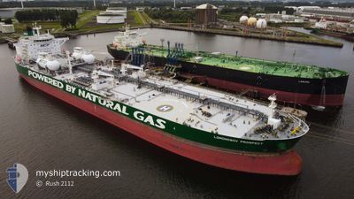
The vessel ADAM (IMO: 9826732, MMSI: 636018688) is a Tanker It's sailing under the flag of [LR] Liberia.
In this page you can find informations about the vessels current position, last detected port calls, and current voyage information. If the vessels is not in coverage by AIS you will find the latest position.
The current position of ADAM is detected by our AIS receivers and we are not responsible for the reliability of the data. The last position was recorded while the vessel was in Coverage by the Ais receivers of our vessel tracking app.
The current draught of ADAM as reported by AIS is 9 meters
Weather
| Temperature | 22.8°C / 73.04°F |
|---|---|
| Wind Speed | 12 knots |
| Direction | 182° S |
| Pressure | 1020.6 hPa |
| Humidity | 72.6 % |
| Cloud Coverage | 100 % |
Featured Company
Last Port Calls
| Port | Arrival | Departure | Time In Port |
|---|---|---|---|
| 2024-10-09 16:29 | 2024-10-13 07:09 | 3 d | |
| 2024-10-05 09:13 | 2024-10-06 08:22 | 23 h | |
| 2024-09-24 16:33 | 2024-09-25 17:33 | 1 d | |
| 2024-09-18 17:52 | 2024-09-19 13:20 | 19 h | |
| 2024-09-12 07:05 | 2024-09-14 03:44 | 1 d | |
| 2024-08-12 10:26 | 2024-08-13 16:35 | 1 d | |
| 2024-08-05 20:56 | 2024-08-06 14:40 | 17 h |
Most Visited Ports (Last year)
| Port | Arrivals | |
|---|---|---|
| 3 | ||
| 3 | ||
| 2 | ||
| 1 | ||
| 1 | ||
| 1 |
Last Trips
| Origin | Departure | Destination | Arrival | Distance | |
|---|---|---|---|---|---|
| 2024-10-06 11:22 | 2024-10-09 18:29 | 1067.22 nm | |||
| 2024-09-25 19:33 | 2024-10-05 12:13 | 1664.86 nm | |||
| 2024-09-19 16:20 | 2024-09-24 18:33 | 1472.68 nm | |||
| 2024-09-14 05:44 | 2024-09-18 20:52 | 1417.94 nm | |||
| 2024-08-13 18:35 | 2024-09-12 09:05 | 3849.38 nm | |||
| 2024-08-06 17:40 | 2024-08-12 12:26 | 1560.09 nm | |||
| 2024-07-21 10:53 | 2024-08-05 23:56 | 1255.03 nm |
Events
| Tid | Event | Detaljer | Position / Dest | Information |
|---|---|---|---|---|
| 2024-10-18 06:49 | Status ändrad | Default Under way using engine |
37.26779 / 16.19286
EG SKT
|
Fart: 12.1 kn Kurs: 126.1° |
| 2024-10-18 06:22 | UTANFÖR täckningsområde |
37.32325 / 16.09476
Ionian Sea
EG SKT
|
Fart: 12.1 kn Kurs: 126.1° |
|
| 2024-10-18 05:57 | STARTAR förflyttning |
37.36262 / 16.03338
EG SKT
|
Fart: 3.1 kn Kurs: 171° |
|
| 2024-10-18 05:52 | Status ändrad | Under way using engine Default |
37.36336 / 16.03712
EG SKT
|
Fart: 0.8 kn Kurs: 281° |
| 2024-10-18 05:31 | Status ändrad | Default Under way using engine |
37.35823 / 16.04001
EG SKT
|
Fart: 0.8 kn Kurs: 281° |
| 2024-10-18 05:10 | Status ändrad | Under way using engine Default |
37.35379 / 16.04056
EG SKT
|
Fart: 0.8 kn Kurs: 291° |
| 2024-10-18 04:46 | Status ändrad | Default Under way using engine |
37.34840 / 16.04212
EG SKT
|
Fart: 0.6 kn Kurs: 286° |
| 2024-10-18 04:13 | Status ändrad | Under way using engine Default |
37.34186 / 16.04244
EG SKT
|
Fart: 0.7 kn Kurs: 262° |
| 2024-10-18 03:56 | Status ändrad | Default Under way using engine |
37.33831 / 16.04255
EG SKT
|
Fart: 0.7 kn Kurs: 257° |
| 2024-10-18 03:41 | Destination ändrad | EG SKT OPL |
37.33521 / 16.04300
EG SKT
|
Fart: 0.7 kn Kurs: 255° |