
ADAM
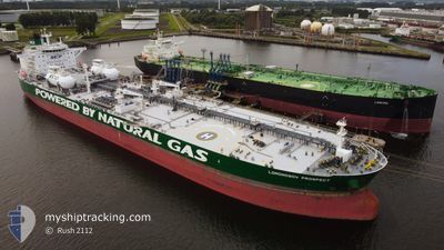
Tanker
Current Trip
| Time Travelled | 5 days |
|---|---|
| Remaining Time | --- |
| Distance Travelled | 1551.86 nm |
| Remaining Distance | --- |
| AVG Speed | 11.1 Knots |
| MAX Speed | 13.1 Knots |
| AVG Wind | 9.4 knots |
| MAX Wind | 20.8 knots |
| MIN Temp | 8.1°C / 46.58°F |
| MAX Temp | 15.8°C / 60.44°F |
| Dybgang | 14 m |
| Position Modtaget | 1 m siden |
Current Position
| Longitude | 1.10686° |
|---|---|
| Latitude | 50.87662° |
| Status | Under way using engine |
| Fart | 10 Knots |
| Kurs | 230.8° |
| Område | English Channel |
| Station | T-AIS |
| Position Modtaget | 1 m siden |
Info
Information
The current position of ADAM is in English Channel with coordinates 50.87662° / 1.10686° as reported on 2024-05-22 11:27 by AIS to our vessel tracker app. The vessel's current speed is 10 Knots and is heading at the port of KORFEZ. The estimated time of arrival as calculated by MyShipTracking vessel tracking app is 2024-06-03 03:00 LT
The vessel ADAM (IMO: 9826732, MMSI: 636018688) is a Tanker It's sailing under the flag of [LR] Liberia.
In this page you can find informations about the vessels current position, last detected port calls, and current voyage information. If the vessels is not in coverage by AIS you will find the latest position.
The current position of ADAM is detected by our AIS receivers and we are not responsible for the reliability of the data. The last position was recorded while the vessel was in Coverage by the Ais receivers of our vessel tracking app.
The current draught of ADAM as reported by AIS is 14 meters
Weather
| Temperature | 15°C / 59°F |
|---|---|
| Wind Speed | 18 knots |
| Direction | 240° WSW |
| Pressure | 1006.8 hPa |
| Humidity | 88.7 % |
| Cloud Coverage | 76 % |
Featured Company
Last Port Calls
| Port | Arrival | Departure | Time In Port |
|---|---|---|---|
| 2024-05-15 11:22 | 2024-05-16 22:04 | 1 d | |
| 2024-04-30 09:55 | 2024-05-01 19:05 | 1 d | |
| 2024-04-21 07:32 | 2024-04-22 16:29 | 1 d | |
| 2024-04-12 09:31 | 2024-04-18 10:31 | 6 d |
Most Visited Ports (Last year)
| Port | Arrivals | |
|---|---|---|
| 3 | ||
| 2 | ||
| 2 | ||
| 2 | ||
| 2 | ||
| 2 |
Last Trips
| Origin | Departure | Destination | Arrival | Distance | |
|---|---|---|---|---|---|
| 2024-05-01 21:05 | 2024-05-15 14:22 | 3346.67 nm | |||
| 2024-04-22 18:29 | 2024-04-30 11:55 | 1644.41 nm | |||
| 2024-04-18 12:31 | 2024-04-21 09:32 | 280.37 nm | |||
| 2024-01-16 04:13 | 2024-04-12 11:31 | 11153.20 nm |
Events
| Tid | Hændelsen | Detaljer | Position / Dest | Info |
|---|---|---|---|---|
| 2024-05-22 09:34 | Ændre havområde | United Kingdom part of the English Channel United Kingdom part of the North Sea |
51.07595 / 1.47006
English Channel
TR TUT
|
Fart: 10.8 kn Kurs: 232.3° |
| 2024-05-22 03:21 | Dybgangen er ændret | 14 14.3 |
51.97152 / 2.58905
TR TUT
|
Fart: 10.9 kn Kurs: 185.1° |
| 2024-05-22 02:42 | Status er ændret | Under way using engine Default |
52.08650 / 2.60168
TR TUT
|
Fart: 11 kn Kurs: 184° |
| 2024-05-22 02:37 | Status er ændret | Default Under way using engine |
52.10333 / 2.60333
TR TUT
|
Fart: 10.6 kn Kurs: 181.5° |
| 2024-05-22 02:35 | Status er ændret | Under way using engine Default |
52.10922 / 2.60389
TR TUT
|
Fart: 10.5 kn Kurs: 182° |
| 2024-05-22 01:52 | Status er ændret | Default Under way using engine |
52.22657 / 2.64655
TR TUT
|
Fart: 10.3 kn Kurs: 208.3° |
| 2024-05-22 01:45 | Fundet i havområde | United Kingdom part of the North Sea |
52.24519 / 2.66093
North Sea
TR TUT
|
Fart: 10.3 kn Kurs: 208.3° |
| 2024-05-22 01:45 | Indenfor Dækning |
52.24519 / 2.66093
North Sea
TR TUT
|
Fart: 10.3 kn Kurs: 208.3° |
|
| 2024-05-21 08:37 | Status er ændret | Default Under way using engine |
55.15586 / 5.71086
TR TUT
|
Fart: 12.4 kn Kurs: 212° |
| 2024-05-21 08:34 | Udenfor Dækning |
55.16642 / 5.72324
North Sea
TR TUT
|
Fart: 12.4 kn Kurs: 212° |