

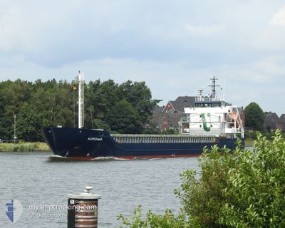
ACEROMAR
General Cargo

Current Trip
| Time Travelled | 1 day |
|---|---|
| Remaining Time | 23 h, 15 mins |
| Distance Travelled | 328.95 nm |
| Remaining Distance | 322.79 nm |
| AVG Speed | 10.7 Knop |
| MAX Speed | 12.3 Knop |
| AVG Wind | 9.3 knots |
| MAX Wind | 21 knots |
| MIN Temp | 4°C / 39.2°F |
| MAX Temp | 9.2°C / 48.56°F |
| Djupgående | 5.4 m |
| Position mottagen | 4 h, 38 m sen |
Current Position
| Longitud | --- |
|---|---|
| Latitude | --- |
| Status | Under way using engine |
| Fart | 11.6 Knop |
| Kurs | 52.4° |
| Område | Baltic Sea |
| Station | T-AIS |
| Position mottagen | 4 h, 38 m sen |
Information
The current position of ACEROMAR is in Baltic Sea with coordinates 56.34321° / 17.47167° as reported on 2025-03-27 13:14 by AIS to our vessel tracker app. The vessel's current speed is 11.6 Knop and is heading at the port of MUUGA. The estimated time of arrival as calculated by MyShipTracking vessel tracking app is 2025-03-28 19:07 LT
The vessel ACEROMAR (IMO: 9552082, MMSI: 253371000) is a General Cargo that was built in 2012 ( 13 År gammal ). It's sailing under the flag of [LU] Luxembourg.
In this page you can find informations about the vessels current position, last detected port calls, and current voyage information. If the vessels is not in coverage by AIS you will find the latest position.
The current position of ACEROMAR is detected by our AIS receivers and we are not responsible for the reliability of the data. The last position was recorded while the vessel was in Coverage by the Ais receivers of our vessel tracking app.
The current draught of ACEROMAR as reported by AIS is 5.4 meters
Weather
| Temperature | 4.4°C / 39.92°F |
|---|---|
| Wind Speed | 20 knots |
| Direction | 219° SW |
| Pressure | 1012.7 hPa |
| Humidity | 93.1 % |
| Cloud Coverage | 100 % |


Featured Company
Last Port Calls
| Port | Arrival | Departure | Time In Port |
|---|---|---|---|
| 2025-03-24 17:44 | 2025-03-26 11:32 | 1 d | |
| 2025-03-19 11:32 | 2025-03-21 21:57 | 2 d | |
| 2025-03-14 22:47 | 2025-03-18 17:31 | 3 d | |
| 2025-03-05 22:57 | 2025-03-09 08:45 | 3 d | |
| 2025-03-04 19:08 | 2025-03-05 22:44 | 1 d | |
| 2025-03-02 14:26 | 2025-03-03 00:41 | 10 h | |
| 2025-02-26 08:24 | 2025-02-28 16:09 | 2 d | |
| 2025-02-20 17:14 | 2025-02-23 23:54 | 3 d | |
| 2025-02-19 20:11 | 2025-02-19 20:47 | 36 m | |
| 2025-02-15 21:49 | 2025-02-19 15:01 | 3 d |
Most Visited Ports (Last year)
| Port | Arrivals | |
|---|---|---|
| 7 | ||
| 4 | ||
| 4 | ||
| 4 | ||
| 4 | ||
| 3 |
Last Trips
| Origin | Departure | Destination | Arrival | Distance | |
|---|---|---|---|---|---|
| 2025-03-21 21:57 | 2025-03-24 17:44 | 615.89 nm | |||
| 2025-03-18 17:31 | 2025-03-19 11:32 | 168.70 nm | |||
| 2025-03-09 08:45 | 2025-03-14 22:47 | 1394.04 nm | |||
| 2025-03-05 22:44 | 2025-03-05 22:57 | 1.63 nm | |||
| 2025-03-03 00:41 | 2025-03-04 19:08 | 399.28 nm | |||
| 2025-02-28 16:09 | 2025-03-02 14:26 | 545.75 nm | |||
| 2025-02-23 23:54 | 2025-02-26 08:24 | 551.32 nm | |||
| 2025-02-19 20:47 | 2025-02-20 17:14 | 209.33 nm | |||
| 2025-02-19 15:01 | 2025-02-19 20:11 | 48.85 nm | |||
| 2025-02-15 16:33 | 2025-02-15 21:49 | 49.25 nm |
Events
| Tid | Event | Detaljer | Position / Dest | Information |
|---|---|---|---|---|
| 2025-03-27 13:22 | Status ändrad | Default Under way using engine |
56.35931 / 17.50878
EEMUU
|
Fart: 11.6 kn Kurs: 52.4° |
| 2025-03-27 13:14 | UTANFÖR täckningsområde |
56.34321 / 17.47167
Baltic Sea
EEMUU
|
Fart: 11.6 kn Kurs: 52.4° |
|
| 2025-03-27 13:09 | Status ändrad | Under way using engine Default |
56.33422 / 17.45068
EEMUU
|
Fart: 11.7 kn Kurs: 52° |
| 2025-03-27 13:06 | Status ändrad | Default Under way using engine |
56.32768 / 17.43542
EEMUU
|
Fart: 11.6 kn Kurs: 52.2° |
| 2025-03-27 11:32 | Status ändrad | Under way using engine Default |
56.14261 / 17.00605
EEMUU
|
Fart: 11.5 kn Kurs: 51° |
| 2025-03-27 11:26 | Status ändrad | Default Under way using engine |
56.13055 / 16.97909
EEMUU
|
Fart: 11.6 kn Kurs: 51° |
| 2025-03-27 11:18 | Status ändrad | Under way using engine Default |
56.11489 / 16.94416
EEMUU
|
Fart: 11.6 kn Kurs: 52° |
| 2025-03-27 11:10 | Status ändrad | Default Under way using engine |
56.09904 / 16.90779
EEMUU
|
Fart: 11.6 kn Kurs: 53.1° |
| 2025-03-27 06:04 | Upptäckt i hav | Swedish part of the Baltic Sea |
55.61187 / 15.40611
Baltic Sea
EEMUU
|
Fart: 11.5 kn Kurs: 69.4° |
| 2025-03-27 01:53 | Byter havsområde | Danish part of the Kattegat Swedish part of the Baltic Sea |
55.17438 / 14.28689
Kattegat
EEMUU
|
Fart: 11.3 kn Kurs: 78.8° |