
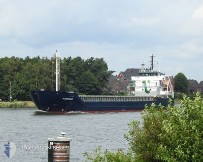
ACEROMAR
General Cargo
Current Trip
| Time Travelled | 1 day |
|---|---|
| Remaining Time | 1 day |
| Distance Travelled | 201.42 nm |
| Remaining Distance | 352.43 nm |
| AVG Speed | 7.7 Knots |
| MAX Speed | 11.7 Knots |
| AVG Wind | 28.5 knots |
| MAX Wind | 33.9 knots |
| MIN Temp | 7.1°C / 44.78°F |
| MAX Temp | 9.7°C / 49.46°F |
| Draught | 6.2 m |
| Position Received | Now |
Current Position
| Longitude | 6.19865° |
|---|---|
| Latitude | 53.70097° |
| Status | Under way using engine |
| Speed | 8.3 Knots |
| Course | 82° |
| Area | North Sea |
| Station | T-AIS |
| Position Received | Now |
Info
Information
The current position of ACEROMAR is in North Sea with coordinates 53.70097° / 6.19865° as reported on 2024-04-20 01:21 by AIS to our vessel tracker app. The vessel's current speed is 8.3 Knots and is heading at the port of SWINOUJSCIE. The estimated time of arrival as calculated by MyShipTracking vessel tracking app is 2024-04-21 23:14 LT
The vessel ACEROMAR (IMO: 9552082, MMSI: 253371000) is a General Cargo that was built in 2012 ( 12 years old ). It's sailing under the flag of [LU] Luxembourg.
In this page you can find informations about the vessels current position, last detected port calls, and current voyage information. If the vessels is not in coverage by AIS you will find the latest position.
The current position of ACEROMAR is detected by our AIS receivers and we are not responsible for the reliability of the data. The last position was recorded while the vessel was in Coverage by the Ais receivers of our vessel tracking app.
The current draught of ACEROMAR as reported by AIS is 6.2 meters
Weather
| Temperature | 7.7°C / 45.86°F |
|---|---|
| Wind Speed | 26 knots |
| Direction | 338° NNW |
| Pressure | 1014.5 hPa |
| Humidity | 72 % |
| Cloud Coverage | 100 % |
Featured Company
Last Port Calls
| Port | Arrival | Departure | Time In Port |
|---|---|---|---|
| 2024-04-14 09:00 | 2024-04-19 00:12 | 4 d | |
| 2024-04-06 16:48 | 2024-04-09 13:49 | 2 d | |
| 2024-04-03 17:25 | 2024-04-05 12:17 | 1 d | |
| 2024-03-29 19:39 | 2024-03-29 19:44 | 5 m | |
| 2024-03-26 05:15 | 2024-03-27 15:15 | 1 d | |
| 2024-03-22 13:36 | 2024-03-23 13:47 | 1 d | |
| 2024-03-18 23:24 | 2024-03-19 11:26 | 12 h | |
| 2024-03-18 22:51 | 2024-03-18 23:04 | 13 m | |
| 2024-03-13 07:10 | 2024-03-13 08:28 | 1 h | |
| 2024-03-08 19:10 |
Last Trips
| Origin | Departure | Destination | Arrival | Distance | |
|---|---|---|---|---|---|
| 2024-04-09 16:49 | 2024-04-14 11:00 | 1063.75 nm | |||
| 2024-04-05 14:17 | 2024-04-06 19:48 | 266.32 nm | |||
| 2024-03-29 20:44 | 2024-04-03 19:25 | 968.28 nm | |||
| 2024-03-27 16:15 | 2024-03-29 20:39 | 426.53 nm | |||
| 2024-03-23 14:47 | 2024-03-26 06:15 | 652.51 nm | |||
| 2024-03-19 12:26 | 2024-03-22 14:36 | 773.09 nm | |||
| 2024-03-19 00:04 | 2024-03-19 00:24 | 1.33 nm | |||
| 2024-03-13 09:28 | 2024-03-18 23:51 | 359.21 nm | |||
| 2024-03-08 21:10 | 2024-03-13 08:10 | 1031.02 nm | |||
| 2024-02-28 13:05 | 2024-02-28 13:42 | 4.36 nm |
Events
| Time | Event | Details | Position / Dest | Info |
|---|---|---|---|---|
| 2024-04-20 00:40 | Status Changed | Under way using engine Default |
53.69056 / 6.04049
PLSWI
|
Speed: 8.3 kn Course: 82° |
| 2024-04-20 00:24 | Status Changed | Default Under way using engine |
53.68569 / 5.97783
PLSWI
|
Speed: 8.2 kn Course: 81.1° |
| 2024-04-19 12:33 | IN Coverage |
52.88533 / 4.25824
North Sea
PLSWI
|
Speed: 8.8 kn Course: 29° |
|
| 2024-04-19 05:41 | OUT of Coverage |
52.09641 / 3.42349
North Sea
PLSWI
|
Speed: 7.8 kn Course: 9.3° |
|
| 2024-04-19 00:12 | PORT DEPARTURE |
|
51.44709 / 3.66982
PLSWI
|
Speed: 9.6 kn Course: 218° |
| 2024-04-18 23:54 | START Moving |
51.45223 / 3.71403
[NL] VLISSINGEN
|
Speed: 3.4 kn Course: 260° |
|
| 2024-04-18 20:05 | Destination Changed | PLSWI NLVLI |
51.45251 / 3.71701
[NL] VLISSINGEN
|
Speed: Course: 238° |
| 2024-04-18 20:05 | ETA Changed | 2024/04/22 06:00 2024/04/14 06:00 |
51.45251 / 3.71701
[NL] VLISSINGEN
|
Speed: Course: 238° |
| 2024-04-17 12:34 | STOP Moving |
51.45256 / 3.71692
[NL] VLISSINGEN
|
Speed: 0.3 kn Course: 237° |
|
| 2024-04-17 12:10 | START Moving |
51.46088 / 3.69050
[NL] VLISSINGEN
|
Speed: 4.4 kn Course: 190° |