
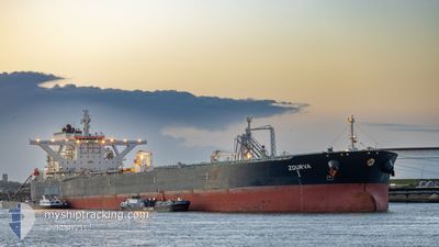
ZOURVA
Tanker
Current Trip
CNNBO
| Time Travelled | --- |
|---|---|
| Remaining Time | --- |
| Distance Travelled | 4927.95 морская миля |
| Remaining Distance | --- |
| AVG Speed | 7.8 Узлы |
| MAX Speed | 15.7 Узлы |
| AVG Wind | 6 knots |
| MAX Wind | 18.4 knots |
| MIN Temp | 23.3°C / 73.94°F |
| MAX Temp | 30°C / 86°F |
| Осадка | 20 м |
| Позиция Получена | 14 d тому назад |
Current Position
| Долгота | --- |
|---|---|
| Широта | --- |
| Статус | Constrained by her draught |
| Скорость | 11.2 Узлы |
| Курс | 49.6° |
| Район | South China Sea |
| Станция | T-AIS |
| Позиция Получена | 14 d тому назад |
Info
Information
The current position of ZOURVA is in South China Sea with coordinates 1.34870° / 104.40577° as reported on 2024-12-23 02:05 by AIS to our vessel tracker app. The vessel's current speed is 11.2 Узлы
The vessel ZOURVA (IMO: 9679593, MMSI: 229597000) is a Tanker It's sailing under the flag of [MT] Malta.
In this page you can find informations about the vessels current position, last detected port calls, and current voyage information. If the vessels is not in coverage by AIS you will find the latest position.
The current position of ZOURVA is detected by our AIS receivers and we are not responsible for the reliability of the data. The last position was recorded while the vessel was in Coverage by the Ais receivers of our vessel tracking app.
The current draught of ZOURVA as reported by AIS is 20 meters
Weather
| Temperature | 22.4°C / 72.32°F |
|---|---|
| Wind Speed | 26 knots |
| Direction | 51° NE |
| Pressure | 1017.4 hPa |
| Humidity | 74.3 % |
| Cloud Coverage | 100 % |
Featured Company
Last Port Calls
Most Visited Ports (Last year)
| Port | Arrivals | |
|---|---|---|
| 1 | ||
| 1 | ||
| 1 | ||
| 1 |
Last Trips
| Origin | Departure | Destination | Arrival | Distance |
|---|
Events
| Время | Событие | Детали | Позиция / Направление | Информация |
|---|---|---|---|---|
| 2025-01-03 22:41 | Начало движения | 1.86 nm, North West of NINGBO |
29.96046 / 121.81608
CNNBO
|
Скорость: 3.7 kn Курс: 73° |
| 2025-01-02 05:52 | Окончание движения | 1.82 nm, West of NINGBO |
29.95572 / 121.81432
CNNBO
|
Скорость: 0.2 kn Курс: 313° |
| 2025-01-02 03:25 | Начало движения | 7.94 nm, East of NINGBO |
29.92738 / 121.99786
CNNBO
|
Скорость: 3.4 kn Курс: 7° |
| 2024-12-31 05:09 | Окончание движения | 8.1 nm, East of NINGBO |
29.92478 / 122.00039
CNNBO
|
Скорость: 0.3 kn Курс: 323° |
| 2024-12-30 21:51 | Начало движения |
29.73575 / 123.06905
CNNBO
|
Скорость: 4 kn Курс: 235° |
|
| 2024-12-30 07:24 | Окончание движения |
29.73606 / 123.07919
CNNBO
|
Скорость: Курс: 318° |