
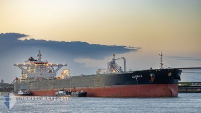
ZOURVA
Tanker
Current Trip
| Time Travelled | 3 days |
|---|---|
| Remaining Time | 10 days |
| Distance Travelled | 554.01 nm |
| Remaining Distance | 2436.13 nm |
| AVG Speed | 10.4 Knop |
| MAX Speed | 13.2 Knop |
| AVG Wind | 12.5 knots |
| MAX Wind | 15 knots |
| MIN Temp | 16.1°C / 60.98°F |
| MAX Temp | 20.8°C / 69.44°F |
| Djupgående | 11 m |
| Position mottagen | 6 m sen |
Current Position
| Longitud | -114.22146° |
|---|---|
| Latitude | 25.50853° |
| Status | Under way using engine |
| Fart | 10.4 Knop |
| Kurs | 143.7° |
| Område | North Pacific Ocean |
| Station | T-AIS |
| Position mottagen | 6 m sen |
Info
Information
The current position of ZOURVA is in North Pacific Ocean with coordinates 25.50853° / -114.22146° as reported on 2024-07-01 09:21 by AIS to our vessel tracker app. The vessel's current speed is 10.4 Knop and is heading at the port of BALBOA. The estimated time of arrival as calculated by MyShipTracking vessel tracking app is 2024-07-11 11:25 LT
The vessel ZOURVA (IMO: 9679593, MMSI: 229597000) is a Tanker It's sailing under the flag of [MT] Malta.
In this page you can find informations about the vessels current position, last detected port calls, and current voyage information. If the vessels is not in coverage by AIS you will find the latest position.
The current position of ZOURVA is detected by our AIS receivers and we are not responsible for the reliability of the data. The last position was recorded while the vessel was in Coverage by the Ais receivers of our vessel tracking app.
The current draught of ZOURVA as reported by AIS is 11 meters
Weather
| Temperature | 18.9°C / 66.02°F |
|---|---|
| Wind Speed | 11 knots |
| Direction | 308° NW |
| Pressure | 1012.6 hPa |
| Humidity | 91 % |
| Cloud Coverage | 58 % |
Featured Company
Last Port Calls
| Port | Arrival | Departure | Time In Port |
|---|---|---|---|
| 2024-06-25 19:36 | 2024-06-27 19:19 | 1 d |
Most Visited Ports (Last year)
| Port | Arrivals | |
|---|---|---|
| 1 | ||
| 1 | ||
| 1 |
Last Trips
| Origin | Departure | Destination | Arrival | Distance |
|---|
Events
| Tid | Event | Detaljer | Position / Dest | Information |
|---|---|---|---|---|
| 2024-07-01 05:09 | Status ändrad | Under way using engine Default |
26.07486 / -114.67861
PA BLB
|
Fart: 9.7 kn Kurs: 144° |
| 2024-07-01 04:50 | Status ändrad | Default Under way using engine |
26.11591 / -114.71031
PA BLB
|
Fart: 9.8 kn Kurs: 145.3° |
| 2024-07-01 04:44 | Status ändrad | Under way using engine Default |
26.12896 / -114.72025
PA BLB
|
Fart: 9.7 kn Kurs: 145° |
| 2024-07-01 04:22 | Status ändrad | Default Under way using engine |
26.17704 / -114.76024
PA BLB
|
Fart: 10.1 kn Kurs: 142° |
| 2024-07-01 04:07 | Status ändrad | Under way using engine Default |
26.21100 / -114.78967
PA BLB
|
Fart: 10.2 kn Kurs: 142° |
| 2024-07-01 04:03 | Status ändrad | Default Under way using engine |
26.22007 / -114.79750
PA BLB
|
Fart: 10.2 kn Kurs: 143.2° |
| 2024-07-01 03:53 | Status ändrad | Under way using engine Default |
26.24105 / -114.81526
PA BLB
|
Fart: 10.1 kn Kurs: 143° |
| 2024-07-01 03:47 | I täckningsområde |
26.23732 / -114.81212
North Pacific Ocean
PA BLB
|
Fart: 10.2 kn Kurs: 143.2° |
|
| 2024-07-01 02:54 | Status ändrad | Default Under way using engine |
26.37690 / -114.92464
PA BLB
|
Fart: 10.1 kn Kurs: 144.2° |
| 2024-07-01 02:52 | UTANFÖR täckningsområde |
26.38143 / -114.92837
North Pacific Ocean
PA BLB
|
Fart: 10.1 kn Kurs: 144.2° |