

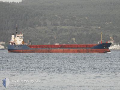
VERA ROSE
General Cargo
Current Trip
| Time Travelled | 14 days |
|---|---|
| Remaining Time | --- |
| Distance Travelled | 760.64 морская миля |
| Remaining Distance | --- |
| AVG Speed | 9.5 Узлы |
| MAX Speed | 11.3 Узлы |
| AVG Wind | 11.1 knots |
| MAX Wind | 23.8 knots |
| MIN Temp | 3.7°C / 38.66°F |
| MAX Temp | 20.3°C / 68.54°F |
| Осадка | 3.5 м |
| Позиция Получена | 8 d тому назад |
Current Position
| Долгота | --- |
|---|---|
| Широта | --- |
| Статус | Under way using engine |
| Скорость | 9.8 Узлы |
| Курс | 84.1° |
| Район | Black Sea |
| Станция | T-AIS |
| Позиция Получена | 8 d тому назад |
Information
The current position of VERA ROSE is in Black Sea with coordinates 41.27522° / 29.43866° as reported on 2025-03-19 16:39 by AIS to our vessel tracker app. The vessel's current speed is 9.8 Узлы
The vessel VERA ROSE (IMO: 9114696, MMSI: 341838001) is a General Cargo that was built in 1995 ( 30 лет ). It's sailing under the flag of [KN] St Kitts Nevis.
In this page you can find informations about the vessels current position, last detected port calls, and current voyage information. If the vessels is not in coverage by AIS you will find the latest position.
The current position of VERA ROSE is detected by our AIS receivers and we are not responsible for the reliability of the data. The last position was recorded while the vessel was in Coverage by the Ais receivers of our vessel tracking app.
The current draught of VERA ROSE as reported by AIS is 3.5 meters
Weather
| Temperature | 5.2°C / 41.36°F |
|---|---|
| Wind Speed | 15 knots |
| Direction | 21° NNE |
| Pressure | 1030.2 hPa |
| Humidity | 55.3 % |
| Cloud Coverage | 96 % |
Featured Company
Last Port Calls
| Port | Arrival | Departure | Time In Port |
|---|---|---|---|
| 2025-03-11 05:29 | 2025-03-14 05:18 | 2 d | |
| 2025-02-25 07:28 | 2025-02-26 20:18 | 1 d | |
| 2025-01-24 03:20 | 2025-01-26 18:34 | 2 d | |
| 2025-01-07 19:03 | 2025-01-12 21:10 | 5 d |
Last Trips
| Origin | Departure | Destination | Arrival | Distance | |
|---|---|---|---|---|---|
| 2025-02-26 21:18 | 2025-03-11 07:29 | 1670.60 морская миля | |||
| 2025-01-26 21:34 | 2025-02-25 08:28 | 2093.98 морская миля | |||
| 2025-01-12 23:10 | 2025-01-24 06:20 | 899.41 морская миля | |||
| 2024-11-28 14:38 | 2025-01-07 21:03 | 1966.95 морская миля |
Events
| Время | Событие | Детали | Позиция / Направление | Информация |
|---|---|---|---|---|
| 2025-03-19 16:39 | Вне покрытия |
41.27522 / 29.43866
Black Sea
GE PTI
|
Скорость: 9.8 kn Курс: 84.1° |
|
| 2025-03-19 15:09 | Изменение морского района | Turkish part of the Black Sea Turkish part of the Sea of Marmara |
41.23032 / 29.15295
Black Sea
GE PTI
|
Скорость: 7.2 kn Курс: 46.8° |
| 2025-03-19 14:59 | ETA изменился | 2025/03/22 10:00 2025/03/16 18:00 |
41.21330 / 29.12721
GE PTI
|
Скорость: 7 kn Курс: 42.9° |
| 2025-03-19 14:47 | Пункт назначения изменился | GE PTI TR CKZ |
41.19089 / 29.09616
GE PTI
|
Скорость: 7.9 kn Курс: 48.3° |
| 2025-03-19 10:57 | Начало движения | 0.85 nm, South East of KARTAL |
40.86901 / 29.21219
TR CKZ
|
Скорость: 6.5 kn Курс: 276.4° |
| 2025-03-19 10:54 | Статус изменился | Under way using engine At anchor |
40.86911 / 29.21838
TR CKZ
|
Скорость: 2.8 kn Курс: 169° |