
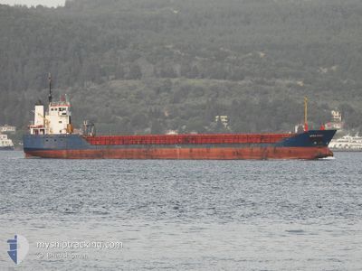
VERA ROSE
General Cargo
Current Trip
| Time Travelled | 14 days |
|---|---|
| Remaining Time | --- |
| Distance Travelled | 760.64 nm |
| Remaining Distance | --- |
| AVG Speed | 9.5 Noeuds |
| MAX Speed | 11.3 Noeuds |
| AVG Wind | 11.1 knots |
| MAX Wind | 23.8 knots |
| MIN Temp | 3.7°C / 38.66°F |
| MAX Temp | 20.3°C / 68.54°F |
| Tirant d eau | 3.5 m |
| Position reçue | 8 d depuis |
Current Position
| Longitude | --- |
|---|---|
| Latitude | --- |
| Etat | Under way using engine |
| Vitesse | 9.8 Noeuds |
| Parcours | 84.1° |
| Zone | Black Sea |
| Station | T-AIS |
| Position reçue | 8 d depuis |
Information
The current position of VERA ROSE is in Black Sea with coordinates 41.27522° / 29.43866° as reported on 2025-03-19 16:39 by AIS to our vessel tracker app. The vessel's current speed is 9.8 Noeuds
The vessel VERA ROSE (IMO: 9114696, MMSI: 341838001) is a General Cargo that was built in 1995 ( 30 Age ). It's sailing under the flag of [KN] St Kitts Nevis.
In this page you can find informations about the vessels current position, last detected port calls, and current voyage information. If the vessels is not in coverage by AIS you will find the latest position.
The current position of VERA ROSE is detected by our AIS receivers and we are not responsible for the reliability of the data. The last position was recorded while the vessel was in Coverage by the Ais receivers of our vessel tracking app.
The current draught of VERA ROSE as reported by AIS is 3.5 meters
Weather
| Temperature | 5.2°C / 41.36°F |
|---|---|
| Wind Speed | 15 knots |
| Direction | 21° NNE |
| Pressure | 1030.2 hPa |
| Humidity | 55.3 % |
| Cloud Coverage | 96 % |
Featured Company
Last Port Calls
| Port | Arrival | Departure | Time In Port |
|---|---|---|---|
| 2025-03-11 05:29 | 2025-03-14 05:18 | 2 d | |
| 2025-02-25 07:28 | 2025-02-26 20:18 | 1 d | |
| 2025-01-24 03:20 | 2025-01-26 18:34 | 2 d | |
| 2025-01-07 19:03 | 2025-01-12 21:10 | 5 d |
Last Trips
Events
| Heure | Evenement | Détails | Position/ Destination | Info |
|---|---|---|---|---|
| 2025-03-19 16:39 | Hors de la zone couverte |
41.27522 / 29.43866
Black Sea
GE PTI
|
Vitesse: 9.8 kn Parcours: 84.1° |
|
| 2025-03-19 15:09 | Changement de zone | Turkish part of the Black Sea Turkish part of the Sea of Marmara |
41.23032 / 29.15295
Black Sea
GE PTI
|
Vitesse: 7.2 kn Parcours: 46.8° |
| 2025-03-19 14:59 | Changement d'ETA | 2025/03/22 10:00 2025/03/16 18:00 |
41.21330 / 29.12721
GE PTI
|
Vitesse: 7 kn Parcours: 42.9° |
| 2025-03-19 14:47 | Changement de destination | GE PTI TR CKZ |
41.19089 / 29.09616
GE PTI
|
Vitesse: 7.9 kn Parcours: 48.3° |
| 2025-03-19 10:57 | Démarrage | 0.85 nm, South East of KARTAL |
40.86901 / 29.21219
TR CKZ
|
Vitesse: 6.5 kn Parcours: 276.4° |
| 2025-03-19 10:54 | Etat Changé | Under way using engine At anchor |
40.86911 / 29.21838
TR CKZ
|
Vitesse: 2.8 kn Parcours: 169° |