
VALUE
Cargo
Current Trip
CONSTANCE CB4
| Time Travelled | 4 days |
|---|---|
| Remaining Time | --- |
| Distance Travelled | 862.47 морская миля |
| Remaining Distance | --- |
| AVG Speed | 10 Узлы |
| MAX Speed | 18.2 Узлы |
| AVG Wind | 12.2 knots |
| MAX Wind | 21.8 knots |
| MIN Temp | 6.7°C / 44.06°F |
| MAX Temp | 14.4°C / 57.92°F |
| Осадка | 9.3 м |
| Позиция Получена | 2 m тому назад |
Current Position
| Долгота | --- |
|---|---|
| Широта | --- |
| Статус | At anchor |
| Скорость | 0.1 Узлы |
| Курс | 80° |
| Район | The Coastal Waters of Southeast Alaska and British Columbia |
| Станция | T-AIS |
| Позиция Получена | 2 m тому назад |
Info
Information
The current position of VALUE is in The Coastal Waters of Southeast Alaska and British Columbia with coordinates 48.34956° / -123.36444° as reported on 2026-03-01 03:34 by AIS to our vessel tracker app. The vessel's current speed is 0.1 Узлы
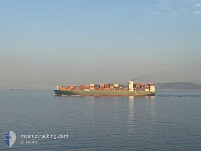
The vessel VALUE (IMO: 9628166, MMSI: 229467000) is a Cargo It's sailing under the flag of [MT] Malta.
In this page you can find informations about the vessels current position, last detected port calls, and current voyage information. If the vessels is not in coverage by AIS you will find the latest position.
The current position of VALUE is detected by our AIS receivers and we are not responsible for the reliability of the data. The last position was recorded while the vessel was in Coverage by the Ais receivers of our vessel tracking app.
The current draught of VALUE as reported by AIS is 9.3 meters
Weather
| Temperature | 7°C / 44.6°F |
|---|---|
| Wind Speed | 2 knots |
| Direction | 317° NW |
| Pressure | 1018.7 hPa |
| Humidity | 67.1 % |
| Cloud Coverage | 67 % |
Featured Company
Last Port Calls
| Port | Arrival | Departure | Time In Port |
|---|---|---|---|
| 2026-02-23 05:31 | 2026-02-24 03:48 | 22 h | |
| 2026-02-20 05:27 | 2026-02-21 18:49 | 1 d | |
| 2026-02-12 01:31 | 2026-02-13 11:40 | 1 d | |
| 2026-02-10 16:56 | 2026-02-11 04:37 | 11 h | |
| 2026-01-23 12:25 | 2026-01-24 08:28 | 20 h | |
| 2026-01-20 06:23 | 2026-01-21 22:59 | 1 d | |
| 2026-01-19 01:54 | 2026-01-19 20:08 | 18 h | |
| 2026-01-16 06:50 | 2026-01-17 18:45 | 1 d | |
| 2026-01-11 09:34 | 2026-01-12 20:36 | 1 d | |
| 2026-01-07 00:36 | 2026-01-08 18:32 | 1 d |
Most Visited Ports (Last year)
| Port | Arrivals | |
|---|---|---|
| 4 | ||
| 4 | ||
| 3 | ||
| 3 | ||
| 2 | ||
| 2 |
Last Trips
| Origin | Departure | Destination | Arrival | Distance | |
|---|---|---|---|---|---|
| 2026-02-21 18:49 | 2026-02-23 05:31 | 384.76 морская миля | |||
| 2026-02-13 11:40 | 2026-02-20 05:27 | 2966.92 морская миля | |||
| 2026-02-11 04:37 | 2026-02-12 01:31 | 54.84 морская миля | |||
| 2026-01-24 08:28 | 2026-02-10 16:56 | 5142.07 морская миля | |||
| 2026-01-21 22:59 | 2026-01-23 12:25 | 352.72 морская миля | |||
| 2026-01-19 20:08 | 2026-01-20 06:23 | 172.09 морская миля | |||
| 2026-01-17 18:45 | 2026-01-19 01:54 | 409.46 морская миля | |||
| 2026-01-12 20:36 | 2026-01-16 06:50 | 639.76 морская миля | |||
| 2026-01-08 18:32 | 2026-01-11 09:34 | 510.81 морская миля | |||
| 2026-01-05 06:41 | 2026-01-07 00:36 | 300.63 морская миля |
Events
| Время | Событие | Детали | Позиция / Направление | Информация |
|---|---|---|---|---|
| 2026-03-01 00:02 | ETA изменился | 2027/02/28 03:00 2026/02/28 03:00 |
48.34908 / -123.36504
CONSTANCE CB4
|
Скорость: Курс: 79° |
| 2026-02-28 03:37 | Окончание движения | --- |
48.34739 / -123.36585
CONSTANCE CB4
|
Скорость: 0.1 kn Курс: 45° |
| 2026-02-28 03:34 | Статус изменился | At anchor Under way using engine |
48.34762 / -123.36547
CONSTANCE CB4
|
Скорость: 0.7 kn Курс: 51° |
| 2026-02-28 02:08 | Изменение морского района | Canadian part of the The Coastal Waters of Southeast Alaska and British Columbia United States part of the The Coastal Waters of Southeast Alaska and British Columbia |
48.22354 / -123.54135
The Coastal Waters of Southeast Alaska and British Columbia
CONSTANCE CB4
|
Скорость: 9.5 kn Курс: 92.6° |
| 2026-02-27 22:20 | Пункт назначения изменился | CONSTANCE CB4 CONTANCE.CB4 |
48.39899 / -124.47916
CONSTANCE CB4
|
Скорость: 11.3 kn Курс: 117° |
| 2026-02-27 21:25 | Изменение морского района | United States part of the The Coastal Waters of Southeast Alaska and British Columbia United States part of the North Pacific Ocean |
48.47382 / -124.71071
The Coastal Waters of Southeast Alaska and British Columbia
CONTANCE.CB4
|
Скорость: 11.7 kn Курс: 109.2° |
| 2026-02-27 21:24 | Статус изменился | Under way using engine Default |
48.47540 / -124.71842
CONTANCE.CB4
|
Скорость: 11.3 kn Курс: 101° |
| 2026-02-27 21:12 | Статус изменился | Default Under way using engine |
48.47800 / -124.77218
CONTANCE.CB4
|
Скорость: 11.1 kn Курс: 91.8° |
| 2026-02-27 21:01 | Статус изменился | Under way using engine Default |
48.47881 / -124.82193
CONTANCE.CB4
|
Скорость: 11.3 kn Курс: 92° |
| 2026-02-27 20:42 | Статус изменился | Default Under way using engine |
48.48102 / -124.91059
CONTANCE.CB4
|
Скорость: 10.8 kn Курс: 96.2° |