
VALUE
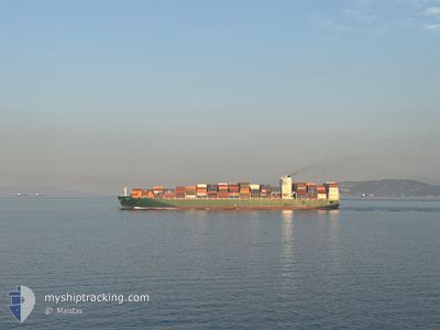
Cargo
Current Trip
USLAX
| Time Travelled | 1 day |
|---|---|
| Remaining Time | --- |
| Distance Travelled | 527.75 nm |
| Remaining Distance | --- |
| AVG Speed | 18.4 Knop |
| MAX Speed | 20.3 Knop |
| AVG Wind | 15.7 knots |
| MAX Wind | 23 knots |
| MIN Temp | 26.1°C / 78.98°F |
| MAX Temp | 29.9°C / 85.82°F |
| Djupgående | 10 m |
| Position mottagen | 1 d sen |
Current Position
| Longitud | --- |
|---|---|
| Latitude | --- |
| Status | Under way using engine |
| Fart | 20.1 Knop |
| Kurs | 59.5° |
| Område | Caribbean Sea |
| Station | T-AIS |
| Position mottagen | 1 d sen |
Info
Information
The current position of VALUE is in Caribbean Sea with coordinates 10.03390° / -79.16408° as reported on 2026-04-01 21:24 by AIS to our vessel tracker app. The vessel's current speed is 20.1 Knop
The vessel VALUE (IMO: 9628166, MMSI: 229467000) is a Cargo It's sailing under the flag of [MT] Malta.
In this page you can find informations about the vessels current position, last detected port calls, and current voyage information. If the vessels is not in coverage by AIS you will find the latest position.
The current position of VALUE is detected by our AIS receivers and we are not responsible for the reliability of the data. The last position was recorded while the vessel was in Coverage by the Ais receivers of our vessel tracking app.
The current draught of VALUE as reported by AIS is 10 meters
Weather
| Temperature | 26.2°C / 79.16°F |
|---|---|
| Wind Speed | 17 knots |
| Direction | 80° E |
| Pressure | 1010.5 hPa |
| Humidity | 78.4 % |
| Cloud Coverage | 49 % |
Featured Company
Last Port Calls
| Port | Arrival | Departure | Time In Port |
|---|---|---|---|
| 2026-04-01 08:50 | 2026-04-01 12:42 | 3 h | |
| 2026-03-30 15:44 | 2026-04-01 00:28 | 1 d | |
| 2026-03-26 05:03 | 2026-03-28 06:53 | 2 d | |
| 2026-03-17 23:30 | 2026-03-18 13:07 | 13 h | |
| 2026-03-12 05:13 | 2026-03-13 18:55 | 1 d | |
| 2026-03-03 03:31 | 2026-03-05 01:01 | 1 d | |
| 2026-03-01 04:16 | 2026-03-02 16:39 | 1 d | |
| 2026-02-23 05:31 | 2026-02-24 03:48 | 22 h | |
| 2026-02-20 05:27 | 2026-02-21 18:49 | 1 d | |
| 2026-02-12 01:31 | 2026-02-13 11:40 | 1 d |
Most Visited Ports (Last year)
| Port | Arrivals | |
|---|---|---|
| 5 | ||
| 4 | ||
| 3 | ||
| 3 | ||
| 3 | ||
| 3 |
Last Trips
| Origin | Departure | Destination | Arrival | Distance | |
|---|---|---|---|---|---|
| 2026-04-01 00:28 | 2026-04-01 08:50 | 21.57 nm | |||
| 2026-03-28 06:53 | 2026-03-30 15:44 | 65.82 nm | |||
| 2026-03-18 13:07 | 2026-03-26 05:03 | 1622.38 nm | |||
| 2026-03-13 18:55 | 2026-03-17 23:30 | 1387.77 nm | |||
| 2026-03-05 01:01 | 2026-03-12 05:13 | 1216.90 nm | |||
| 2026-03-02 16:39 | 2026-03-03 03:31 | 173.66 nm | |||
| 2026-02-24 03:48 | 2026-03-01 04:16 | 948.65 nm | |||
| 2026-02-21 18:49 | 2026-02-23 05:31 | 384.76 nm | |||
| 2026-02-13 11:40 | 2026-02-20 05:27 | 2966.92 nm | |||
| 2026-02-11 04:37 | 2026-02-12 01:31 | 54.84 nm |
Events
| Tid | Event | Detaljer | Position / Dest | Information |
|---|---|---|---|---|
| 2026-04-01 21:44 | Status ändrad | Default Under way using engine |
10.09089 / -79.06657
USLAX
|
Fart: 20.1 kn Kurs: 59.5° |
| 2026-04-01 21:24 | UTANFÖR täckningsområde |
10.03390 / -79.16408
Caribbean Sea
|
Fart: 20.1 kn Kurs: 59.5° |
|
| 2026-04-01 17:42 | AVGÅTT HAMN |
|
9.35072 / -79.91705
USLAX
|
Fart: 3.1 kn Kurs: 318° |
| 2026-04-01 17:42 | STARTAR förflyttning |
9.35004 / -79.91626
[PA] CRISTOBAL
|
Fart: 3.1 kn Kurs: 318° |
|
| 2026-04-01 17:09 | Status ändrad | Under way using engine Moored |
9.35254 / -79.91085
[PA] CRISTOBAL
|
Fart: Kurs: 54° |
| 2026-04-01 14:23 | Status ändrad | Moored Constrained by her draught |
9.35239 / -79.91071
[PA] CRISTOBAL
|
Fart: Kurs: 55° |
| 2026-04-01 14:22 | Status ändrad | Constrained by her draught Moored |
9.35238 / -79.91080
[PA] CRISTOBAL
|
Fart: Kurs: 55° |
| 2026-04-01 14:21 | Status ändrad | Moored Under way using engine |
9.35240 / -79.91079
[PA] CRISTOBAL
|
Fart: Kurs: 54° |
| 2026-04-01 14:14 | STOPPAR förflyttning |
9.35230 / -79.91090
[PA] CRISTOBAL
|
Fart: 0.2 kn Kurs: 54° |
|
| 2026-04-01 13:50 | ANLÄNDER HAMN |
|
9.35007 / -79.91546
[PA] CRISTOBAL
|
Fart: 0.8 kn Kurs: 71° |