
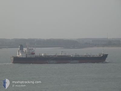
TAURUS
Oil/Chemical Tanker
Current Trip
| Time Travelled | 13 days |
|---|---|
| Remaining Time | 4 days |
| Distance Travelled | 3671.16 морская миля |
| Remaining Distance | 1140.56 морская миля |
| AVG Speed | 11.2 Узлы |
| MAX Speed | 14.7 Узлы |
| AVG Wind | 12.6 knots |
| MAX Wind | 26.8 knots |
| MIN Temp | -0.1°C / 31.82°F |
| MAX Temp | 19°C / 66.2°F |
| Осадка | 11.9 м |
| Позиция Получена | 2 h, 16 m тому назад |
Current Position
| Долгота | 11.66550° |
|---|---|
| Широта | 37.19929° |
| Статус | Under way using engine |
| Скорость | 11.8 Узлы |
| Курс | 112.6° |
| Район | Mediterranean Sea - Eastern Basin |
| Станция | T-AIS |
| Позиция Получена | 2 h, 16 m тому назад |
Info
Information
The current position of TAURUS is in Mediterranean Sea - Eastern Basin with coordinates 37.19929° / 11.66550° as reported on 2024-05-21 16:32 by AIS to our vessel tracker app. The vessel's current speed is 11.8 Узлы and is heading at the port of MERSIN. The estimated time of arrival as calculated by MyShipTracking vessel tracking app is 2024-05-25 22:21 LT
The vessel TAURUS (IMO: 9417206, MMSI: 636014088) is a Oil/Chemical Tanker that was built in 2009 ( 15 лет ). It's sailing under the flag of [LR] Liberia.
In this page you can find informations about the vessels current position, last detected port calls, and current voyage information. If the vessels is not in coverage by AIS you will find the latest position.
The current position of TAURUS is detected by our AIS receivers and we are not responsible for the reliability of the data. The last position was recorded while the vessel was in Coverage by the Ais receivers of our vessel tracking app.
The current draught of TAURUS as reported by AIS is 11.9 meters
Weather
| Temperature | 18.6°C / 65.48°F |
|---|---|
| Wind Speed | 12 knots |
| Direction | 331° NNW |
| Pressure | 1016 hPa |
| Humidity | 88.2 % |
| Cloud Coverage | --- |
Featured Company
Last Port Calls
| Port | Arrival | Departure | Time In Port |
|---|---|---|---|
| 2024-05-06 20:27 | 2024-05-08 03:58 | 1 d | |
| 2024-04-24 00:58 | 2024-04-26 15:30 | 2 d | |
| 2024-04-17 19:51 | 2024-04-20 00:10 | 2 d | |
| 2024-04-05 23:49 | 2024-04-07 07:07 | 1 d | |
| 2024-04-02 10:39 | 2024-04-04 11:23 | 2 d | |
| 2024-03-28 20:02 | 2024-03-29 18:58 | 22 h | |
| 2024-03-25 01:03 | 2024-03-27 00:27 | 1 d | |
| 2024-03-24 07:08 | 2024-03-25 00:48 | 17 h | |
| 2024-03-17 05:48 | 2024-03-20 01:14 | 2 d | |
| 2024-03-11 08:01 | 2024-03-13 23:29 | 2 d |
Last Trips
| Origin | Departure | Destination | Arrival | Distance | |
|---|---|---|---|---|---|
| 2024-04-26 16:30 | 2024-05-06 23:27 | 1519.55 морская миля | |||
| 2024-04-20 02:10 | 2024-04-24 01:58 | 809.39 морская миля | |||
| 2024-04-07 07:07 | 2024-04-17 21:51 | 2337.46 морская миля | |||
| 2024-04-04 11:23 | 2024-04-05 23:49 | 273.87 морская миля | |||
| 2024-03-29 18:58 | 2024-04-02 10:39 | 230.53 морская миля | |||
| 2024-03-27 00:27 | 2024-03-28 20:02 | 489.40 морская миля | |||
| 2024-03-25 00:48 | 2024-03-25 01:03 | 0.31 морская миля | |||
| 2024-03-20 02:14 | 2024-03-24 07:08 | 1220.07 морская миля | |||
| 2024-03-14 00:29 | 2024-03-17 06:48 | 166.40 морская миля | |||
| 2024-03-11 08:27 | 2024-03-11 09:01 | 2.84 морская миля |
Events
| Время | Событие | Детали | Позиция / Направление | Информация |
|---|---|---|---|---|
| 2024-05-21 16:42 | Статус изменился | Default Under way using engine |
37.18667 / 11.70333
TRMER
|
Скорость: 11.8 kn Курс: 112.6° |
| 2024-05-21 16:32 | Вне покрытия |
37.19929 / 11.66550
Mediterranean Sea - Eastern Basin
TRMER
|
Скорость: 11.8 kn Курс: 112.6° |
|
| 2024-05-21 16:23 | Статус изменился | Under way using engine Default |
37.21135 / 11.62847
TRMER
|
Скорость: 11 kn Курс: 110° |
| 2024-05-21 15:33 | Статус изменился | Default Under way using engine |
37.26667 / 11.43667
TRMER
|
Скорость: 11.7 kn Курс: 108.6° |
| 2024-05-21 15:26 | Изменение морского района | Tunisian part of the Mediterranean Sea - Eastern Basin Tunisian part of the Mediterranean Sea - Western Basin |
37.27537 / 11.40778
Mediterranean Sea - Eastern Basin
TRMER
|
Скорость: 11.6 kn Курс: 108.4° |
| 2024-05-21 15:07 | Обнаружено в море | Tunisian part of the Mediterranean Sea - Western Basin |
37.29528 / 11.33397
Mediterranean Sea - Western Basin
TRMER
|
Скорость: 11.4 kn Курс: 109.6° |
| 2024-05-21 15:07 | Статус изменился | Under way using engine Default |
37.29528 / 11.33397
TRMER
|
Скорость: 11 kn Курс: 114° |
| 2024-05-21 15:07 | В покрытии |
37.29528 / 11.33397
Mediterranean Sea - Western Basin
TRMER
|
Скорость: 11.4 kn Курс: 109.6° |
|
| 2024-05-19 04:27 | Статус изменился | Default Under way using engine |
36.24667 / -3.17333
TRMER
|
Скорость: 11.9 kn Курс: 81° |
| 2024-05-19 04:22 | Вне покрытия |
36.24398 / -3.19508
Alboran Sea
TRMER
|
Скорость: 11.9 kn Курс: 81° |